Download
Preview
Add to list
More
14.5 km
~3 hrs 51 min
574 m
Point-to-Point
“Explore the Rhön Mountains' natural beauty, history, and wildlife on the 14 km Oberweißenbrunn to Wasserkuppe hike.”
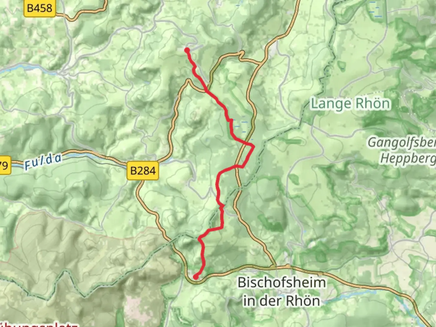
Starting near Rhön-Grabfeld, Germany, the Oberweißenbrunn to Wasserkuppe Airport Walk is a point-to-point trail that spans approximately 14 km (8.7 miles) with an elevation gain of around 500 meters (1,640 feet). This medium-difficulty hike offers a blend of natural beauty, historical significance, and diverse wildlife, making it a rewarding experience for outdoor enthusiasts.### Getting There To reach the trailhead near Rhön-Grabfeld, you can either drive or use public transport. If driving, set your GPS to Oberweißenbrunn, a small village in the Rhön Mountains. For those using public transport, take a train to Fulda and then a bus to Oberweißenbrunn. The bus stop is conveniently located near the start of the trail.### Trail Overview The trail begins in Oberweißenbrunn, a quaint village known for its traditional German architecture and serene landscapes. As you start your hike, you'll immediately notice the lush greenery and rolling hills that characterize the Rhön Mountains. The initial part of the trail is relatively gentle, allowing you to ease into the hike.### Significant Landmarks and Nature Around 3 km (1.9 miles) into the hike, you'll come across the Schwarzes Moor, a significant natural landmark. This raised bog is one of the largest in the Rhön Biosphere Reserve and is home to a variety of plant and animal species. Keep an eye out for rare birds and unique flora as you traverse the wooden boardwalks that protect the delicate ecosystem.Continuing on, you'll reach the Heidelstein, approximately 6 km (3.7 miles) from the start. This peak offers panoramic views of the surrounding landscape and is a great spot for a short break. The Heidelstein is also home to a memorial for the victims of the Rhön air disaster, adding a touch of historical significance to your hike.### Wildlife and Flora The Rhön Mountains are a biodiversity hotspot, and this trail is no exception. As you hike, you'll likely encounter a variety of wildlife, including deer, foxes, and numerous bird species. The flora is equally diverse, with beech and oak forests giving way to open meadows filled with wildflowers, especially in the spring and summer months.### Historical Significance The region has a rich history, particularly during the Cold War when the Rhön Mountains were part of the inner German border. Remnants of this period can still be seen, including old watchtowers and border markers. These historical elements add an intriguing layer to your hike, offering a glimpse into Germany's past.### Final Stretch to Wasserkuppe As you approach the final 3 km (1.9 miles) of the trail, the terrain becomes steeper, leading you up to Wasserkuppe, the highest peak in the Rhön Mountains at 950 meters (3,117 feet). Wasserkuppe is not only a natural landmark but also a hub for gliding and other aerial sports. The Wasserkuppe Airport, located at the summit, is a testament to the area's long history of aviation.### Navigation and Safety Given the trail's moderate difficulty, it's advisable to use a reliable navigation tool like HiiKER to ensure you stay on track. The trail is well-marked, but having a digital map can provide additional peace of mind. Always carry sufficient water, snacks, and weather-appropriate clothing, as conditions can change rapidly in the mountains.This hike offers a perfect blend of natural beauty, historical intrigue, and physical challenge, making it a must-do for anyone visiting the Rhön Mountains.

What to expect?
Activity types
Comments and Reviews
User comments, reviews and discussions about the Oberweißenbrunn to Wasserkuppe Airport Walk, Germany.
4.5
average rating out of 5
2 rating(s)