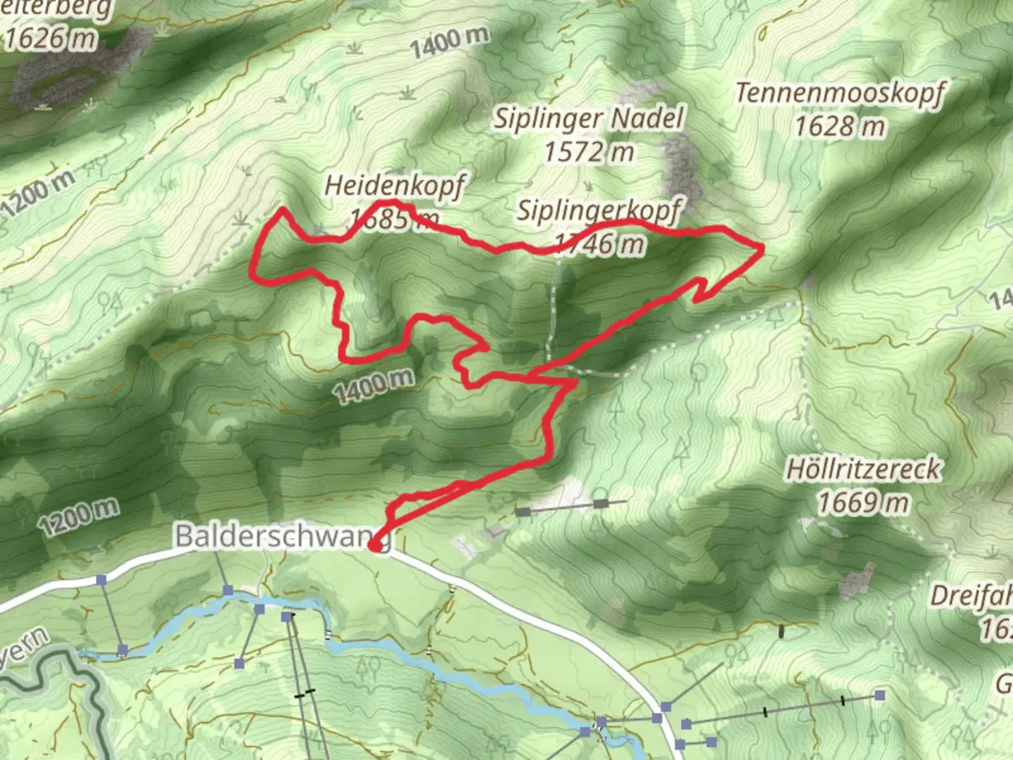
Siplingerkopf and Heidenkopf via Oberallgaeuer Rundwanderweg
Download
Preview
Add to list
More
12.0 km
~3 hrs 58 min
950 m
Loop
“Explore the Allgäu Alps on a 12km loop with stunning views and rich history.”
Nestled in the picturesque region of Oberallgäu, Germany, the Siplingerkopf and Heidenkopf via Oberallgäuer Rundwanderweg offers a captivating loop trail that spans approximately 12 kilometers (about 7.5 miles) with an elevation gain of around 900 meters (approximately 2,950 feet). This medium-difficulty hike promises a rewarding adventure through the stunning landscapes of the Allgäu Alps.
Getting There
To reach the trailhead, travelers can opt for public transport or drive. If you choose public transport, the nearest major town is Sonthofen, which is well-connected by train. From Sonthofen, local buses can take you closer to the trailhead near the village of Balderschwang. For those driving, Balderschwang is accessible via the B308 road, and parking is available near the trailhead.
Trail Highlights
#### Siplingerkopf
As you embark on the trail, the initial ascent leads you towards Siplingerkopf, a prominent peak offering panoramic views of the surrounding alpine scenery. The climb is steady, and as you gain elevation, the lush green meadows gradually give way to rocky terrain. At approximately 4 kilometers (2.5 miles) into the hike, you'll reach the summit of Siplingerkopf, standing at an elevation of 1,746 meters (5,728 feet). From here, the vistas of the Allgäu Alps are breathtaking, with the rugged peaks stretching into the horizon.
#### Heidenkopf
Continuing along the loop, the trail descends slightly before ascending again towards Heidenkopf. This section of the hike is characterized by its diverse flora, with alpine flowers dotting the landscape during the warmer months. At around 7 kilometers (4.3 miles) into the hike, you'll reach Heidenkopf, another vantage point that offers equally stunning views. The elevation here is slightly lower than Siplingerkopf, but the perspective of the surrounding valleys and peaks is no less impressive.
Nature and Wildlife
The trail traverses a region rich in biodiversity. Hikers may encounter a variety of wildlife, including chamois and marmots, especially in the quieter sections of the trail. Birdwatchers will delight in spotting alpine species such as the golden eagle and the alpine chough. The flora is equally diverse, with edelweiss and gentian adding splashes of color to the alpine meadows.
Historical Significance
The Allgäu region is steeped in history, with evidence of human settlement dating back to the Bronze Age. The trail itself passes through areas that have been used for centuries by shepherds and farmers. The traditional alpine huts, or "Almhütten," that dot the landscape are a testament to the region's pastoral heritage. These huts often serve as rest stops where hikers can enjoy local delicacies such as cheese and cured meats.
Navigation and Safety
Given the trail's moderate difficulty, it's advisable to use a reliable navigation tool like HiiKER to ensure you stay on course. Weather conditions in the Alps can change rapidly, so hikers should be prepared with appropriate gear, including sturdy hiking boots, layered clothing, and rain protection. The trail is well-marked, but fog and low visibility can make navigation challenging, particularly at higher elevations.
This loop trail offers a perfect blend of natural beauty, wildlife encounters, and historical intrigue, making it a must-visit for hikers exploring the Allgäu Alps.

Comments and Reviews
User comments, reviews and discussions about the Siplingerkopf and Heidenkopf via Oberallgaeuer Rundwanderweg, Germany.
4.0
average rating out of 5
2 rating(s)