Download
Preview
Add to list
More
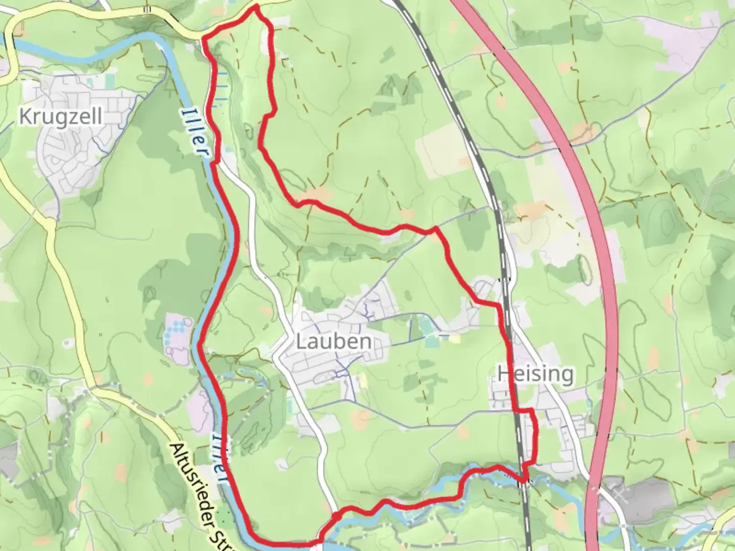
11.3 km
~2 hrs 24 min
87 m
Loop
“A scenic, accessible 11 km loop showcasing the Iller River and historic Gräbelesmühle near Sonthofen.”
Starting near Oberallgäu, Germany, the Iller via Gräbelesmühle trail is a scenic 11 km (approximately 6.8 miles) loop with no significant elevation gain, making it accessible for hikers of varying skill levels. The trailhead is conveniently located near the town of Sonthofen, which can be reached by car or public transport. If you're driving, parking is available near the trailhead. For those using public transport, take a train to Sonthofen station and then a local bus or taxi to the starting point.### Trail OverviewThe trail begins with a gentle walk along the banks of the Iller River, offering picturesque views of the surrounding Allgäu Alps. The path is well-marked and maintained, making navigation straightforward. For added assurance, consider using the HiiKER app to stay on track.### Key Landmarks and Points of InterestGräbelesmühle: About 3 km (1.9 miles) into the hike, you'll come across the historic Gräbelesmühle, an old mill that has been beautifully preserved. This spot is perfect for a short break and some photos. The mill is a testament to the region's agricultural history and offers a glimpse into the traditional way of life in the Allgäu region.Iller River: The trail closely follows the Iller River for a significant portion, providing ample opportunities to enjoy the serene waters and perhaps spot some local wildlife. Keep an eye out for ducks, herons, and other waterfowl that frequent the area.Forested Sections: As you continue, the trail meanders through lush forested areas, offering shade and a cool respite, especially during the warmer months. These sections are rich in flora, with a variety of trees and underbrush that are home to numerous bird species.### Historical SignificanceThe Allgäu region has a rich history dating back to Roman times. The area around Sonthofen and the Iller River has been inhabited for centuries, with evidence of early settlements and agricultural practices. The Gräbelesmühle itself is a relic of this long history, showcasing traditional milling techniques that were once vital to the local economy.### Wildlife and NatureThe trail offers a diverse range of natural habitats, from riverbanks to forests. In addition to birds, you might encounter small mammals like squirrels and rabbits. The flora is equally diverse, with wildflowers blooming in the spring and summer, adding a splash of color to the landscape.### Practical Information- Distance: 11 km (6.8 miles) - Elevation Gain: 0 meters (0 feet) - Difficulty: Medium - Trail Type: Loop### Getting ThereBy Car: Drive to Sonthofen and follow signs to the trailhead. Parking is available near the starting point.By Public Transport: Take a train to Sonthofen station. From there, you can catch a local bus or taxi to the trailhead.### NavigationThe trail is well-marked, but for added security, use the HiiKER app to ensure you stay on the correct path. The app provides real-time updates and detailed maps, making it easier to navigate the loop.This trail offers a perfect blend of natural beauty, historical landmarks, and accessible hiking, making it a must-visit for anyone in the Oberallgäu region.

Comments and Reviews
User comments, reviews and discussions about the Iller via Gräbelesmühle, Germany.
4.4
average rating out of 5
5 rating(s)