Download
Preview
Add to list
More
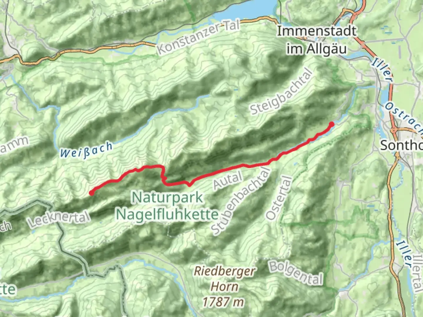
15.3 km
~3 hrs 44 min
405 m
Point-to-Point
“Embark on a captivating alpine adventure through lush meadows, stunning vistas, and rich cultural heritage.”
Nestled in the picturesque region of Oberallgäu, Germany, the Bergrest Hochgratbahn to Gunzesried Walk offers a captivating journey through the Bavarian Alps. This point-to-point trail spans approximately 15 kilometers (about 9.3 miles) with an elevation gain of around 400 meters (approximately 1,312 feet), making it a moderately challenging hike suitable for those with some hiking experience.
Getting There
To reach the trailhead, you can travel by car or public transport. If driving, head towards the Hochgratbahn cable car station near Oberstaufen, which is well-signposted and offers ample parking facilities. For those opting for public transport, take a train to Oberstaufen and then a local bus to the Hochgratbahn station. The journey is scenic and provides a glimpse of the charming Bavarian countryside.
Trail Highlights
As you embark on this hike, you'll be greeted by the stunning vistas of the Allgäu Alps. The trail begins near the Hochgratbahn cable car station, a popular starting point for many alpine adventures. The initial section of the trail ascends gradually, allowing you to acclimate to the elevation while enjoying panoramic views of the surrounding peaks.
#### Nature and Wildlife
The trail meanders through lush alpine meadows, home to a diverse array of flora and fauna. In spring and summer, the meadows burst into a riot of colors with wildflowers such as gentians and alpine roses. Keep an eye out for local wildlife, including chamois and marmots, which are often spotted along the trail. Bird enthusiasts may also catch sight of golden eagles soaring above.
#### Significant Landmarks
Approximately halfway through the hike, you'll encounter the picturesque Hochgrat summit, standing at 1,834 meters (6,017 feet). This peak offers breathtaking views of the surrounding alpine landscape and is a perfect spot for a rest and some photography. The summit is accessible via a short detour from the main trail, which is well worth the effort.
Continuing on, the trail descends towards the charming village of Gunzesried. Along the way, you'll pass through dense forests and cross several mountain streams, providing a refreshing contrast to the open alpine meadows. The descent offers a different perspective of the landscape, with views of the valley below and the distant peaks of the Alps.
Historical Significance
The region around Oberallgäu is steeped in history, with evidence of human settlement dating back to the Bronze Age. The trail itself traverses areas that have been used for centuries by local shepherds and farmers. The traditional alpine huts and pastures you encounter along the way are a testament to the region's rich cultural heritage.
Navigation and Safety
For navigation, it's recommended to use the HiiKER app, which provides detailed maps and real-time updates on trail conditions. The trail is well-marked, but weather conditions can change rapidly in the mountains, so be prepared with appropriate gear and clothing. Always check the weather forecast before setting out and inform someone of your plans.
This hike offers a perfect blend of natural beauty, cultural history, and alpine adventure, making it a must-do for any hiking enthusiast exploring the Bavarian Alps.

Comments and Reviews
User comments, reviews and discussions about the Bergrest Hochgratbahn to Gunzesried Walk, Germany.
average rating out of 5
0 rating(s)