Download
Preview
Add to list
More
9.0 km
~2 hrs 18 min
311 m
Loop
“Explore Happurger Stausee's scenic loop, rich history, and diverse wildlife on this 9 km moderate trail.”
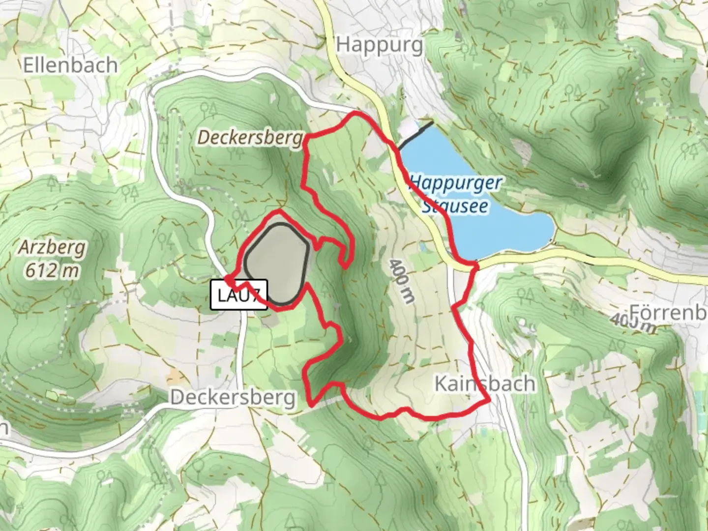
Starting your hike near Nürnberger Land, Germany, the trailhead for this loop is conveniently accessible by both car and public transport. If you're driving, you can park near the Happurger Stausee, a picturesque reservoir. For those using public transport, take a train to the Happurg station, which is a short walk from the trailhead.Trail OverviewThis 9 km (5.6 miles) loop trail offers a moderate challenge with an elevation gain of around 300 meters (984 feet). The trail is well-marked and navigable, but it's always a good idea to have a reliable navigation tool like HiiKER to ensure you stay on track.Key Landmarks and Points of InterestAs you begin your hike, you'll quickly find yourself immersed in the serene beauty of the Happurger Stausee. This reservoir is not only a stunning sight but also a popular spot for various water activities. The trail initially follows the shoreline, offering panoramic views of the water and surrounding hills.Approximately 2 km (1.2 miles) into the hike, you'll encounter the first significant elevation gain as you ascend towards the forested areas. The climb is steady but manageable, and the lush greenery provides ample shade, making it a pleasant experience even on warmer days.Historical SignificanceAround the 4 km (2.5 miles) mark, you'll come across remnants of historical significance. The area around Happurg has a rich history dating back to medieval times. Look out for old stone structures and ruins that hint at the region's past. These landmarks offer a fascinating glimpse into the lives of those who once inhabited this area.Flora and FaunaThe trail is a haven for nature enthusiasts. As you hike through the mixed forests, keep an eye out for a variety of wildlife, including deer, foxes, and numerous bird species. The flora is equally diverse, with a mix of deciduous and coniferous trees, wildflowers, and ferns creating a vibrant tapestry of colors and textures.Midpoint and Scenic ViewsAt around the 5 km (3.1 miles) mark, you'll reach one of the highest points of the trail. Here, you'll be rewarded with breathtaking views of the Nürnberger Land region. This is an excellent spot to take a break, enjoy a snack, and soak in the scenery. The elevation gain to this point is approximately 200 meters (656 feet).Descent and ReturnThe descent begins shortly after this viewpoint, leading you back towards the reservoir. The trail meanders through more forested areas and open meadows, offering a different perspective of the landscape. As you approach the final stretch, the path levels out, making for a leisurely end to your hike.Final StretchThe last 2 km (1.2 miles) bring you back along the shoreline of the Happurger Stausee. This section is relatively flat and provides a relaxing conclusion to your hike. The total elevation gain for the entire loop is around 300 meters (984 feet), making it a moderate but rewarding trail.Whether you're a seasoned hiker or a casual walker, this trail offers a perfect blend of natural beauty, historical intrigue, and physical challenge. Make sure to bring plenty of water, wear sturdy hiking boots, and check the weather forecast before setting out.

Comments and Reviews
User comments, reviews and discussions about the Happurger Stausee via Happurg 4 and 5, Germany.
4.6
average rating out of 5
5 rating(s)