Download
Preview
Add to list
More
11.7 km
~2 hrs 44 min
250 m
Loop
“Embark on a 12 km loop trail near Lichtenfels, blending lush forests, castle ruins, and panoramic vistas.”
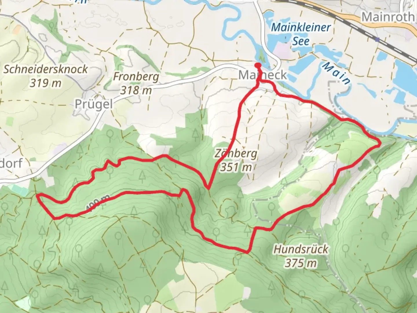
Starting near the charming town of Lichtenfels in Germany, this 12 km (7.5 miles) loop trail offers a delightful mix of natural beauty, moderate physical challenge, and historical intrigue. With an elevation gain of around 200 meters (656 feet), the trail is rated as medium difficulty, making it accessible to most hikers with a reasonable level of fitness.
Getting There To reach the trailhead, you can either drive or use public transport. If you're driving, head towards Lichtenfels and look for parking near the town center. For those using public transport, Lichtenfels is well-connected by train. The nearest significant landmark to the trailhead is the Lichtenfels train station, from where you can start your hike.
Trail Navigation For navigation, it's highly recommended to use the HiiKER app, which provides detailed maps and real-time updates to ensure you stay on the right path.
Trail Highlights As you embark on this loop trail, you'll first encounter a gentle ascent through lush forests. The initial 3 km (1.9 miles) will take you through a canopy of deciduous trees, offering a cool and shaded environment, especially pleasant during the warmer months. Keep an eye out for local wildlife such as deer and various bird species.
Historical Significance Around the 5 km (3.1 miles) mark, you'll come across the ruins of an old castle, a testament to the region's rich medieval history. This site offers a perfect spot for a short break and some exploration. The castle ruins provide a glimpse into the past, with remnants of stone walls and towers that once stood as a fortress.
Scenic Views Continuing on, the trail opens up to more expansive views as you reach higher elevations. Around the 7 km (4.3 miles) point, you'll find a scenic overlook that offers panoramic views of the surrounding countryside, including the Main River valley. This is an excellent spot for photography and taking in the natural beauty of the region.
Flora and Fauna The trail then descends gradually, leading you through meadows and mixed woodlands. During spring and summer, these meadows are often dotted with wildflowers, adding a splash of color to your hike. The diverse ecosystem supports a variety of flora and fauna, so keep your eyes peeled for interesting plant species and small mammals.
Final Stretch As you approach the final 2 km (1.2 miles) of the loop, the trail meanders alongside a small stream, providing a serene and calming atmosphere. The gentle sound of flowing water and the sight of small fish darting about can be quite therapeutic.
Practical Tips - Wear sturdy hiking boots, as some sections of the trail can be rocky and uneven. - Bring enough water and snacks, especially if you plan to take your time exploring the historical sites and scenic viewpoints. - Check the weather forecast before you go, as the trail can become slippery in wet conditions.
This trail offers a well-rounded hiking experience with a mix of natural beauty, historical landmarks, and moderate physical challenge, making it a rewarding adventure for those who take it on.

Comments and Reviews
User comments, reviews and discussions about the Obermain - Ostweg and Geutenreuther Spange, Germany.
average rating out of 5
0 rating(s)