Download
Preview
Add to list
More
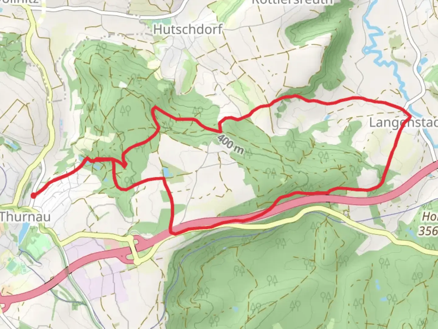
11.4 km
~2 hrs 41 min
241 m
Loop
“Explore the Thurnau Rundweg Blauer Ring for scenic woodlands, historical landmarks, and charming Bavarian countryside.”
Starting near Kulmbach, Germany, the Thurnau Rundweg Blauer Ring is a picturesque loop trail that spans approximately 11 kilometers (around 6.8 miles) with an elevation gain of about 200 meters (656 feet). This medium-difficulty trail offers a delightful mix of natural beauty, historical landmarks, and charming Bavarian countryside.### Getting ThereTo reach the trailhead, you can drive or use public transport. If driving, head towards Kulmbach and follow signs to Thurnau. There is ample parking available near the starting point. For those using public transport, take a train to Kulmbach station. From there, you can catch a local bus or taxi to Thurnau, which is about 10 kilometers (6.2 miles) away.### Trail NavigationFor navigation, it's highly recommended to use the HiiKER app, which provides detailed maps and real-time updates to ensure you stay on track.### Trail Highlights#### Thurnau CastleOne of the first significant landmarks you'll encounter is Thurnau Castle, a stunning medieval fortress that dates back to the 13th century. The castle is well-preserved and offers a glimpse into the region's rich history. It's worth taking a short detour to explore the castle grounds and perhaps even join a guided tour.#### Scenic Woodlands and MeadowsAs you continue, the trail meanders through lush woodlands and open meadows. The diverse flora includes oak, beech, and pine trees, providing a serene canopy that offers shade and a cool breeze. In spring and summer, the meadows burst into a riot of wildflowers, making it a perfect spot for nature photography.#### WildlifeKeep an eye out for local wildlife such as deer, foxes, and a variety of bird species. Early morning or late afternoon hikes increase your chances of spotting these animals in their natural habitat.### Elevation and TerrainThe trail features a moderate elevation gain of around 200 meters (656 feet), with a few steep sections that require careful footing. The terrain is a mix of well-maintained paths, forest trails, and occasional rocky patches. Good hiking boots are recommended for added stability and comfort.### Historical SignificanceThe region around Thurnau is steeped in history. Apart from the castle, you'll find several old churches and traditional Bavarian houses that have stood the test of time. The trail itself has historical significance, as it was once used by local villagers for trade and travel.### Points of Interest#### Local VillagesThe trail passes through a couple of quaint villages where you can take a break and enjoy some local Bavarian cuisine. These villages offer a glimpse into traditional Bavarian life, with their half-timbered houses and cobblestone streets.#### Panoramic ViewsAs you ascend to higher elevations, you'll be rewarded with panoramic views of the surrounding countryside. On a clear day, you can see for miles, making it a perfect spot for a picnic or a rest.### Practical Tips- Water and Snacks: There are limited facilities along the trail, so carry enough water and snacks to keep you energized. - Weather: Check the weather forecast before you set out. The trail can become slippery in wet conditions. - Clothing: Dress in layers, as the weather can change rapidly. A waterproof jacket is advisable. - Safety: Always inform someone of your hiking plans and estimated return time.By following these guidelines and using the HiiKER app for navigation, you'll be well-prepared to enjoy the Thurnau Rundweg Blauer Ring trail to its fullest.

Comments and Reviews
User comments, reviews and discussions about the Thurnau Rundweg Blauer Ring, Germany.
average rating out of 5
0 rating(s)