Download
Preview
Add to list
More
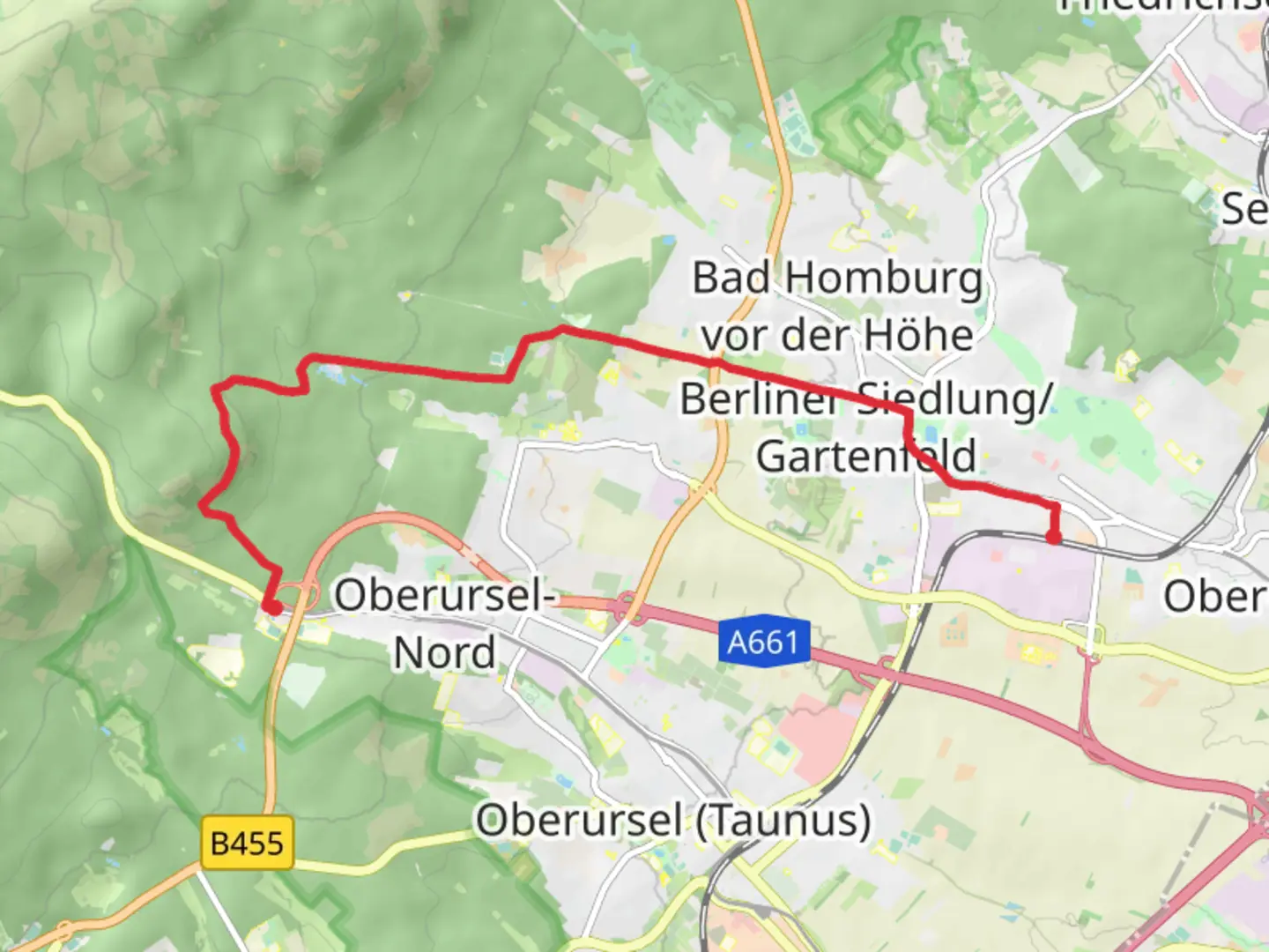
10.1 km
~2 hrs 29 min
281 m
Point-to-Point
“Explore lush Taunus forests, historic Saalburg Fort, and breathtaking Herzberg Tower on this scenic 10 km trail.”
Starting near Hochtaunuskreis, Germany, this trail stretches approximately 10 km (6.2 miles) and offers an elevation gain of around 200 meters (656 feet). The trailhead is conveniently accessible by public transport or car. If you're taking public transport, you can reach Bad Homburg via the S-Bahn (S5 line) from Frankfurt. From the Bad Homburg station, it's a short walk to the trailhead. For those driving, there are parking facilities available near the starting point.Trail OverviewThe trail begins in the picturesque town of Bad Homburg, known for its historic spa and beautiful parks. As you set off, you'll quickly find yourself immersed in the lush greenery of the Taunus forest. The initial part of the trail is relatively flat, making it a pleasant warm-up as you meander through the dense woodland.Significant Landmarks and NatureAround the 2 km (1.2 miles) mark, you'll come across the Saalburg Roman Fort, a reconstructed Roman fort that offers a fascinating glimpse into the region's ancient history. This UNESCO World Heritage site is well worth a short detour to explore its museum and reconstructed buildings.Continuing on, the trail gradually ascends, offering occasional clearings where you can catch your breath and enjoy panoramic views of the surrounding Taunus mountains. The forest is home to a variety of wildlife, including deer, foxes, and numerous bird species, so keep your eyes peeled for these natural inhabitants.Mid-Trail HighlightsAt approximately 5 km (3.1 miles), you'll reach the Herzberg Tower, a popular lookout point. The tower provides an excellent vantage point to take in the sweeping vistas of the Taunus region. It's a great spot for a break and some photos.As you proceed, the trail becomes a bit steeper, with a series of switchbacks leading you higher into the forest. The terrain here is more rugged, so sturdy hiking boots are recommended. The dense canopy overhead provides ample shade, making this section particularly enjoyable during warmer months.Final StretchThe last 2 km (1.2 miles) of the trail are a gentle descent towards Hohemark. This section is less forested, offering more open views and a chance to see the landscape transition from dense woods to open meadows. As you approach Hohemark, you'll pass by several small streams and possibly encounter local hikers and cyclists enjoying the area.Navigation and SafetyFor navigation, it's advisable to use the HiiKER app, which provides detailed maps and real-time tracking to ensure you stay on course. The trail is well-marked, but having a reliable navigation tool can enhance your hiking experience and provide peace of mind.Historical SignificanceThe Taunus region is steeped in history, with evidence of human settlement dating back to Roman times. The Saalburg Roman Fort is a testament to the area's strategic importance during the Roman Empire. Additionally, the town of Bad Homburg itself has a rich history, known for its therapeutic spas that have attracted visitors for centuries.This trail offers a perfect blend of natural beauty, historical landmarks, and moderate physical challenge, making it an ideal choice for hikers looking to explore the scenic and historical richness of the Taunus region.

What to expect?
Activity types
Comments and Reviews
User comments, reviews and discussions about the Bad Homburg to Hohemark via Taunusklub Route, Germany.
average rating out of 5
0 rating(s)