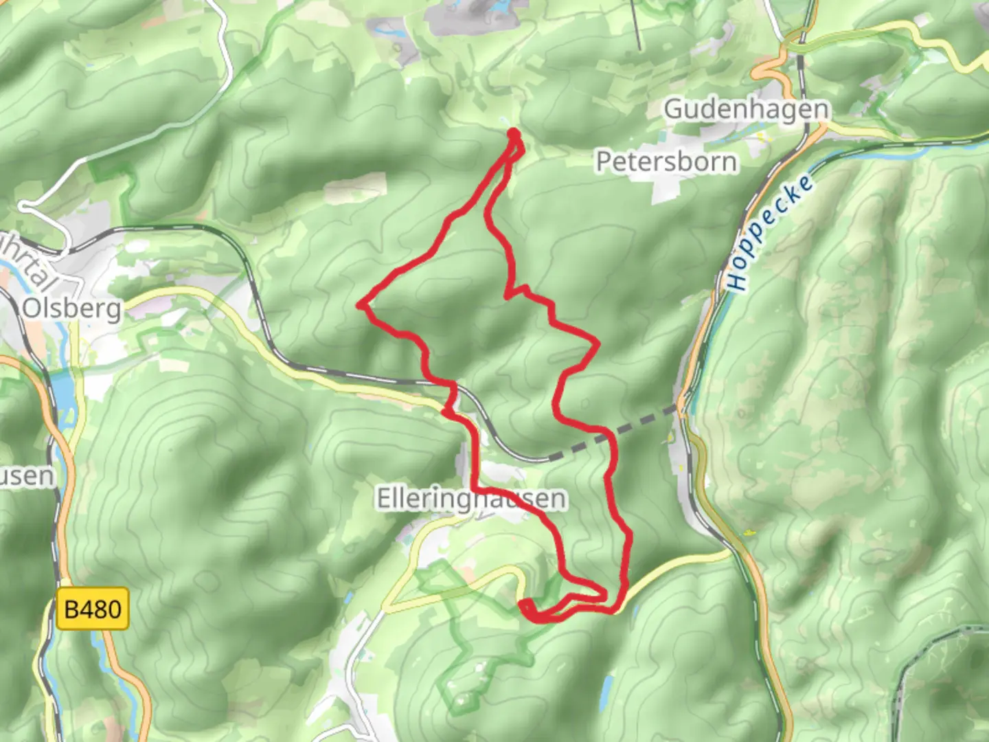
Borberg Kirchhof, Ginsterkopf, Habberg and Schusterknapp Loop
Download
Preview
Add to list
More
15.6 km
~3 hrs 58 min
515 m
Loop
“Explore Hochsauerlandkreis's diverse landscapes and historical sites on this moderately challenging 16 km loop trail.”
Starting near Hochsauerlandkreis, Germany, this 16 km (approximately 10 miles) loop trail offers a moderately challenging hike with an elevation gain of around 500 meters (1,640 feet). The trailhead is easily accessible by car, with parking available near the village of Brilon. For those using public transport, the nearest significant landmark is Brilon Stadt train station, from which local buses or a short taxi ride can take you to the trailhead.
Initial Ascent and Borberg Kirchhof
The hike begins with a gradual ascent through dense forest, leading you to Borberg Kirchhof. This historical site is an ancient churchyard dating back to the Middle Ages. The ruins and the small chapel here offer a glimpse into the region's past, and the elevated position provides panoramic views of the surrounding landscape. This section covers approximately 4 km (2.5 miles) with an elevation gain of about 150 meters (492 feet).
Ginsterkopf and Scenic Views
Continuing from Borberg Kirchhof, the trail takes you towards Ginsterkopf. This part of the hike is characterized by open meadows and rolling hills, offering expansive views of the Hochsauerland region. The trail here is well-marked and relatively flat, making it a pleasant walk. You will cover another 4 km (2.5 miles) with minimal elevation change, allowing you to enjoy the scenery and perhaps spot some local wildlife such as deer or various bird species.
Habberg and Forested Paths
As you approach Habberg, the trail re-enters a dense forest. This section is more challenging, with a steeper ascent of about 200 meters (656 feet) over 3 km (1.9 miles). The forest is rich with flora and fauna, including ancient oak and beech trees. Keep an eye out for signs of wild boar, which are known to inhabit this area. The dense canopy provides a cool, shaded environment, making this part of the hike particularly enjoyable during warmer months.
Schusterknapp and Return Loop
The final significant landmark on this loop is Schusterknapp. This area is known for its rocky outcrops and offers another excellent vantage point for views of the surrounding countryside. The descent from Schusterknapp is gradual, covering the remaining 5 km (3.1 miles) back to the trailhead. This section is less forested, with more open fields and occasional farmsteads, giving you a different perspective of the region's landscape.
Navigation and Safety
For navigation, it is highly recommended to use the HiiKER app, which provides detailed maps and real-time GPS tracking to ensure you stay on the correct path. The trail is generally well-marked, but having a reliable navigation tool can enhance your hiking experience and provide peace of mind.
Historical and Natural Significance
The Hochsauerland region is steeped in history, with many trails like this one passing through areas of historical significance. The Borberg Kirchhof, in particular, is a testament to the region's medieval past. The natural beauty of the area, from dense forests to open meadows, offers a diverse hiking experience that showcases the best of Germany's countryside.
Whether you're a seasoned hiker or someone looking to explore the natural and historical beauty of Hochsauerlandkreis, this loop trail provides a rewarding and enriching experience.

What to expect?
Activity types
Comments and Reviews
User comments, reviews and discussions about the Borberg Kirchhof, Ginsterkopf, Habberg and Schusterknapp Loop, Germany.
5.0
average rating out of 5
1 rating(s)