Download
Preview
Add to list
More
12.8 km
~2 hrs 58 min
250 m
Loop
“Explore serene reservoirs, vibrant forests, and panoramic views on this moderately challenging 13 km loop near Greiz.”
Starting near the picturesque town of Greiz in Germany, this 13 km (8 miles) loop trail offers a delightful mix of natural beauty and moderate physical challenge. With an elevation gain of around 200 meters (656 feet), it is suitable for hikers with a medium level of fitness.
Getting There To reach the trailhead, you can either drive or use public transport. If you're driving, set your GPS to Greiz, and look for parking near the Weidatalsperre dam. For those using public transport, take a train to Greiz station. From there, local buses or a short taxi ride will get you to the starting point near the dam.
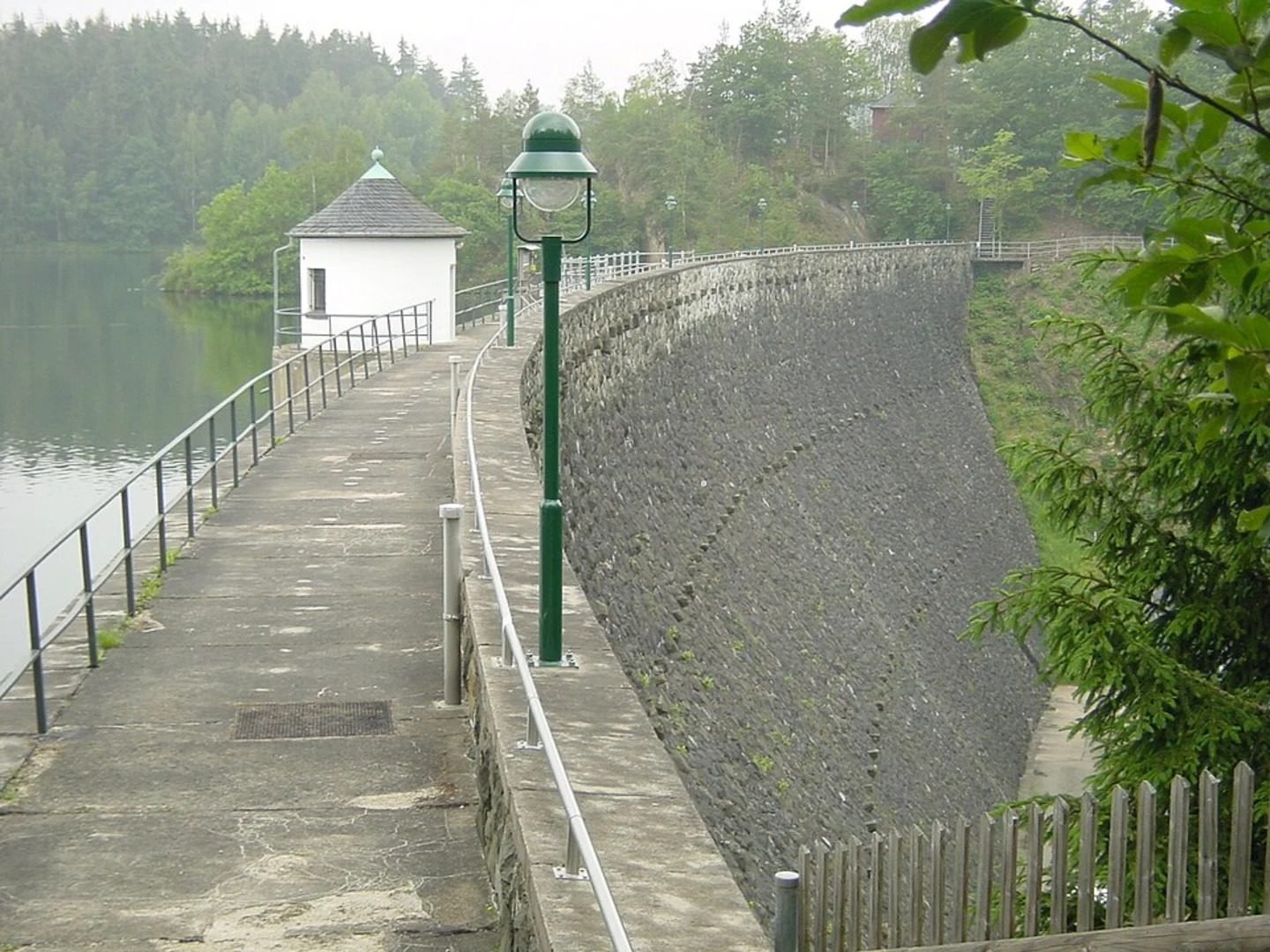
Trail Overview The trail begins near the Weidatalsperre dam, a significant landmark in the area. This dam, constructed in the early 20th century, is not only an engineering marvel but also a crucial water reservoir for the region. As you start your hike, you'll be greeted by the serene waters of the reservoir, reflecting the surrounding forested hills.
Key Sections and Landmarks - **First 3 km (1.9 miles):** The initial stretch of the trail takes you along the edge of the reservoir. This section is relatively flat and offers stunning views of the water. Keep an eye out for various bird species that frequent the area, including herons and kingfishers. - **3 km to 6 km (1.9 to 3.7 miles):** As you move further, the trail begins to ascend gently through dense forests. This part of the hike is particularly beautiful in autumn when the foliage turns vibrant shades of red and gold. The forest is home to a variety of wildlife, including deer and foxes, so tread quietly and you might spot some.
- 6 km to 9 km (3.7 to 5.6 miles): Around the halfway mark, you'll reach a higher elevation offering panoramic views of the surrounding Thuringian countryside. This is a great spot to take a break and enjoy a packed lunch. The elevation gain here is about 100 meters (328 feet), making it the most challenging part of the hike.
- 9 km to 13 km (5.6 to 8 miles): The trail then descends gradually back towards the reservoir. This section is less forested, providing more open views and a chance to see the dam from different angles. As you near the end of the loop, you'll pass through meadows and small clearings, which are perfect for spotting butterflies and other insects.
Navigation and Safety For navigation, it's highly recommended to use the HiiKER app, which provides detailed maps and real-time GPS tracking to ensure you stay on the right path. The trail is well-marked, but having a reliable navigation tool can enhance your hiking experience and provide peace of mind.
Historical Significance The region around Greiz has a rich history, with the town itself dating back to the 13th century. The Weidatalsperre dam, built between 1908 and 1911, was a significant project aimed at controlling floods and providing a stable water supply. Hiking this trail not only offers natural beauty but also a glimpse into the historical efforts to manage and utilize natural resources in the area.
Final Stretch As you complete the loop and return to the starting point near the dam, take a moment to appreciate the engineering feat that created this serene reservoir. The combination of natural beauty, moderate physical challenge, and historical context makes this trail a rewarding experience for any hiker.

Comments and Reviews
User comments, reviews and discussions about the Weidatalsperre via Rundweg Weidatalsperre, Germany.
4.33
average rating out of 5
3 rating(s)