Download
Preview
Add to list
More
13.8 km
~3 hrs 26 min
404 m
Loop
“A picturesque 14 km loop trail near Greiz, blending natural beauty, history, and diverse wildlife.”
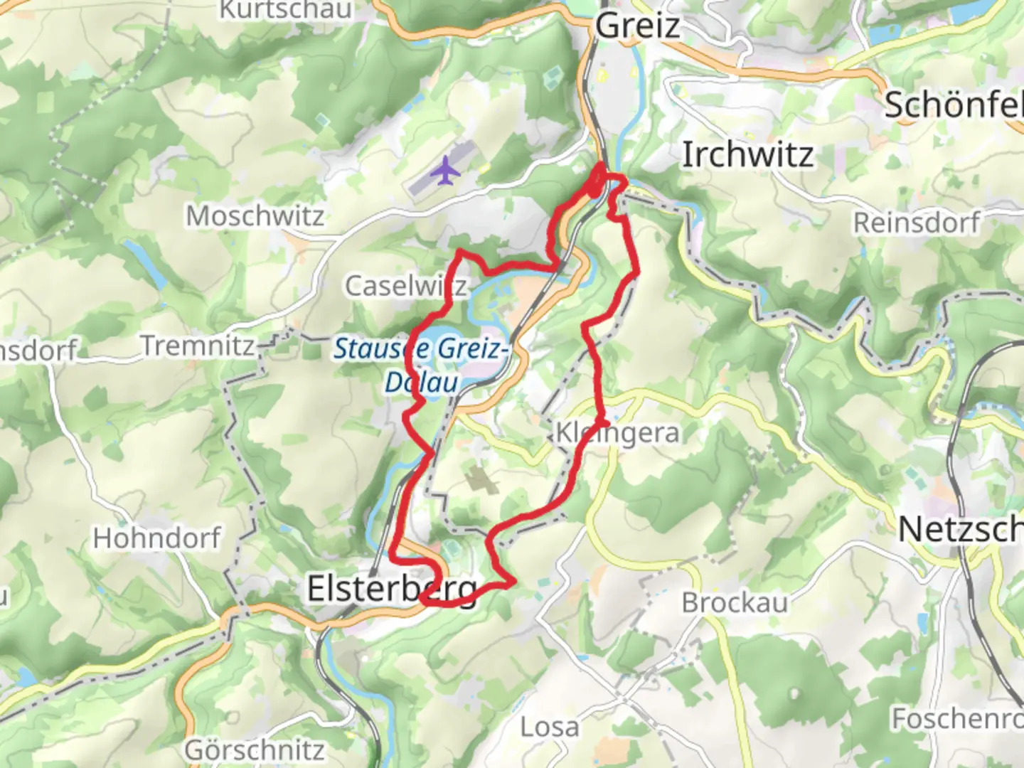
Starting near Greiz, Germany, the Stausee Greiz Doelau via Vogtland Weg is a picturesque loop trail that spans approximately 14 km (8.7 miles) with an elevation gain of around 400 meters (1,312 feet). This medium-difficulty trail offers a blend of natural beauty, historical landmarks, and diverse wildlife, making it a rewarding experience for hikers.
Getting There To reach the trailhead, you can either drive or use public transport. If driving, head towards Greiz and look for parking near the Greiz-Dölau area. For those using public transport, take a train to Greiz station and then a local bus or taxi to the trailhead.
Trail Overview The trail begins near the Greiz-Dölau area, a region known for its lush landscapes and historical significance. As you start your hike, you'll be greeted by the serene waters of the Stausee Greiz, a reservoir that serves as a focal point for the trail. The initial part of the hike is relatively flat, making it a good warm-up for the more challenging sections ahead.
Key Landmarks and Sections
#### Stausee Greiz At approximately 2 km (1.2 miles) into the hike, you'll reach the Stausee Greiz. This reservoir is not only a beautiful spot for photos but also a habitat for various bird species. Keep an eye out for herons and kingfishers as you walk along the water's edge.
#### Vogtland Weg Around the 5 km (3.1 miles) mark, you'll join the Vogtland Weg, a historic trail that has been used for centuries. This section of the hike is more challenging, with a steady incline that will take you through dense forests and open meadows. The elevation gain here is about 200 meters (656 feet), so pace yourself and take breaks as needed.
#### Historical Significance The Vogtland region has a rich history dating back to the medieval period. As you hike, you'll come across several old stone markers and remnants of ancient trade routes. These landmarks offer a glimpse into the past and add a layer of historical intrigue to your hike.
Flora and Fauna The trail is home to a variety of plant and animal species. In the spring and summer months, the meadows are filled with wildflowers, including daisies and buttercups. The forested areas are home to deer, foxes, and a variety of bird species. If you're lucky, you might even spot a rare black stork.
Navigation To ensure you stay on the right path, it's advisable to use a reliable navigation tool like HiiKER. The app provides detailed maps and real-time updates, making it easier to navigate the various sections of the trail.
Final Stretch As you near the end of the loop, the trail descends gradually back towards Greiz-Dölau. This section offers stunning views of the surrounding countryside, making it a perfect way to end your hike. The final 2 km (1.2 miles) are relatively easy, allowing you to cool down and reflect on the journey.
Practical Tips - Wear sturdy hiking boots, as some sections can be rocky and uneven. - Bring plenty of water and snacks, especially if you plan to take breaks and enjoy the scenery. - Check the weather forecast before you go, as the trail can be slippery after rain. - Use HiiKER for navigation to ensure you stay on track.
This trail offers a perfect blend of natural beauty, historical landmarks, and moderate physical challenge, making it a must-visit for any hiking enthusiast.

Comments and Reviews
User comments, reviews and discussions about the Stausee Greiz Doelau via Vogtland Weg, Germany.
4.25
average rating out of 5
4 rating(s)