Download
Preview
Add to list
More
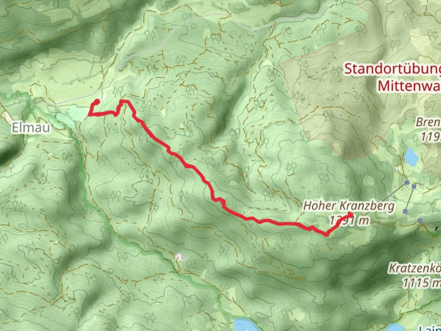
9.1 km
~2 hrs 41 min
529 m
Out and Back
“The Kranzberg Walk via Wanderweg 811 offers a scenic 9 km hike with stunning alpine views and historical landmarks.”
Starting near the picturesque town of Garmisch-Partenkirchen, Germany, the Kranzberg Walk via Wanderweg 811 is a delightful out-and-back trail that spans approximately 9 km (5.6 miles) with an elevation gain of around 500 meters (1,640 feet). This medium-difficulty hike offers a blend of natural beauty, historical significance, and opportunities for wildlife spotting.
Getting There
To reach the trailhead, you can either drive or use public transport. If driving, head towards Garmisch-Partenkirchen and look for parking near the base of the trail. For those using public transport, take a train to Garmisch-Partenkirchen station. From there, local buses or a short taxi ride can get you to the trailhead.
Trail Overview
The trail begins near the base of the Kranzberg mountain, a region known for its stunning alpine scenery and rich history. As you start your ascent, you'll be greeted by dense forests of spruce and fir, providing ample shade and a serene atmosphere. The initial part of the trail is relatively gentle, making it a good warm-up for the steeper sections ahead.
Key Landmarks and Elevation
At approximately 2 km (1.2 miles) into the hike, you'll reach a small clearing that offers your first panoramic view of the surrounding Bavarian Alps. This is a great spot to take a short break and soak in the scenery. The elevation gain up to this point is around 150 meters (492 feet).
Continuing on, the trail becomes steeper and more challenging. Around the 4 km (2.5 miles) mark, you'll encounter a series of switchbacks that will test your endurance. These switchbacks lead you through a more rugged terrain, with rocky outcrops and occasional glimpses of local wildlife such as chamois and marmots.
Historical Significance
As you approach the 5 km (3.1 miles) point, you'll come across a historical marker indicating the site of an old World War II lookout post. This area was strategically important due to its elevated position and clear views of the surrounding valleys. Take a moment to reflect on the history and the soldiers who once stood guard here.
Reaching the Summit
The final push to the summit of Kranzberg involves a steep climb, but the effort is well worth it. At the top, you'll be rewarded with breathtaking 360-degree views of the Bavarian Alps, including the iconic Zugspitze, Germany's highest peak. The summit is an excellent spot for a picnic, so consider packing a light meal to enjoy while taking in the views.
Wildlife and Flora
Throughout the hike, keep an eye out for the diverse flora and fauna that call this region home. In spring and summer, the meadows are adorned with wildflowers such as alpine roses and gentians. Birdwatchers will also find plenty to admire, with species like the golden eagle and alpine chough frequently spotted soaring above.
Navigation and Safety
Given the varying terrain and elevation changes, it's advisable to use a reliable navigation tool like HiiKER to stay on track. The trail is well-marked, but having a digital map can provide additional peace of mind. Ensure you wear sturdy hiking boots and bring plenty of water, especially during the warmer months.
Return Journey
The descent follows the same path, allowing you to revisit some of the scenic spots and perhaps notice details you missed on the way up. The return journey is generally easier, but take care on the steeper sections to avoid slipping.
By the time you return to the trailhead, you'll have covered approximately 9 km (5.6 miles) and experienced an elevation gain of around 500 meters (1,640 feet), making for a fulfilling and memorable hike in one of Germany's most beautiful regions.

What to expect?
Activity types
Comments and Reviews
User comments, reviews and discussions about the Kranzberg Walk via Wanderweg 811, Germany.
4.38
average rating out of 5
8 rating(s)