Download
Preview
Add to list
More
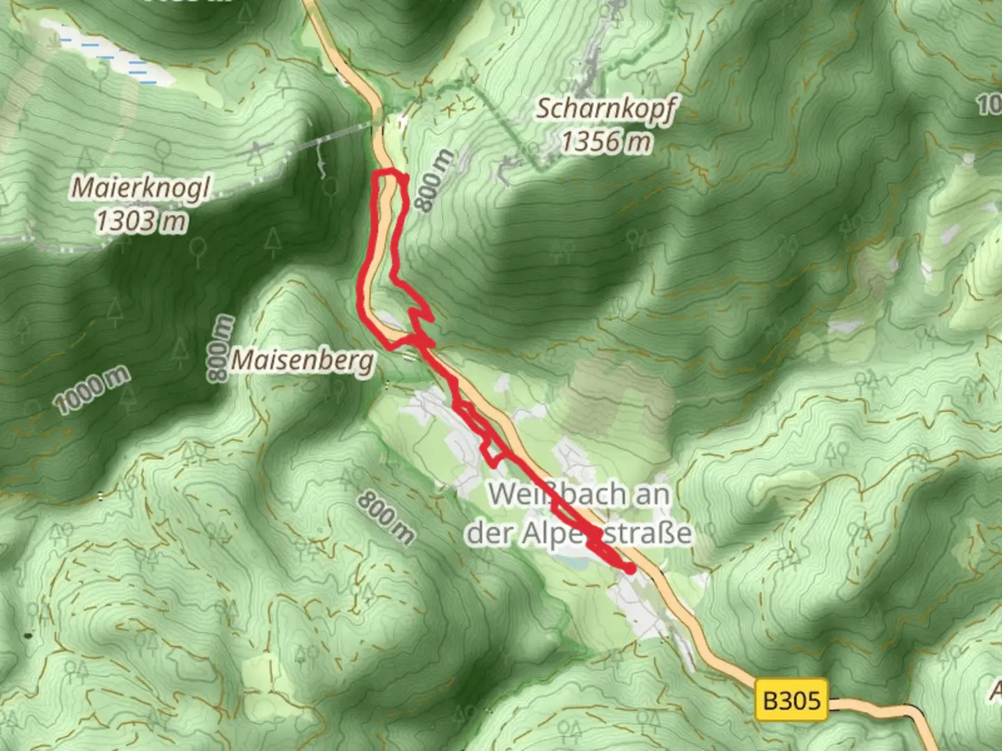
6.5 km
~1 hrs 36 min
182 m
Loop
“Discover lush landscapes and historic sites on this scenic 6-kilometer loop in Berchtesgadener Land.”
Starting near the picturesque region of Berchtesgadener Land in Germany, this loop trail spans approximately 6 kilometers (around 3.7 miles) with an elevation gain of about 100 meters (328 feet). The trailhead is conveniently located near the town of Weißbach, making it accessible for both locals and tourists.### Getting There To reach the trailhead, you can take public transport or drive. If you're using public transport, the nearest major hub is the town of Bad Reichenhall. From there, you can catch a local bus to Weißbach. If you're driving, you can park near the Weißbach town center, where there are several parking options available.### Trail Overview The trail is rated as medium difficulty, making it suitable for hikers with some experience. The loop design ensures that you return to your starting point, eliminating the need for complex navigation. However, it's always a good idea to have a reliable navigation tool like HiiKER to keep you on track.### Key Landmarks and Points of Interest As you embark on this trail, you'll be greeted by the lush greenery and serene landscapes typical of the Berchtesgadener Land region. The trail meanders through dense forests and open meadows, offering a variety of scenic views.#### Historical Significance The region is steeped in history, with several landmarks that date back to medieval times. One notable site is the ancient salt mines, which have been a significant part of the local economy for centuries. These mines are not directly on the trail but are worth a visit if you have extra time.### Flora and Fauna The trail is a haven for nature enthusiasts. You'll encounter a diverse range of flora, including alpine flowers and dense pine forests. Wildlife is abundant, with chances to spot deer, foxes, and a variety of bird species. Keep your eyes peeled for the golden eagle, a majestic bird often seen soaring above the treetops.### Trail Sections 1. Initial Ascent: The first part of the trail involves a gentle ascent through a forested area. The path is well-marked and relatively easy to navigate. This section covers approximately 2 kilometers (1.2 miles) and gains about 50 meters (164 feet) in elevation.
- Mid-Section Meadows: After the initial ascent, the trail opens up into beautiful meadows. This is a great spot to take a break and enjoy the panoramic views of the surrounding mountains. This section is relatively flat and stretches for about 1.5 kilometers (0.9 miles).3. Descent and Return: The final section involves a gradual descent back into the forest, leading you back to the trailhead. This part of the trail is about 2.5 kilometers (1.6 miles) long and descends approximately 50 meters (164 feet).### Practical Tips
- Footwear: Sturdy hiking boots are recommended due to the varied terrain.
- Weather: Check the weather forecast before you go, as conditions can change rapidly in mountainous areas.
- Supplies: Bring enough water and snacks, as there are no facilities along the trail.
- Navigation: Use HiiKER to ensure you stay on the correct path.This trail offers a perfect blend of natural beauty, historical significance, and moderate physical challenge, making it a rewarding experience for any hiker.

What to expect?
Activity types
Comments and Reviews
User comments, reviews and discussions about the Weißbach via Salz AlpenSteig, Germany.
4.67
average rating out of 5
3 rating(s)