Download
Preview
Add to list
More
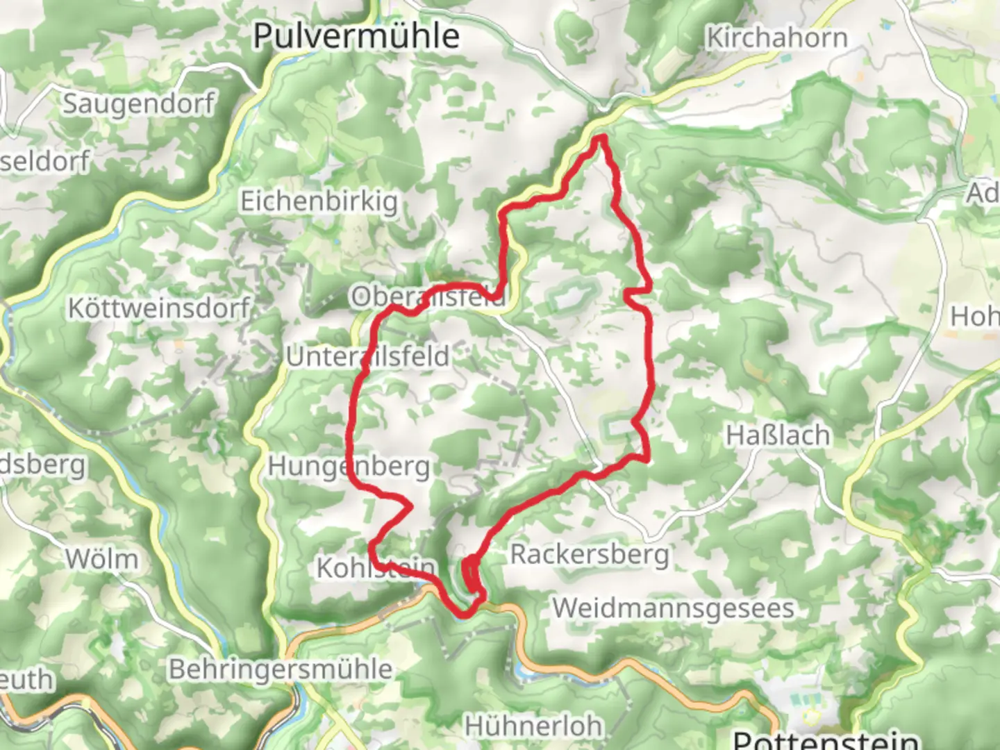
16.2 km
~4 hrs 7 min
528 m
Loop
“Explore stunning landscapes and rich history on the captivating Tuchersfeld and Zauppenberg Loop trail.”
Nestled in the picturesque Franconian Switzerland region near Bayreuth, Germany, the Tuchersfeld and Zauppenberg Loop offers a captivating journey through a landscape rich in natural beauty and historical intrigue. This 16 km (approximately 10 miles) loop trail, with an elevation gain of around 500 meters (about 1,640 feet), is rated as medium difficulty, making it suitable for hikers with a moderate level of fitness.
Getting There
To reach the trailhead, travelers can drive from Bayreuth, which is about a 30-minute journey by car. For those relying on public transport, take a train to Pegnitz and then a bus towards Pottenstein, alighting at Tuchersfeld. The trailhead is conveniently located near the village, making it easily accessible for both local and international visitors.
Trail Highlights
#### Tuchersfeld
The trail begins in the charming village of Tuchersfeld, renowned for its striking rock formations that tower over traditional half-timbered houses. These geological wonders, known as the "Tuchersfeld Rocks," are a testament to the region's unique karst landscape. As you set off, take a moment to explore the Franconian Switzerland Museum, which offers insights into the area's cultural and natural history.
#### Zauppenberg
As you ascend towards Zauppenberg, the trail meanders through dense forests and open meadows, providing a diverse array of flora and fauna. Keep an eye out for native wildlife such as deer and various bird species that inhabit this serene environment. The climb to Zauppenberg rewards hikers with panoramic views of the surrounding countryside, a perfect spot for a rest and some photography.
Historical Significance
The Franconian Switzerland region is steeped in history, with evidence of human settlement dating back to prehistoric times. Along the trail, you may encounter remnants of medieval fortifications and ancient pathways that hint at the area's strategic importance throughout history. The region's castles and ruins, visible from various points on the trail, serve as reminders of its storied past.
Navigation and Safety
For navigation, the HiiKER app is an invaluable tool, providing detailed maps and real-time updates to ensure you stay on track. The trail is well-marked, but it's always wise to have a reliable navigation aid at hand. Weather conditions can change rapidly, so be prepared with appropriate clothing and gear. The trail's moderate difficulty means that while it is accessible to many, proper preparation is essential for a safe and enjoyable hike.
Flora and Fauna
The trail's diverse ecosystems support a wide range of plant and animal life. In spring and summer, the meadows burst into color with wildflowers, while the forests offer a cool respite during warmer months. Birdwatchers will delight in the variety of species, from common songbirds to the occasional sighting of a majestic bird of prey.
Embarking on the Tuchersfeld and Zauppenberg Loop is a journey through both natural splendor and historical depth, offering hikers a memorable experience in one of Germany's most enchanting regions.

Comments and Reviews
User comments, reviews and discussions about the Tuchersfeld and Zauppenberg Loop, Germany.
average rating out of 5
0 rating(s)