Download
Preview
Add to list
More
8.6 km
~2 hrs 30 min
475 m
Loop
“The Harter Fell and Dunnerdale Forest Loop offers a scenic 9 km hike with stunning views and diverse wildlife.”
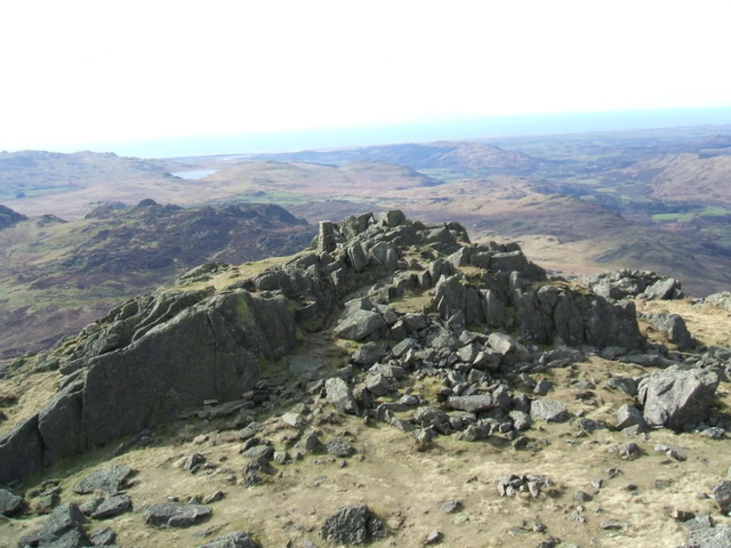
Starting near Westmorland and Furness, England, the Harter Fell and Dunnerdale Forest Loop is a captivating 9 km (5.6 miles) loop trail with an elevation gain of approximately 400 meters (1,312 feet). This medium-difficulty hike offers a blend of scenic beauty, historical significance, and diverse wildlife, making it a rewarding experience for hikers.### Getting There To reach the trailhead, you can drive or use public transport. If driving, head towards the village of Ulpha, which is the nearest significant landmark. From Ulpha, follow the signs towards Birks Bridge, where you can find parking facilities. For those using public transport, the nearest major town is Broughton-in-Furness. From Broughton-in-Furness, you can take a local bus or taxi to Ulpha and then proceed to Birks Bridge.### Trail Overview The trail begins at Birks Bridge, a picturesque stone bridge over the River Duddon. As you start your hike, you'll be greeted by the serene sounds of the river and the lush greenery of Dunnerdale Forest. The initial section of the trail is relatively flat, allowing you to ease into the hike while enjoying the forest's tranquility.### Ascent to Harter Fell After approximately 2 km (1.2 miles), the trail begins to ascend towards Harter Fell. This section is more challenging, with a steady climb that will test your endurance. The path is well-marked, but it's advisable to use a navigation tool like HiiKER to stay on track. As you climb, you'll be rewarded with stunning views of the surrounding fells and valleys. Keep an eye out for red deer and various bird species that inhabit the area.### Summit and Panoramic Views Reaching the summit of Harter Fell at around 4 km (2.5 miles) into the hike, you'll find yourself at an elevation of 653 meters (2,142 feet). The summit offers panoramic views of the Lake District, including Scafell Pike, England's highest peak. This is an excellent spot to take a break, have a snack, and soak in the breathtaking scenery.### Descent and Dunnerdale Forest The descent from Harter Fell takes you through a different route, leading you back into Dunnerdale Forest. This section is less strenuous but requires careful footing, especially if the ground is wet. The forest is rich in flora and fauna, with ancient oak trees and a variety of woodland creatures. At around 6 km (3.7 miles), you'll pass by the remnants of old mining operations, a testament to the area's historical significance in the 19th century.### Return to Birks Bridge As you approach the final stretch of the hike, the trail flattens out, guiding you back towards Birks Bridge. The last 3 km (1.9 miles) offer a gentle walk along the river, providing a peaceful end to your journey. Before concluding your hike, take a moment to explore the area around Birks Bridge, which is known for its natural beauty and historical charm.### Tips and Recommendations - Wear sturdy hiking boots, as the terrain can be uneven and slippery. - Bring sufficient water and snacks, especially for the ascent. - Check the weather forecast and dress in layers, as conditions can change rapidly. - Use HiiKER for navigation to ensure you stay on the correct path. - Be mindful of wildlife and maintain a respectful distance.This trail offers a perfect blend of natural beauty, historical intrigue, and physical challenge, making it a must-visit for any hiking enthusiast.

What to expect?
Activity types
Comments and Reviews
User comments, reviews and discussions about the Harter Fell and Dunnerdale Forest Loop, England.
4.6
average rating out of 5
5 rating(s)