Download
Preview
Add to list
More
11.3 km
~3 hrs 14 min
583 m
Out and Back
“The Great Dun Fell Walk offers a scenic, historically rich 11 km hike with diverse wildlife and challenging terrain.”
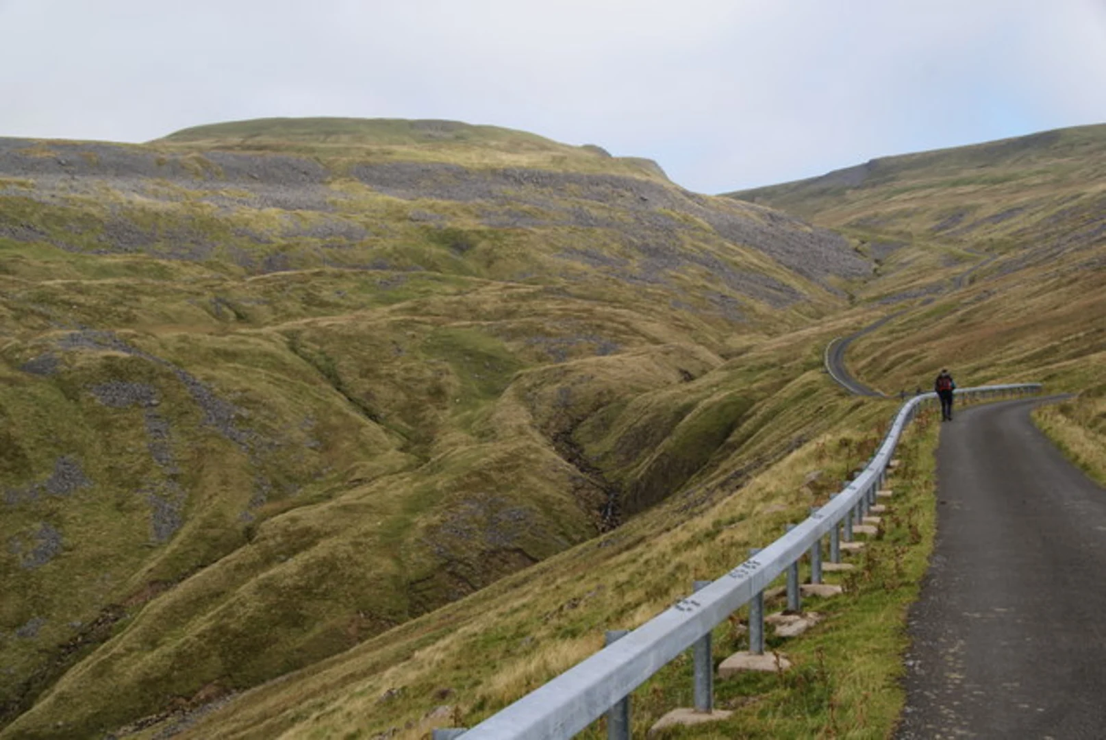
Starting near Westmorland and Furness in England, the Great Dun Fell Walk is an 11 km (approximately 6.8 miles) out-and-back trail with an elevation gain of around 500 meters (about 1,640 feet). This medium-difficulty hike offers a blend of natural beauty, historical significance, and a rewarding challenge for hikers.### Getting There To reach the trailhead, you can drive or use public transport. If driving, head towards the village of Knock, which is the nearest significant landmark. There is limited parking available near the start of the trail. For those using public transport, the nearest train station is in Appleby-in-Westmorland. From there, you can take a local bus or taxi to Knock.### Trail Overview The trail begins with a gentle ascent through pastoral landscapes, offering views of rolling hills and farmland. As you progress, the path becomes steeper and more rugged, transitioning into moorland. The terrain can be uneven and boggy in places, so sturdy hiking boots are recommended.### Landmarks and Points of Interest - Knock Pike: At approximately 2 km (1.2 miles) into the hike, you will pass Knock Pike, a small hill that offers panoramic views of the Eden Valley. This is a great spot for a short break and some photography. - Great Dun Fell Radar Station: The most notable landmark on this trail is the radar station at the summit of Great Dun Fell. This large, golf ball-shaped structure is part of the UK's air traffic control system. It is visible from several points along the trail and serves as a useful navigation aid. - Cross Fell: On clear days, you can see Cross Fell, the highest point in the Pennines, from various points along the trail. This adds an extra layer of scenic beauty to your hike.### Flora and Fauna The trail passes through diverse habitats, including grasslands, moorlands, and rocky outcrops. You may encounter a variety of wildlife, such as red grouse, skylarks, and occasionally, red deer. The flora includes heather, bilberry, and various grasses that change color with the seasons, offering a different visual experience depending on the time of year.### Historical Significance The area around Great Dun Fell has a rich history. The Pennines, often referred to as the "backbone of England," have been inhabited since prehistoric times. The radar station itself has historical significance, having been established during the Cold War era as part of the UK's defense infrastructure.### Navigation and Safety Given the variable weather conditions in the Pennines, it is crucial to be prepared. The trail can become foggy and windy, especially near the summit. Using a reliable navigation tool like HiiKER is highly recommended to ensure you stay on the correct path. Always check the weather forecast before setting out and carry appropriate gear, including a map, compass, and extra layers of clothing.### Return Journey The return journey follows the same path back to the trailhead, offering a different perspective on the landscape as you descend. Take your time to enjoy the views and perhaps spot some wildlife you may have missed on the way up.This hike offers a rewarding experience with its mix of natural beauty, historical landmarks, and challenging terrain. Whether you're a seasoned hiker or looking for a new adventure, the Great Dun Fell Walk is a trail worth exploring.

What to expect?
Activity types
Comments and Reviews
User comments, reviews and discussions about the Great Dun Fell Walk, England.
4.33
average rating out of 5
6 rating(s)