Download
Preview
Add to list
More
9.8 km
~2 hrs 55 min
584 m
Loop
“Explore the Cautley Spout Tongue trail's stunning landscapes, historical sites, and diverse wildlife on this rewarding hike.”
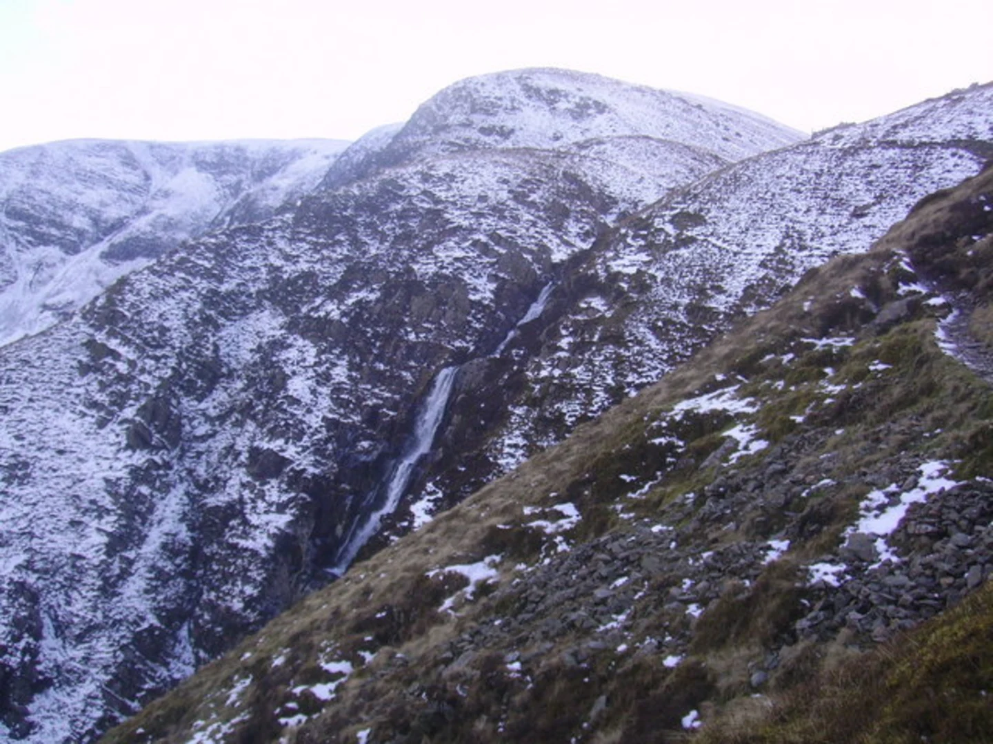
Starting near Westmorland and Furness, England, the Cautley Spout Tongue, The Calf, and Red Gill Beck trail is a captivating 10 km (6.2 miles) loop with an elevation gain of approximately 500 meters (1,640 feet). This medium-difficulty hike offers a blend of natural beauty, historical significance, and diverse wildlife, making it a rewarding experience for outdoor enthusiasts.### Getting There To reach the trailhead, you can drive or use public transport. If driving, set your GPS to the nearest known address: The Cross Keys Inn, Cautley, Sedbergh, LA10 5NE. For those using public transport, the nearest train station is Oxenholme Lake District, from where you can take a bus or taxi to the Cross Keys Inn.### Trail Overview The trail begins near the Cross Keys Inn, a historic 16th-century coaching inn. From here, you will follow a well-marked path that leads you towards Cautley Spout, one of England's highest waterfalls. The initial section is relatively gentle, allowing you to warm up as you approach the falls.### Cautley Spout At approximately 2 km (1.2 miles) into the hike, you'll reach Cautley Spout. This stunning waterfall cascades down a series of rocky steps, dropping nearly 198 meters (650 feet) in total. The area around the falls is often lush and green, especially after rainfall, making it a perfect spot for photography and a brief rest.### Ascent to The Calf Continuing from Cautley Spout, the trail becomes steeper as you ascend towards The Calf, the highest point in the Howgill Fells at 676 meters (2,218 feet). This section covers about 3 km (1.9 miles) and involves a significant elevation gain. The path is well-trodden but can be slippery in wet conditions, so sturdy hiking boots are recommended.### The Calf Upon reaching The Calf, you'll be rewarded with panoramic views of the surrounding fells and valleys. On a clear day, you can see as far as the Lake District and the Yorkshire Dales. This is an excellent spot for a break and to take in the breathtaking scenery.### Descent via Red Gill Beck The descent begins as you head towards Red Gill Beck, a picturesque stream that meanders through the landscape. This section of the trail is about 3 km (1.9 miles) and is less steep than the ascent, but still requires careful footing. The path follows the beck, offering opportunities to spot local wildlife such as red squirrels, deer, and various bird species.### Historical Significance The Howgill Fells, where this trail is located, have a rich history dating back to the Bronze Age. Evidence of ancient settlements and burial mounds can be found scattered across the landscape. The area was also historically used for sheep farming, a tradition that continues to this day.### Final Stretch The final 2 km (1.2 miles) of the trail loop back towards the Cross Keys Inn. This section is relatively flat and provides a gentle end to your hike. As you approach the inn, you might consider stopping in for a well-deserved meal or refreshment.### Navigation For navigation, it is highly recommended to use the HiiKER app, which provides detailed maps and real-time updates to ensure you stay on track throughout your hike.This trail offers a perfect mix of natural beauty, challenging terrain, and historical intrigue, making it a must-do for any hiking enthusiast visiting the region.

What to expect?
Activity types
Comments and Reviews
User comments, reviews and discussions about the Cautley Spout Tongue, The Calf and Red Gill Beck, England.
4.67
average rating out of 5
3 rating(s)