Download
Preview
Add to list
More
13.6 km
~3 hrs 15 min
328 m
Loop
“Discover the Steyning Loop: a 14 km trail brimming with natural beauty, history, and moderate challenges.”
Starting near the charming town of Steyning in West Sussex, England, the Steyning Loop is a delightful 14 km (approximately 8.7 miles) trail that offers a mix of natural beauty, historical landmarks, and moderate physical challenge. With an elevation gain of around 300 meters (approximately 984 feet), this loop trail is rated as medium difficulty, making it suitable for hikers with a reasonable level of fitness.
Getting There
To reach the trailhead, you can either drive or use public transport. If driving, head towards Steyning, where you can find parking options near the town center. For those using public transport, the nearest train station is Shoreham-by-Sea. From there, you can take a bus to Steyning, with services running regularly.
Trail Overview
The trail begins near the Steyning town center, a picturesque area with cobbled streets and historic buildings. As you set off, you'll quickly find yourself immersed in the lush countryside of the South Downs National Park. The initial part of the trail is relatively flat, allowing you to ease into the hike.
Significant Landmarks and Nature
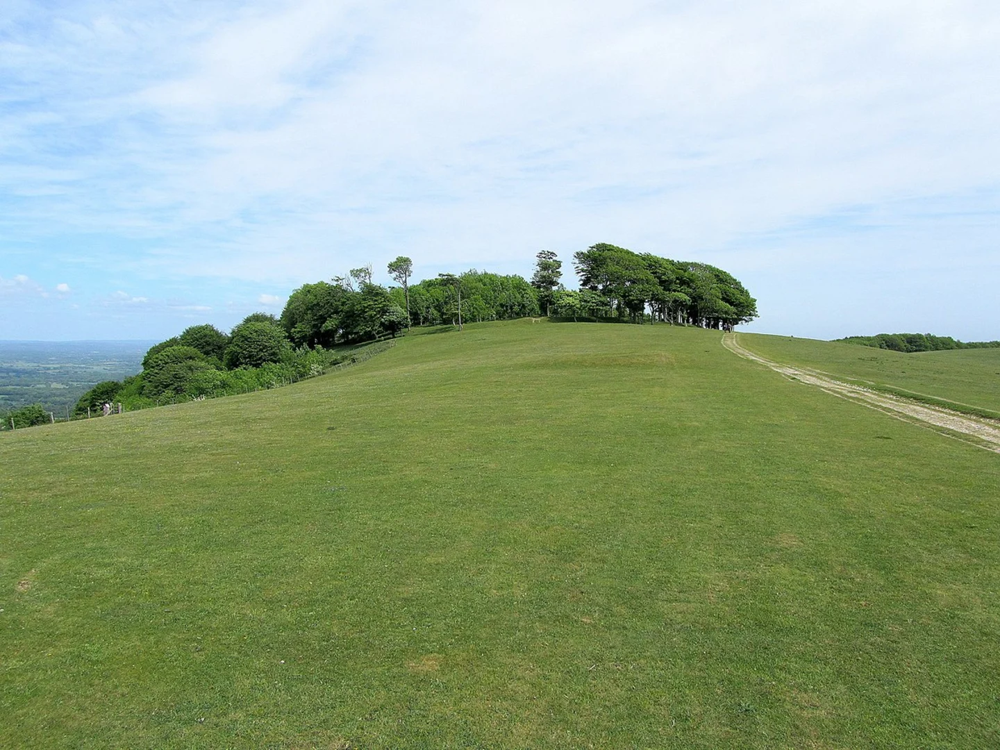
#### Chanctonbury Ring
Around 5 km (3.1 miles) into the hike, you'll encounter the Chanctonbury Ring, an ancient hill fort with a rich history dating back to the Iron Age. The site also features a ring of beech trees planted in the 18th century. The elevation here is about 240 meters (787 feet), offering panoramic views of the surrounding countryside. It's a perfect spot for a short break and some photography.
#### South Downs Way
As you continue, the trail intersects with the South Downs Way, a long-distance footpath that stretches across the South Downs National Park. This section of the trail is particularly scenic, with rolling hills and expansive views. Keep an eye out for local wildlife, including deer, foxes, and a variety of bird species.
Navigation and Terrain
The trail is well-marked, but it's always a good idea to have a reliable navigation tool like HiiKER to ensure you stay on track. The terrain varies from grassy paths to more rugged sections with loose stones, so sturdy hiking boots are recommended.
Historical Significance
Steyning itself is steeped in history, with roots going back to Saxon times. The town was once an important port before the River Adur silted up. As you hike, you'll pass by several historical landmarks, including the ruins of Bramber Castle, which dates back to the Norman Conquest. The castle is located about 2 km (1.2 miles) from the trailhead and offers a glimpse into England's medieval past.
Final Stretch
The final part of the loop brings you back towards Steyning, descending gently through woodland and open fields. This section is less strenuous, allowing you to cool down as you approach the end of your hike.
Wildlife and Flora
Throughout the hike, you'll encounter a variety of flora, including wildflowers, ancient woodlands, and chalk grasslands. The area is also home to numerous species of butterflies and birds, making it a haven for nature enthusiasts.
Practical Tips
- Water and Snacks: Ensure you carry enough water and some high-energy snacks, especially if you plan to take your time exploring the landmarks. - Weather: The weather can be unpredictable, so pack a waterproof jacket and check the forecast before setting out. - Facilities: There are limited facilities along the trail, so make use of the amenities in Steyning before you start.
This 14 km loop offers a perfect blend of natural beauty, historical intrigue, and moderate physical challenge, making it a rewarding experience for any hiker.

What to expect?
Activity types
Comments and Reviews
User comments, reviews and discussions about the Steyning Loop, England.
4.67
average rating out of 5
3 rating(s)