Download
Preview
Add to list
More
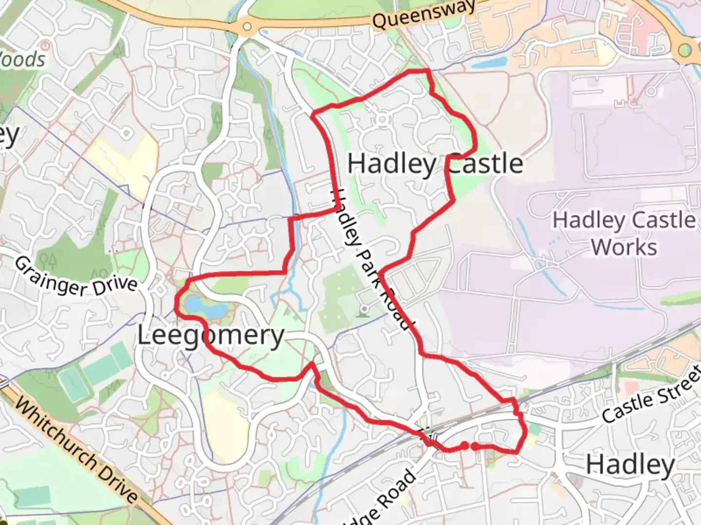
4.8 km
~59 min
18 m
Loop
Directions 1. From the start, walk west (away from the bus station, towards the tall tower block) along the High Street for 82 metres. 2. Take the steps on the right onto the bridge or take the ramp just before the steps. 3. Cross the bridge and take the path to the left, then to the right passing under the railway bridge to descend to the road. 4. Follow the main path, ignoring all paths to the side to reach and cross Chockleys Drive. 5. Continue in the same direction and follow the main path to pass through an underpass. Turn left at the junction after the underpass. 6. Follow the main path for 0.4 miles and take the left-hand fork just before reaching the pool. 7. Follow the main path with the pool on the right-hand side, passing steps down to the pool on your right. As the path forks, just past house number 10, bear right on the main doublewidth path heading towards an underpass. 8. Turn right through the underpass (note the art work ) and continue ahead, following the main path with houses to your left and a playing field to your right, passing a waste bin. At the footpath junction, turn left and continue keeping the Hurley Brook on your right-hand side. 9. Pause at a crossing of paths with a metal footbridge over the brook on your right. (You might want to deviate for a few minutes to look at the old mill, a short distance to your left, then return to this point. ) The way onward is to follow the Silkin Way over the footbridge (again, note the art work), and straight on to reach a road (Hadley Park Road). 10. Turn left on the road and follow for 200 metres. Take the footpath (still following the Silkin Way) on the right opposite house number 187 and signed towards ‘Hortonwood’ and Telford Town Centre. Follow this path for 0.27 mile, crossing a road, to reach Hadley Park Guillotine Lock. 11. Turn right immediately before the lock (leaving the Silkin Way) and follow the path as it bends right and left then passes a second lock, Turnip Lock, on the left-hand side. Continue on this path ignoring side paths into the housing estate and follow the main path as it skirts a playing field on the left-hand side. 12. Just beyond the end of the playing field, and before reaching a playground, turn left. Follow the path, as it bends to the right, then the left, before turning right into a tarmac lane. Follow the lane to reach a road (Hadley Park Road). 13. Turn left on Hadley Park Road and continue for 305 metres. 14. Turn left into Parkdale and continue for 129 metres to turn right onto a path running adjacent to Sankey Drive. Follow the path to a T-junction with a minor path coming in from the right. Turn left alongside the fenced railway embankment, and then turn right to pass under a railway bridge. 15. As the path meets a short section of road, follow the road as it slopes upwards to meet a road junction. 16. Turn left on the road (Britannia Way) to reach a pedestrian-controlled crossing. Cross carefully to the opposite side of the road and follow the path that continues onward from the crossing, then bearing slightly left, for 129 metres to reach Hadley High Street. 17. Turn right onto Hadley High Street and walk for 177 metres to return to the walk start point.

Comments and Reviews
User comments, reviews and discussions about the Hadley, England.
average rating out of 5
0 rating(s)