Download
Preview
Add to list
More
21.2 km
~1 day 0 hrs
472 m
Loop
“A tapestry of sweeping views, wildflowers, and ancient woodlands awaits on this scenic North Downs loop.”
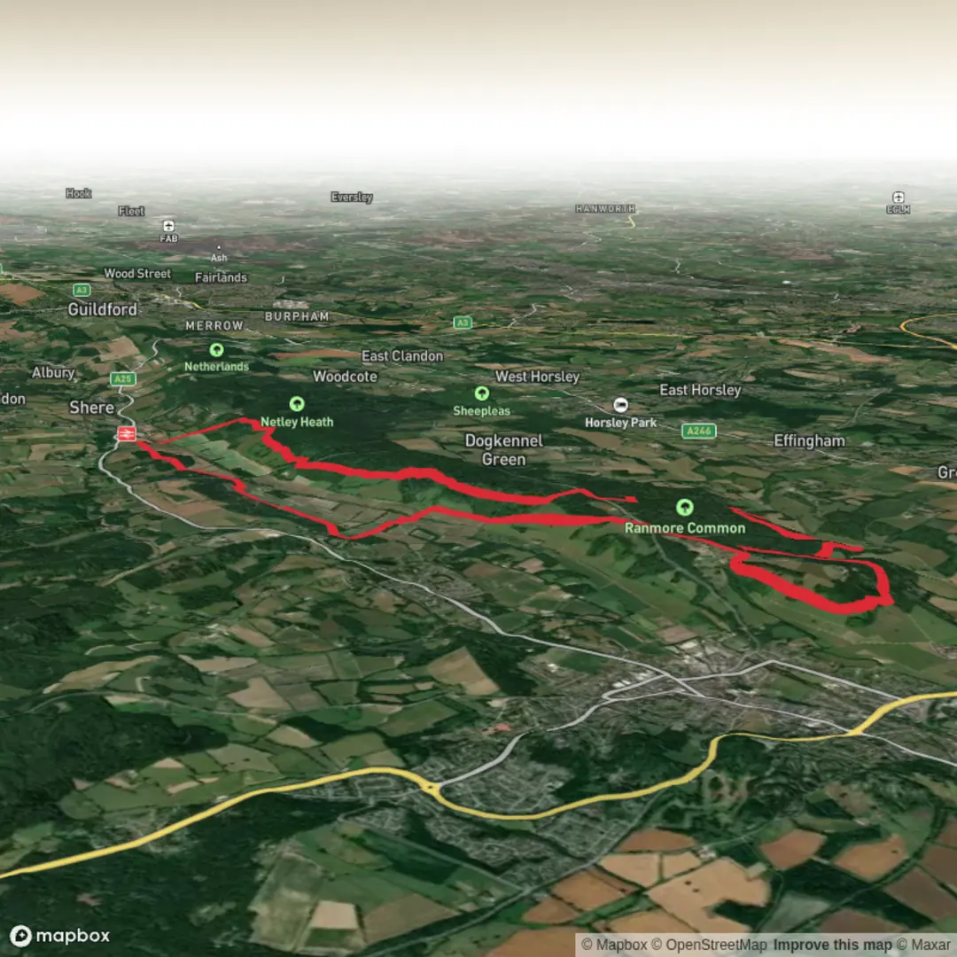
Starting from the outskirts of Dorking, Surrey, the trailhead for this 21 km (13 miles) circular hike is conveniently located near Dorking railway station, making it accessible by both public transport and car. Trains from London Waterloo and London Victoria run frequently to Dorking, and there is parking available at the station and nearby public car parks.
Initial Ascent and North Downs Way
The route begins with a gentle climb out of Dorking, quickly immersing you in the rolling chalk hills of the North Downs. The first 2 km (1.2 miles) ascend through mixed woodland and open fields, with the elevation gain starting gradually before a steeper section brings you up to the ridge. Expect to gain around 500 metres (1,640 feet) of elevation over the course of the hike, with the most significant climbs in the first half.
Broomy Downs and Picketts Hole
After reaching the crest, the path traverses Broomy Downs, a classic stretch of the North Downs Way. Here, the landscape opens up to sweeping views across the Mole Valley and towards the South Downs on clear days. The chalk grassland is rich in wildflowers during late spring and summer, attracting butterflies such as the chalkhill blue and marbled white. At approximately 6 km (3.7 miles), you’ll pass Picketts Hole, a small, secluded valley that’s a haven for birdlife, including green woodpeckers and buzzards. The area is also known for its ancient yew trees and remnants of old field boundaries, hinting at centuries of agricultural use.
Ranmore Common and Historical Features
Continuing west, the trail enters Ranmore Common at around the 10 km (6.2 miles) mark. This National Trust-managed woodland is notable for its towering beech and oak trees, and in autumn, the forest floor is carpeted with fungi and fallen leaves. Ranmore Common is also home to St. Barnabas Church, a striking Victorian building designed by Sir George Gilbert Scott, which stands as a prominent landmark on the ridge. The churchyard offers a peaceful spot for a break and panoramic views over the Weald.
Navigation and Wayfinding
The route is well-signposted as part of the North Downs Way, but carrying a digital map on HiiKER is recommended, especially for the sections where the trail branches off onto smaller paths or bridleways. Waymarks are generally clear, but fog or heavy foliage can obscure signage in places.
Wildlife and Seasonal Highlights
Throughout the hike, keep an eye out for roe deer, foxes, and a variety of woodland birds. In spring, bluebells and wild garlic carpet the woods, while autumn brings vibrant foliage and the chance to spot fungi like fly agaric and parasol mushrooms. The chalk grasslands are particularly rich in orchids and rare plants, making this route a favorite for botanists.
Return to Dorking
The final stretch descends gently back towards Dorking, passing through a patchwork of farmland and hedgerows. The last 3 km (1.9 miles) offer a relaxed finish, with the spire of St. Martin’s Church in Dorking visible as you approach the town. Refreshments and facilities are available in Dorking, and the railway station is a short walk from the end of the trail.
This route offers a rewarding mix of open downs, ancient woodland, and historical landmarks, with enough elevation change to provide a challenge without being overly strenuous.

Surfaces
Dirt
Unknown
Gravel
Asphalt
Cobblestone
Ground
Unpaved
Grass
Comments and Reviews
User comments, reviews and discussions about the Broomy Downs, Picketts Hole and Ranmore Common via North Downs Way, England.
average rating out of 5
0 rating(s)