Download
Preview
Add to list
More
35.6 km
~2 days
970 m
Multi-Day
“A windswept loop through wild Cheviot hills reveals sweeping vistas, hidden history, and untamed beauty.”
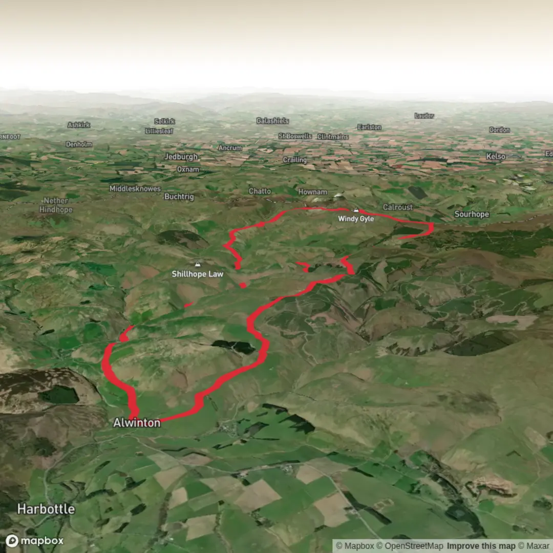
Starting from the remote valley near Shillmoor Farm in the heart of Northumberland National Park, this 36 km (22.4 miles) loop with approximately 1,000 metres (3,280 feet) of elevation gain offers a classic Cheviots experience. The trailhead is accessible by car via the minor road from Alwinton, with limited parking available at Shillmoor. For those using public transport, the nearest regular bus service stops at Alwinton village, about 6 km (3.7 miles) away, requiring a walk or taxi to the trailhead.Initial Ascent and Valley ViewsThe route begins with a steady climb from Shillmoor, quickly gaining height as you ascend the grassy slopes of The Dodd. Early on, the valley opens up behind you, offering sweeping views of the Coquet Valley and the rolling Cheviot hills. The path is well-defined but can be boggy after rain, so waterproof boots are recommended. As you approach the ridge, keep an eye out for red grouse and skylarks, which are common in this upland habitat.Windy Gyle and the Border RidgeAfter about 8 km (5 miles), the trail reaches the prominent summit of Windy Gyle, marked by Russell’s Cairn. This spot, straddling the England-Scotland border, is steeped in history—once a meeting point for border reivers and a site of ancient gatherings. The panoramic views here stretch across both countries, with the Cheviot massif to the north and the Otterburn Ranges to the south. The border ridge path is exposed and can be windy, so pack layers even in summer.Hindside Knowe and Remote MoorlandContinuing east along the border, the route undulates over Hindside Knowe and other lesser-known summits. This section is wild and remote, with few signs of civilization. The moorland is home to mountain hares and, in spring and summer, a profusion of wildflowers. Navigation can be challenging in poor visibility, so carrying a map, compass, and using HiiKER for GPS guidance is strongly advised.Descent to Shillmoor via Shillhope LawAfter passing the high point near Mozie Law, the trail turns south, descending gradually towards Shillhope Law. The descent offers a change in scenery, with heather moor giving way to grassy slopes and scattered juniper. The final stretch follows the Usway Burn, a clear upland stream, back to Shillmoor. Look for dippers and herons along the water, and, in autumn, the hillsides glow with purple heather.Points of Interest and Practical Considerations- Russell’s Cairn on Windy Gyle is a notable landmark, offering shelter and a place to rest. - The area is rich in archaeological remains, including ancient boundary stones and evidence of Iron Age settlements. - Weather in the Cheviots can change rapidly; always check the forecast and be prepared for mist and rain. - Water sources are available from streams, but purification is recommended. - Mobile signal is patchy; download maps and route details from HiiKER before setting out.This loop is a rewarding challenge for experienced hikers, offering solitude, wildlife, and a sense of the region’s storied past.

Surfaces
Unknown
Grass
Unpaved
Paved
Comments and Reviews
User comments, reviews and discussions about the Windy Gyle, Hindside Knowe and Shillmoor Loop, England.
average rating out of 5
0 rating(s)