Download
Preview
Add to list
More
14.1 km
~3 hrs 51 min
621 m
Loop
“Embark on a scenic 14 km loop from Clapham, unveiling natural beauty, geological wonders, and historical intrigue.”
Starting your adventure near the picturesque village of Clapham in North Yorkshire, England, this 14 km (8.7 miles) loop trail offers a blend of natural beauty, geological wonders, and historical intrigue. The trailhead is conveniently accessible by car, with parking available in Clapham village. For those using public transport, Clapham railway station is the nearest stop, and from there, it's a short walk to the village center where the trail begins.
Initial Ascent and Clapham Lake
The journey starts with a gentle ascent through Clapham village, leading you towards Clapham Lake. This serene body of water is surrounded by lush greenery and offers a peaceful start to your hike. The path here is well-marked and relatively easy, making it a good warm-up for the more challenging sections ahead. As you continue, you'll gain approximately 200 meters (656 feet) in elevation over the first 3 km (1.9 miles).
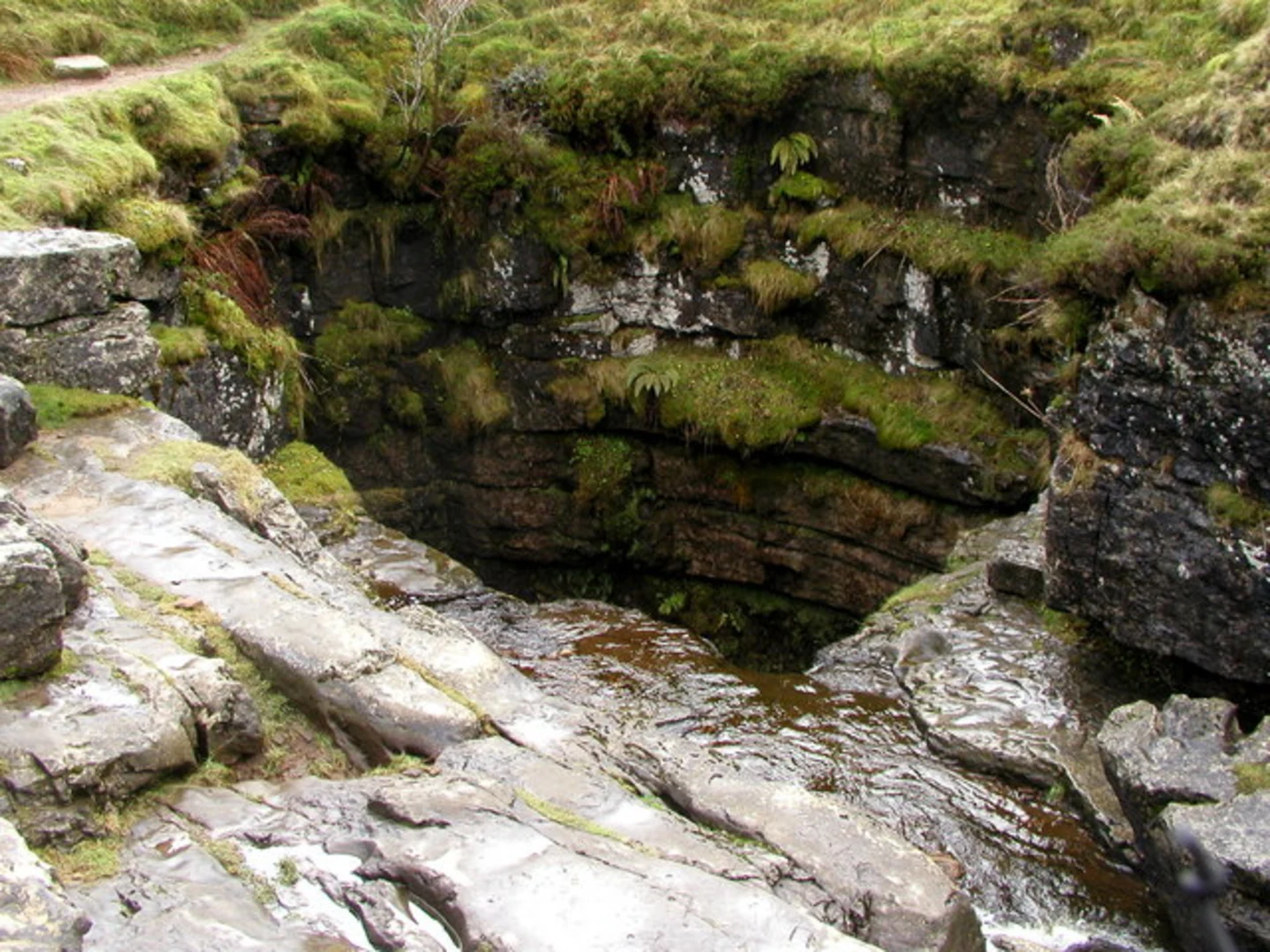
Trow Gill and Gaping Gill
Around the 4 km (2.5 miles) mark, you'll encounter Trow Gill, a dramatic limestone gorge that provides a stunning natural spectacle. The path through Trow Gill can be narrow and rocky, so take care as you navigate this section. Shortly after, you'll reach Gaping Gill, one of the largest underground chambers in Britain. This natural wonder is a must-see, and if you're lucky, you might catch a glimpse of cavers exploring its depths. The elevation gain here is moderate, adding another 100 meters (328 feet) to your climb.
Ascent to Ingleborough
Continuing on, the trail becomes steeper as you approach the ascent to Ingleborough, one of the Yorkshire Dales' famous Three Peaks. This section is the most challenging part of the hike, with an elevation gain of about 300 meters (984 feet) over 2 km (1.2 miles). The path is well-trodden but can be slippery in wet conditions, so sturdy footwear is essential. As you climb, take in the panoramic views of the surrounding dales and valleys.
Summit of Ingleborough
Reaching the summit of Ingleborough at 723 meters (2,372 feet) above sea level, you'll be rewarded with breathtaking 360-degree views. On a clear day, you can see as far as the Lake District and the Irish Sea. The summit plateau is broad and flat, providing ample space to rest and enjoy the scenery. This is a great spot for a picnic before beginning your descent.
Descent and Return to Clapham
The descent from Ingleborough is gradual and less strenuous, leading you back towards Clapham. The path here is well-defined and offers beautiful views of the surrounding landscape. As you make your way down, you'll pass through areas rich in flora and fauna, including wildflowers and birdlife typical of the Yorkshire Dales. The final stretch of the trail brings you back through Clapham village, completing the loop.
Historical Significance
The region around Clapham and Ingleborough is steeped in history. Clapham itself is a charming village with roots dating back to the medieval period. The area is also known for its rich geological history, with limestone formations that have been studied for centuries. Gaping Gill, in particular, has been a site of interest for geologists and cavers alike.
Navigation and Preparation
For navigation, it's highly recommended to use HiiKER, which provides detailed maps and real-time updates. Ensure you are well-prepared with appropriate clothing, footwear, and supplies, as weather conditions can change rapidly in the Yorkshire Dales. The trail is rated as medium difficulty, so a reasonable level of fitness is required.
Embark on this loop trail to experience the natural beauty, geological wonders, and historical richness of North Yorkshire.

What to expect?
Activity types
Comments and Reviews
User comments, reviews and discussions about the The Lake, Gaping Gill and Ingleborough Loop - Clapham, England.
4.57
average rating out of 5
7 rating(s)