Download
Preview
Add to list
More
22.2 km
~1 day 0 hrs
543 m
Loop
“Winding through wild moorland and timeless villages, this scenic loop brims with Bowland’s rural charm.”
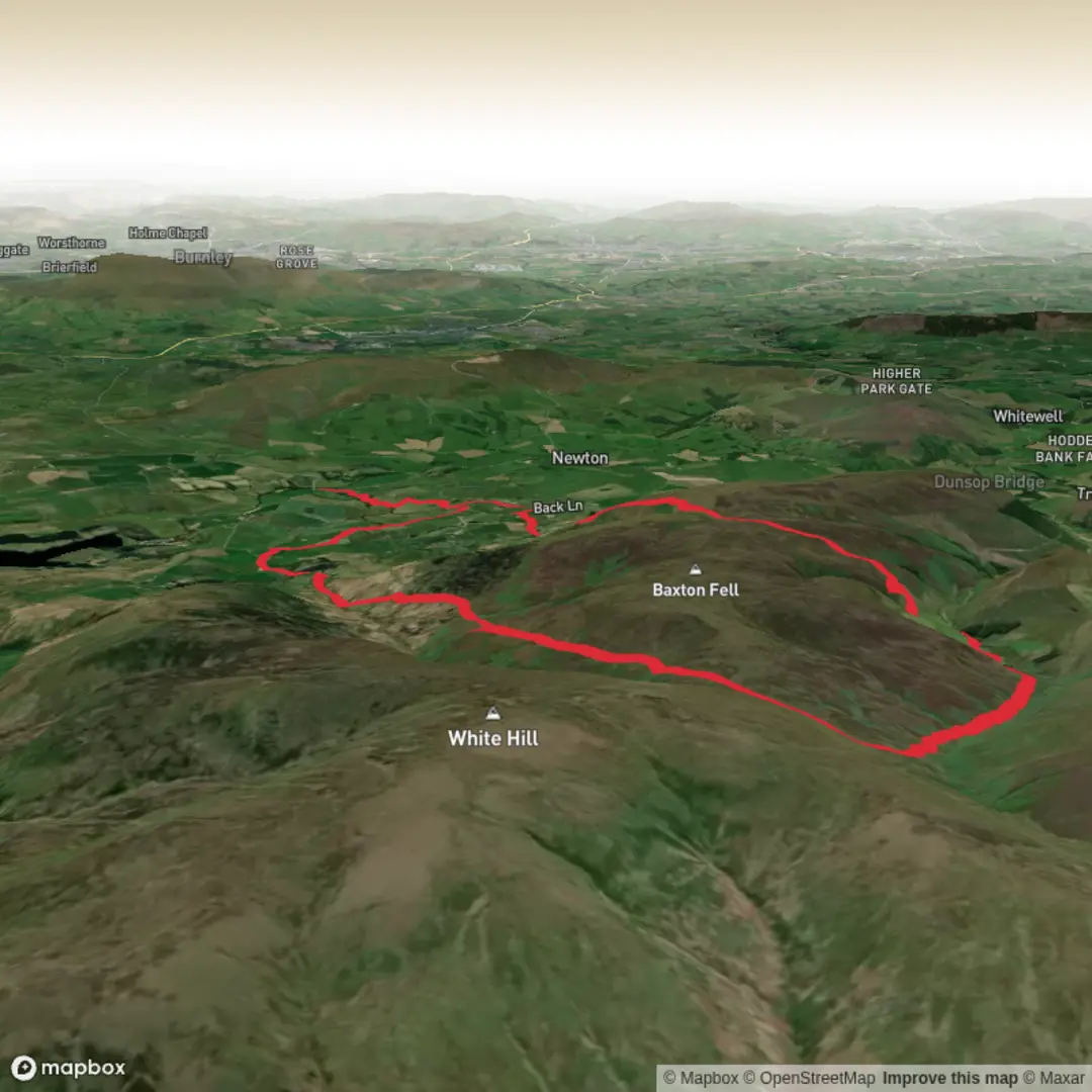
Starting from the charming village of Slaidburn, nestled in the heart of the Forest of Bowland, this 22 km (about 13.7 miles) loop offers a classic Pennine experience with rolling moorland, sweeping views, and a taste of rural Lancashire’s history. The hike begins near the Slaidburn Village Hall, a recognizable landmark and a convenient spot for parking or meeting up with fellow hikers.Getting ThereSlaidburn is accessible by car via the B6478, with parking available at the village hall or nearby public car parks. For those using public transport, the nearest train station is Clitheroe, about 14 km (8.7 miles) away. From Clitheroe, local buses (such as the 10 or 11) run to Slaidburn, though services can be infrequent, especially on weekends, so checking current timetables is essential.Trail Overview and NavigationThe loop covers approximately 500 metres (1,640 feet) of elevation gain, with the route undulating across open moorland, grassy tracks, and quiet country lanes. Navigation is straightforward but requires attention, especially in poor weather, as the moorland sections can be exposed and paths may become indistinct. HiiKER is recommended for reliable, up-to-date trail mapping and wayfinding.Landmarks and Points of InterestHistoric Slaidburn: The village itself is steeped in history, with its medieval church, St. Andrew’s, and the 17th-century Hark to Bounty Inn, both worth a visit before or after your hike.Baxton Fell: After leaving Slaidburn, the route climbs steadily towards Baxton Fell. At around 6 km (3.7 miles), you’ll reach the open expanse of the fell, offering panoramic views across the Hodder Valley and towards the Yorkshire Dales. The summit area is marked by rough grassland and heather, with skylarks and curlews often seen in spring and summer.Wildlife and Nature: The Forest of Bowland is a designated Area of Outstanding Natural Beauty, home to upland birds such as lapwings, red grouse, and the occasional hen harrier. The moorland is interspersed with peat bogs and small streams, supporting a variety of wildflowers and insects in the warmer months.Historic Farmsteads and Stone Walls: As the route loops back towards Slaidburn, you’ll pass several traditional stone farmsteads and dry-stone walls, characteristic of the Lancashire uplands. These features reflect centuries of agricultural history and the region’s importance in sheep and cattle farming.Terrain and ConditionsExpect a mix of grassy paths, gravel tracks, and short sections of quiet tarmac lanes. After rain, the moorland can become boggy, so waterproof boots are advisable. The exposed nature of the route means weather can change rapidly; carrying layers and waterproofs is recommended year-round.Practical TipsThere are limited facilities along the route, so bring sufficient water and snacks. Slaidburn offers a café and pub for refreshments before or after your walk. Mobile signal can be patchy on the fells, so downloading the route on HiiKER before setting out is wise. The loop is best tackled in daylight hours, and while stiles and gates are generally well-maintained, some may be awkward for larger dogs.This hike offers a rewarding blend of natural beauty, wildlife, and rural heritage, making it a memorable day out in the Forest of Bowland.

Surfaces
Unknown
Ground
Asphalt
Gravel
Unpaved
Concrete
Paved
Wood
Grass
Comments and Reviews
User comments, reviews and discussions about the Baxton Fell Loop from Slaidburn, England.
average rating out of 5
0 rating(s)