Download
Preview
Add to list
More
5.3 km
~1 hrs 17 min
145 m
Loop
“"Explore the scenic and historical 5 km Titley and Mortimer Trail, perfect for moderately experienced hikers."”
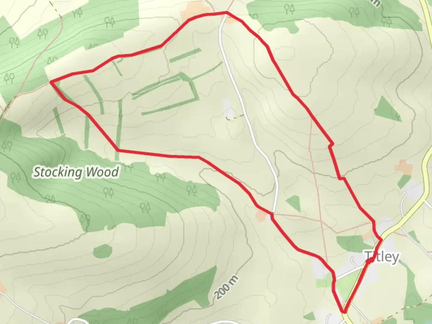
Starting near Herefordshire, England, the Titley and Mortimer Trail is a delightful 5 km (approximately 3.1 miles) loop with an elevation gain of around 100 meters (328 feet). This trail is rated as medium difficulty, making it suitable for moderately experienced hikers.### Getting There To reach the trailhead, you can drive or use public transport. If driving, head towards the village of Titley, which is well-signposted from the A44. There is limited parking available near the St. Peter's Church in Titley. For those using public transport, the nearest train station is in Leominster, about 12 miles (19 km) away. From Leominster, you can take a local bus or taxi to Titley.### Trail Overview The trail begins near St. Peter's Church in Titley, a historical landmark dating back to the 12th century. As you set off, you'll be greeted by a mix of open fields and dense woodlands, offering a variety of landscapes to enjoy.### Key Sections and Landmarks#### Titley Junction About 1 km (0.6 miles) into the hike, you'll come across the old Titley Junction railway station. This disused station is a relic of the Victorian era, providing a glimpse into the region's industrial past. The station was once part of the Leominster and Kington Railway, which played a crucial role in local trade and transport.#### Mortimer Forest Continuing on, you'll enter Mortimer Forest around the 2 km (1.2 miles) mark. This ancient woodland is rich in biodiversity, home to a variety of bird species, including woodpeckers and nuthatches. Keep an eye out for deer, which are often seen grazing in the early morning or late afternoon.#### Panoramic Views As you ascend to the highest point of the trail, approximately 3 km (1.9 miles) in, you'll be rewarded with panoramic views of the Herefordshire countryside. This section offers a great spot for a break and some photography. The elevation gain here is about 50 meters (164 feet), making it the steepest part of the hike.### Navigation and Safety The trail is well-marked, but it's always a good idea to have a reliable navigation tool. HiiKER is an excellent app for this purpose, providing detailed maps and real-time GPS tracking. Make sure to wear sturdy hiking boots, as some sections can be muddy, especially after rain.### Flora and Fauna Throughout the hike, you'll encounter a variety of plant species, from ancient oaks to vibrant wildflowers. The trail is particularly beautiful in spring when bluebells carpet the forest floor. Birdwatchers will enjoy spotting species like the red kite and buzzard soaring above.### Historical Significance The region is steeped in history, with the Mortimer family playing a significant role during the medieval period. The Mortimers were influential in the Welsh Marches, and their legacy is still evident in the local architecture and place names.### Final Stretch As you loop back towards Titley, the final 1 km (0.6 miles) is a gentle descent through open fields, offering a relaxing end to your hike. You'll return to St. Peter's Church, where you can take a moment to explore the churchyard and its ancient yew trees.This trail offers a perfect blend of natural beauty, historical intrigue, and moderate physical challenge, making it a rewarding experience for any hiker.

What to expect?
Activity types
Comments and Reviews
User comments, reviews and discussions about the Titley and Mortimer Trail, England.
5.0
average rating out of 5
1 rating(s)