Download
Preview
Add to list
More
18.8 km
~4 hrs 31 min
454 m
Loop
“Explore Gloucestershire's scenic 19 km trail with diverse landscapes, historical sites, and moderate challenges.”
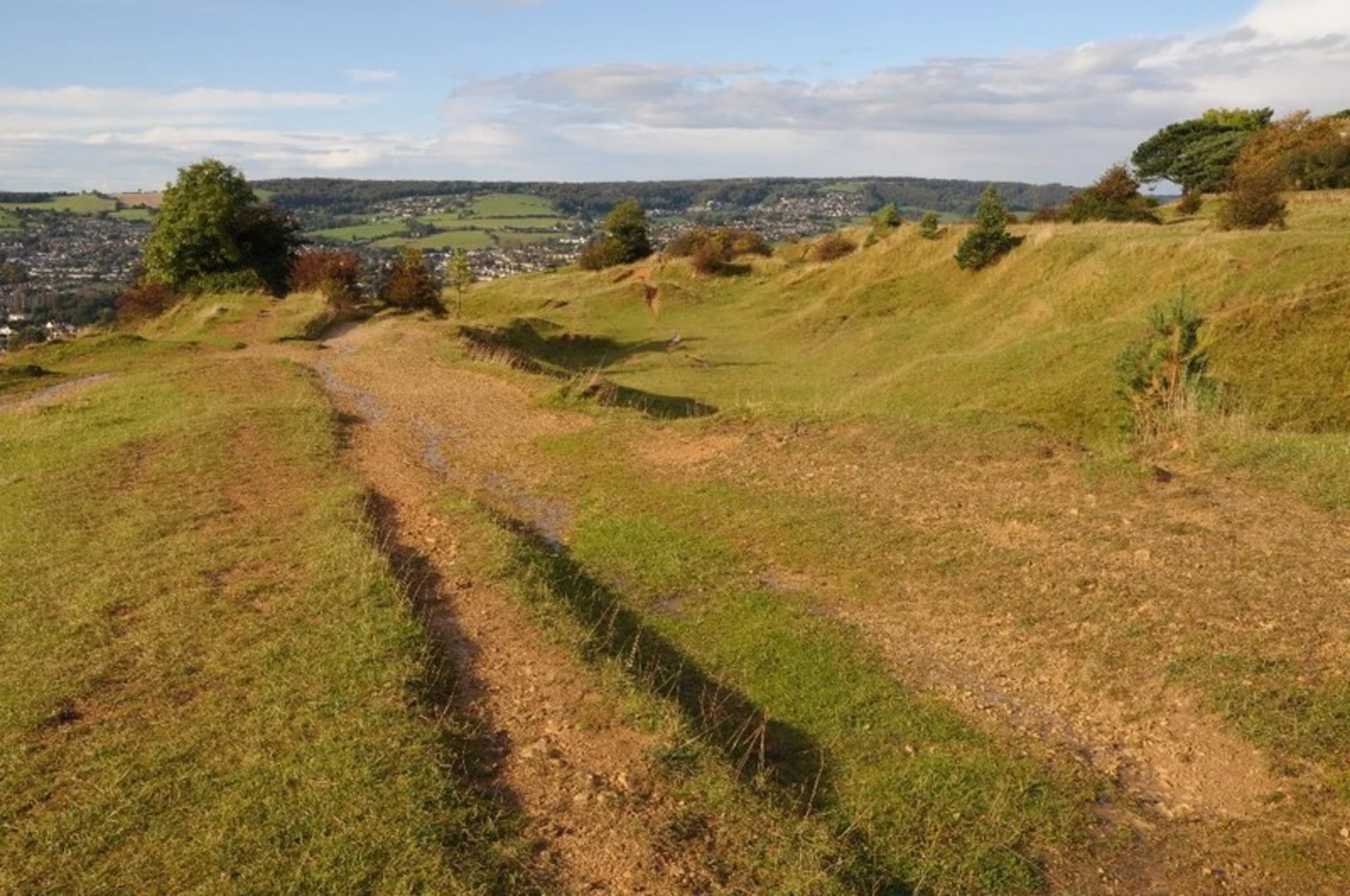
Starting near Gloucestershire, England, this 19 km (approximately 11.8 miles) loop trail offers a moderate challenge with an elevation gain of around 400 meters (about 1,312 feet). The trailhead is conveniently accessible by both public transport and car. If you're driving, you can park near the Stroud town center, which is well-signposted and has ample parking facilities. For those using public transport, Stroud railway station is the nearest major hub, with frequent services from London Paddington and other regional stations. From the station, it's a short walk to the trailhead.### Initial Ascent and The KnappThe trail begins with a gentle ascent through the picturesque town of Stroud, known for its vibrant arts scene and historic architecture. As you leave the town behind, the path gradually climbs towards The Knapp, a wooded area that offers a serene escape from urban life. The initial 3 km (1.9 miles) of the trail will take you through mixed woodlands, where you can spot a variety of bird species, including woodpeckers and nuthatches. The elevation gain here is moderate, around 100 meters (328 feet), making it a good warm-up for the more challenging sections ahead.### Rodborough CommonAround the 5 km (3.1 miles) mark, you'll reach Rodborough Common, a significant landmark known for its expansive views and rich biodiversity. This area is a designated Site of Special Scientific Interest (SSSI) due to its unique limestone grassland habitat. Keep an eye out for rare orchids and butterflies, particularly during the summer months. The common is also home to a herd of Belted Galloway cattle, which help maintain the grassland ecosystem. The elevation gain here is more gradual, adding another 150 meters (492 feet) over the next 4 km (2.5 miles).### Historical SignificanceRodborough Common is steeped in history, with evidence of human activity dating back to the Iron Age. The common was also a strategic location during the English Civil War, and you can still see remnants of old fortifications. As you hike through this area, you'll pass by Rodborough Fort, a 1761 folly that offers panoramic views of the surrounding countryside. This is a great spot to take a break and soak in the historical ambiance.### Descent and Return to StroudThe trail then begins its descent back towards Stroud, passing through a mix of open fields and wooded areas. Around the 14 km (8.7 miles) mark, you'll come across The Heavens, another area of natural beauty with a network of well-maintained paths. This section is relatively flat, making for a pleasant and leisurely walk back to the town. The final 5 km (3.1 miles) will take you through the outskirts of Stroud, where you can enjoy views of the Cotswold Hills and the River Frome.### Navigation and SafetyFor navigation, it's highly recommended to use the HiiKER app, which provides detailed maps and real-time updates. The trail is well-marked, but having a reliable navigation tool will ensure you stay on track. Always carry sufficient water, snacks, and a basic first aid kit. The weather can be unpredictable, so pack layers and waterproof gear.This loop trail offers a perfect blend of natural beauty, historical significance, and moderate physical challenge, making it an ideal choice for hikers looking to explore the Gloucestershire countryside.

What to expect?
Activity types
Comments and Reviews
User comments, reviews and discussions about the Stroud, The Knapp and Rodborough Loop, England.
average rating out of 5
0 rating(s)