Download
Preview
Add to list
More
159.9 km
~10 days
4832 m
Multi-Day
“Winding through lush valleys, dramatic coasts, and storybook villages, the South Hams Way dazzles with timeless English charm.”
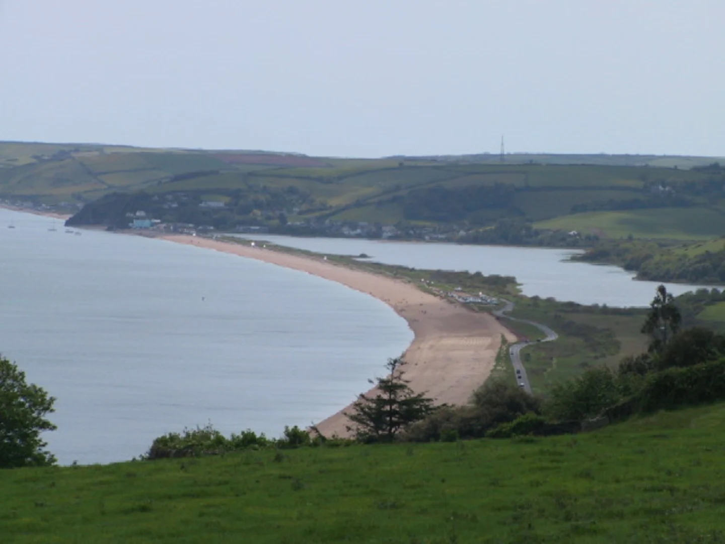
Starting near the picturesque market town of Totnes in Devon, England, the South Hams Way is a loop trail stretching approximately 160 km (about 99 miles) with a total elevation gain of around 4,800 metres (15,750 feet). This route weaves through the heart of the South Hams district, renowned for its rolling countryside, dramatic coastline, and quintessential English villages.Getting ThereTotnes is well-served by public transport, with regular trains from Exeter, Plymouth, and London Paddington. The train station is a short walk from the town centre, where the trail begins. For those arriving by car, Totnes offers several long-stay car parks, such as the Totnes Station Car Park and the Civic Hall Car Park, both within easy reach of the trailhead.Trail Overview and NavigationThe South Hams Way forms a loop, allowing hikers to start and finish in Totnes. The route is best navigated using HiiKER, which provides up-to-date mapping, elevation profiles, and waypoints. The trail is rated as medium difficulty, with a mix of gentle riverside paths, steep coastal climbs, and undulating farmland.Landmarks and Points of Interest- Dartington Hall (approx. 3 km / 1.8 miles from Totnes): One of the first significant landmarks, this medieval estate is surrounded by ancient woodland and gardens. The hall has a rich history dating back to the 14th century and is now a centre for arts and learning. - River Dart Valley: The trail follows the River Dart for several kilometres, offering serene riverside walking and the chance to spot kingfishers, otters, and herons. The valley is lush with wildflowers in spring and early summer. - Dartmoor National Park (approx. 25 km / 15.5 miles in): The route skirts the southern edge of Dartmoor, with panoramic views of granite tors and moorland. This section includes some of the highest elevation gains, with climbs that reward hikers with sweeping vistas. - Salcombe Estuary (approx. 70 km / 43 miles in): The path descends to the coast at Salcombe, a historic port town known for its pastel-coloured houses and bustling harbour. The estuary is a haven for birdlife, including oystercatchers and curlews. - South West Coast Path Section: The trail merges with the South West Coast Path for several stretches, traversing dramatic cliffs, secluded coves, and sandy beaches. Look out for Start Point Lighthouse, a prominent landmark perched on a rugged headland. - Kingsbridge (approx. 100 km / 62 miles in): This market town is a good resupply point, with shops, cafes, and accommodation. The town’s history as a medieval wool trading centre is evident in its architecture. - Avon Estuary and Bantham Beach: The route crosses the Avon Estuary via a pedestrian ferry (seasonal), leading to Bantham Beach, popular with surfers and known for its views of Burgh Island. - Historic Villages: The trail passes through several charming villages, including Modbury, known for its independent shops, and Stoke Gabriel, famous for its ancient yew tree and riverside setting.Nature and WildlifeThe South Hams region is designated an Area of Outstanding Natural Beauty (AONB), supporting a diverse range of habitats. Expect to see ancient oak woodlands, wildflower meadows, and salt marshes. Coastal sections are frequented by seals and, occasionally, dolphins. The hedgerows and meadows are alive with butterflies and bees in summer.Elevation and TerrainThe total elevation gain of 4,800 metres (15,750 feet) is spread across rolling hills, steep coastal climbs, and gentle river valleys. The most challenging ascents are found near Dartmoor and along the coastal cliffs. Terrain varies from well-maintained footpaths and bridleways to rugged, muddy tracks, especially after rain.Planning and PreparationAccommodation options range from campsites and hostels to B&Bs and inns in towns and villages along the route. Water sources are available in most settlements, but carrying a filter or purification tablets is advisable for remote sections. Weather in Devon can be unpredictable, so pack waterproofs and layers. The trail is best tackled from late spring to early autumn for optimal conditions.Historical SignificanceThe South Hams has a rich tapestry of history, from prehistoric standing stones on Dartmoor to medieval churches and Elizabethan manor houses. The region played a role in the English Civil War and was a centre for maritime trade and fishing. Many villages retain their historic character, with thatched cottages and cobbled lanes.For navigation, HiiKER provides comprehensive mapping and trail information, ensuring hikers stay on track and make the most of this scenic and culturally rich journey through Devon’s South Hams.

Comments and Reviews
User comments, reviews and discussions about the South Hams Way, England.
average rating out of 5
0 rating(s)