Download
Preview
Add to list
More
6.7 km
~1 hrs 43 min
237 m
Out and Back
“The River Calder Streamside Walk - Cold Fell is a scenic, history-rich hike with lush woodlands and panoramic views.”
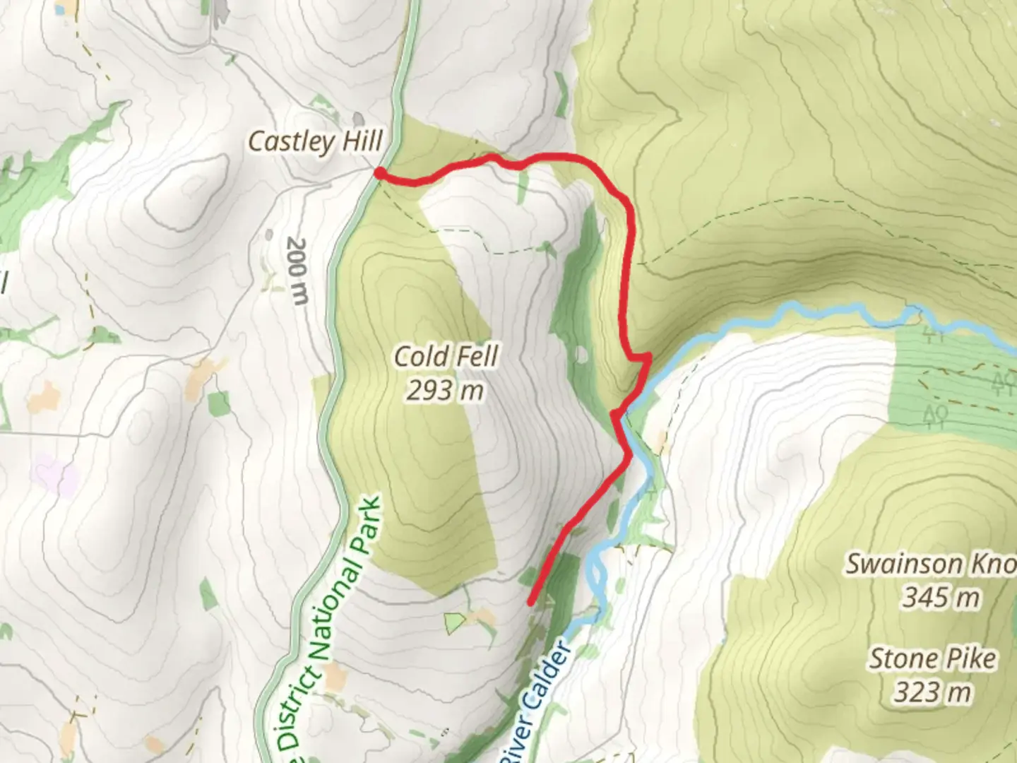
Starting near the quaint village of Cumberland in England, the River Calder Streamside Walk - Cold Fell is a delightful out-and-back trail that spans approximately 7 km (4.3 miles) with an elevation gain of around 200 meters (656 feet). This medium-difficulty hike offers a blend of serene river views, lush woodlands, and open fell landscapes, making it a rewarding experience for nature enthusiasts and history buffs alike.### Getting ThereTo reach the trailhead, you can either drive or use public transport. If driving, head towards Cumberland and look for parking near the village center. For those relying on public transport, the nearest significant landmark is the Cumberland Railway Station. From there, local buses or a short taxi ride can get you to the trailhead.### Trail OverviewThe trail begins near the village center, where you can find a small parking area. As you set off, you'll quickly find yourself walking alongside the River Calder. The initial section of the trail is relatively flat, making it an excellent warm-up as you follow the gentle curves of the river. The path here is well-trodden and easy to navigate, with the sound of flowing water providing a soothing backdrop.### Flora and FaunaAs you progress, the trail meanders through dense woodlands, home to a variety of flora and fauna. Keep an eye out for native bird species such as the European robin and the great tit. The underbrush is often teeming with small mammals like hedgehogs and squirrels. In spring and summer, the forest floor is carpeted with wildflowers, including bluebells and primroses, adding a splash of color to your hike.### Historical SignificanceApproximately 3 km (1.9 miles) into the hike, you'll come across remnants of old stone walls and ruins, hinting at the area's historical significance. These ruins are believed to be part of ancient farming settlements that date back to the medieval period. Take a moment to appreciate the history embedded in these stones, imagining the lives of those who once called this rugged landscape home.### Ascending Cold FellAs you continue, the trail begins to ascend towards Cold Fell. This section is more challenging, with a steeper incline and rocky terrain. The elevation gain here is around 200 meters (656 feet), so take your time and ensure you have sturdy footwear. The effort is well worth it, as the higher you climb, the more expansive the views become. On a clear day, you can see for miles, with panoramic vistas of the surrounding fells and valleys.### Navigation and SafetyGiven the varying terrain, it's advisable to use a reliable navigation tool like HiiKER to stay on track. The trail is generally well-marked, but certain sections, especially in the woodlands and near the summit of Cold Fell, can be tricky to navigate. Always carry a map and compass as a backup, and be prepared for sudden changes in weather, which are common in this region.### Return JourneyAfter reaching the summit of Cold Fell, take a moment to soak in the breathtaking views before retracing your steps back to the trailhead. The descent is much easier, allowing you to enjoy the scenery from a different perspective. As you make your way back along the River Calder, you'll have a chance to reflect on the diverse landscapes and rich history you've encountered on this memorable hike.Whether you're a seasoned hiker or a casual walker, the River Calder Streamside Walk - Cold Fell offers a perfect blend of natural beauty and historical intrigue, making it a must-visit trail in the Cumberland area.

What to expect?
Activity types
Comments and Reviews
User comments, reviews and discussions about the River Calder Streamside Walk - Cold Fell, England.
5.0
average rating out of 5
1 rating(s)