Download
Preview
Add to list
More
16.8 km
~4 hrs 37 min
758 m
Loop
“Winding through ancient woods, lofty ridges, and hidden waterfalls, this loop unveils Lakeland’s wild heart.”
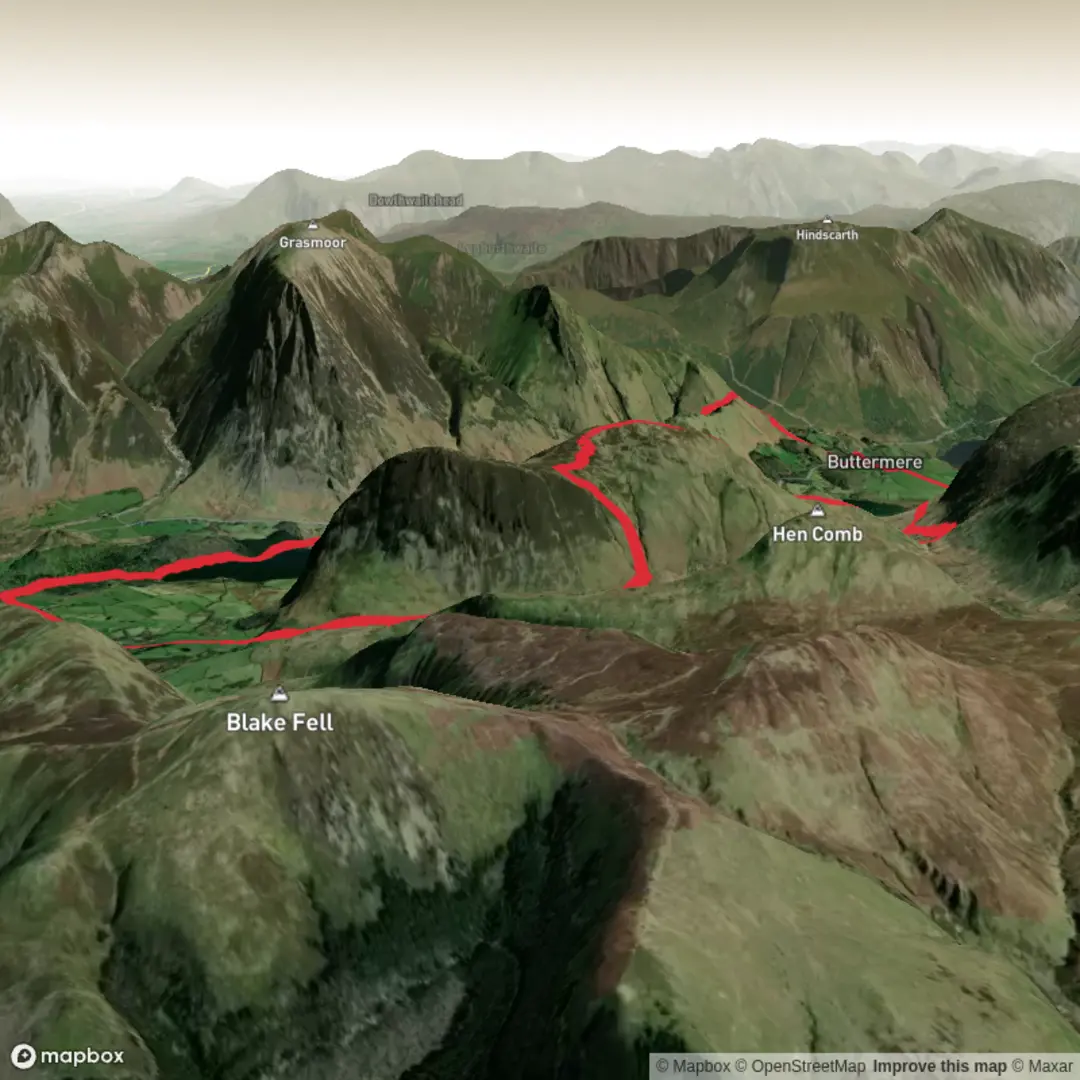
Starting from the National Trust car park at Lanthwaite Wood, just north of Crummock Water in the Lake District, this loop hike covers approximately 17 km (about 10.5 miles) with a total elevation gain of around 800 metres (2,625 feet). The trailhead is easily accessed by car via the B5289 from Keswick or Cockermouth, with parking available at Lanthwaite Wood. For those using public transport, regular buses run from Keswick and Cockermouth to the nearby village of Lorton, from where it’s a short walk to the starting point.
Initial Woodland and Lakeshore
The route begins by weaving through the ancient oaks and birches of Lanthwaite Wood, a serene woodland managed by the National Trust. Early on, the trail skirts the northern shore of Crummock Water, offering expansive views across the lake to the imposing slopes of Grasmoor and Whiteside. The lakeshore path is relatively flat for the first 2 km (1.2 miles), making for a gentle warm-up and a chance to spot herons, dippers, and, if you’re lucky, red squirrels darting among the trees.
Climbing Mellbreak
After leaving the lakeshore, the path turns south and begins the ascent of Mellbreak, a distinctive twin-summited fell that dominates the western side of Crummock Water. The climb is steep and rocky in places, gaining about 400 metres (1,300 feet) over 2 km (1.2 miles). The northern summit is reached first, with panoramic views over Loweswater, Crummock Water, and the Buttermere Valley. The southern summit, slightly higher, is reached after a short traverse along the ridge. This section can be exposed in poor weather, so sturdy boots and weatherproof clothing are essential.
Descent and Return via Mosedale
Descending from Mellbreak’s southern summit, the trail drops steeply into the secluded valley of Mosedale. The descent is rough underfoot, with loose stones and occasional boggy patches, so take care, especially after rain. The valley floor is a haven for wildlife, with curlews and lapwings nesting in the spring and summer. The route follows the Mosedale Beck northwards, passing through open pasture and scattered woodland.
Historic Sites and Natural Features
As the path curves back towards Crummock Water, it passes close to Scale Force, the highest waterfall in the Lake District, hidden in a deep, wooded gorge. A short detour of about 0.5 km (0.3 miles) leads to the base of the falls, where water plunges 51 metres (167 feet) in a single drop. The area around Crummock Water is steeped in history, with evidence of Bronze Age settlements and ancient packhorse routes that once linked the valleys.
Final Stretch and Navigation
The final section follows the western shore of Crummock Water, returning through Lanthwaite Wood to the starting point. The path here is undulating but less strenuous, with frequent glimpses of the lake and surrounding fells. Navigation is straightforward in good weather, but the area can be misty and disorienting—using HiiKER for route guidance is highly recommended.
Throughout the hike, expect a mix of well-trodden paths, rocky ascents, and occasional boggy ground. Weather in the Lake District can change rapidly, so pack layers, waterproofs, and sufficient food and water for a full day out. The loop offers a rewarding blend of dramatic scenery, rich wildlife, and glimpses into the region’s ancient past.

Surfaces
Unknown
Grass
Asphalt
Gravel
Wood
Comments and Reviews
User comments, reviews and discussions about the Crummock Water, Lanthwaite Wood and Mellbreak Loop, England.
average rating out of 5
0 rating(s)