Download
Preview
Add to list
More
55.7 km
~2 day
1755 m
Out and Back
“Explore Mazourka Peak Trail's rugged beauty, rich history, and diverse wildlife in California's Eastern Sierra.”
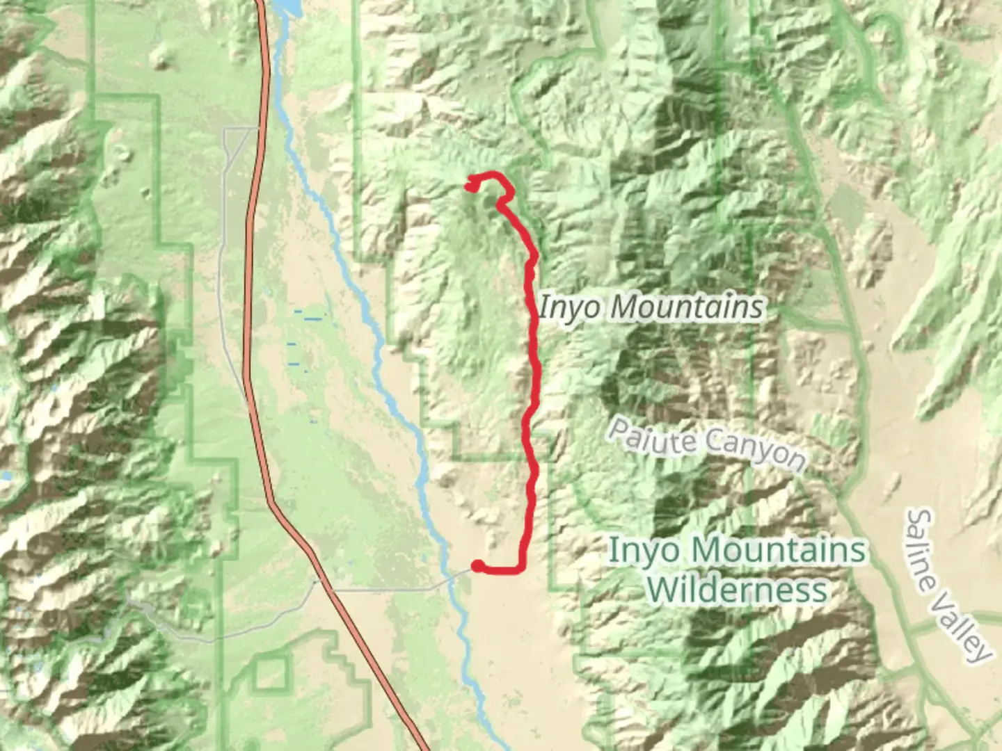
Nestled in the rugged terrain of Inyo County, California, the Mazourka Peak Trail offers a challenging yet rewarding adventure for hikers seeking to explore the natural beauty of the Eastern Sierra. This out-and-back trail stretches approximately 56 kilometers (about 35 miles) with an elevation gain of around 1,700 meters (5,577 feet), providing a medium difficulty level that requires a good level of fitness and preparation.
Getting There
The trailhead is conveniently located near Independence, California. For those traveling by car, take U.S. Highway 395 to Independence, then head east on Mazourka Canyon Road. The road is unpaved and can be rough, so a high-clearance vehicle is recommended. Public transportation options are limited in this remote area, so driving is the most practical way to reach the trailhead.
Trail Overview
The Mazourka Peak Trail begins with a gradual ascent through the arid landscape of the Inyo Mountains. As you progress, the trail becomes steeper, winding through a series of switchbacks that offer stunning views of the Owens Valley below. The first few kilometers (miles) are characterized by sparse vegetation, with hardy desert plants such as sagebrush and juniper dotting the landscape.
Flora and Fauna
As you climb higher, the vegetation becomes more diverse. Keep an eye out for pinyon pines and the occasional bristlecone pine, some of the oldest living trees on Earth. Wildlife is abundant in this region, and hikers may encounter mule deer, coyotes, and a variety of bird species, including the majestic golden eagle soaring overhead.
Historical Significance
The Inyo Mountains hold a rich history, with evidence of Native American habitation dating back thousands of years. The area was also a significant site during the California Gold Rush, and remnants of old mining operations can still be seen along the trail. These historical landmarks provide a glimpse into the past and add an intriguing layer to the hiking experience.
Reaching the Summit
The final push to Mazourka Peak is challenging, with a steep ascent that rewards hikers with panoramic views of the Sierra Nevada to the west and the vast expanse of the Great Basin to the east. The summit, at an elevation of approximately 3,200 meters (10,500 feet), is a perfect spot to rest and take in the breathtaking scenery.
Navigation and Safety
Given the trail's remote location, it's essential to be well-prepared. Ensure you have adequate water, food, and clothing for changing weather conditions. Navigation tools such as HiiKER are highly recommended to stay on track, as the trail can be difficult to follow in some sections. Cell phone reception is limited, so inform someone of your plans before setting out.
The Mazourka Peak Trail offers a unique blend of natural beauty, challenging terrain, and historical intrigue, making it a must-visit for avid hikers looking to explore the less-traveled paths of California's Eastern Sierra.

What to expect?
Activity types
Comments and Reviews
User comments, reviews and discussions about the Mazourka Peak Trail, California.
average rating out of 5
0 rating(s)