Download
Preview
Add to list
More
46.6 km
~2 day
2281 m
Point-to-Point
“Embark on a thrilling, panoramic adventure through the Grand Canyon's rugged trails, rich in history and natural beauty.”
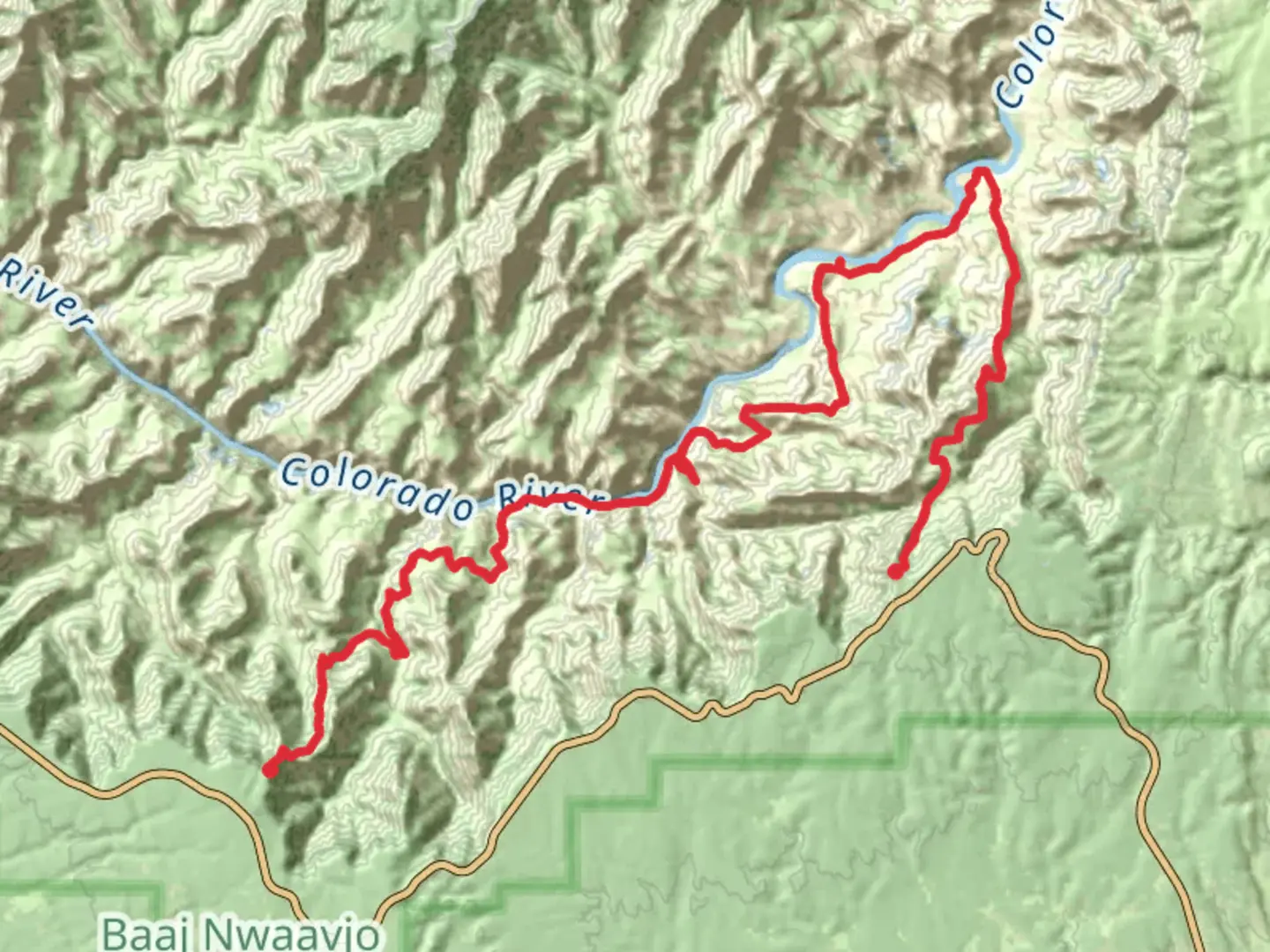
Embarking on the Tanner, Escalante Route, and Grandview Trail is a journey through the heart of the Grand Canyon, offering a challenging yet rewarding experience for seasoned hikers. This point-to-point trail spans approximately 47 kilometers (about 29 miles) with an elevation gain of around 2,200 meters (7,218 feet), making it a difficult trek that requires thorough preparation and planning.
Getting There
The trailhead is located near the Grand Canyon in Arizona. For those traveling by car, the most convenient access point is the Grandview Point, which is approximately 12 miles east of the Grand Canyon Village along Desert View Drive. Parking is available at the Grandview Point parking area. If you're relying on public transport, the nearest major hub is Flagstaff, Arizona. From Flagstaff, you can take a shuttle service to the Grand Canyon Village and then arrange for a taxi or shuttle to Grandview Point.
Trail Overview
The journey begins at the Tanner Trailhead, descending steeply from the South Rim. The initial section is rugged and demands careful navigation, with loose rocks and steep drop-offs. As you descend, the views of the Colorado River and the surrounding canyon walls are breathtaking, offering a glimpse into the geological history of the region.
#### Tanner Trail
The Tanner Trail is known for its challenging terrain and lack of water sources, so carrying sufficient water is crucial. The trail descends approximately 1,500 meters (4,921 feet) over 14 kilometers (8.7 miles) to the Colorado River. Along the way, you'll encounter stunning vistas of the Palisades of the Desert and the Escalante Butte.
#### Escalante Route
Continuing onto the Escalante Route, the trail follows the Colorado River for about 17 kilometers (10.5 miles). This section is less defined and requires keen navigation skills, with the HiiKER app being an invaluable tool. The route offers a mix of sandy beaches and rocky scrambles, with highlights including the historic 75 Mile Creek and the serene Escalante Creek. Keep an eye out for wildlife such as bighorn sheep and various bird species.
#### Grandview Trail
The final leg of the journey is the Grandview Trail, which ascends back to the South Rim over approximately 16 kilometers (9.9 miles). This section is steep and strenuous, with an elevation gain of about 700 meters (2,297 feet). The trail passes through the remnants of the Last Chance Mine, offering a glimpse into the area's mining history. As you climb, the panoramic views of the canyon unfold, providing a fitting end to this epic trek.
Historical Significance
The Grand Canyon is not only a natural wonder but also a site of rich historical significance. The trails you traverse were once used by Native American tribes, and later by miners during the late 19th and early 20th centuries. The Grandview Trail, in particular, was developed by miners seeking copper and other minerals, and remnants of their endeavors can still be seen today.
Preparation and Safety
Given the trail's difficulty, it's essential to be well-prepared. Ensure you have adequate supplies, including water, food, and navigation tools like the HiiKER app. Weather conditions can vary greatly, so check forecasts and be prepared for extreme temperatures. Permits are required for overnight camping in the Grand Canyon, so plan accordingly. Always inform someone of your itinerary and expected return time.

What to expect?
Activity types
Comments and Reviews
User comments, reviews and discussions about the Tanner, Escalante Route and Grandview Trail, Arizona.
average rating out of 5
0 rating(s)