Download
Preview
Add to list
More
5.3 km
~1 hrs 29 min
256 m
Loop
“Experience the diverse beauty of Teton Range on a scenic 5 km loop with lush meadows, forests, and panoramic views.”
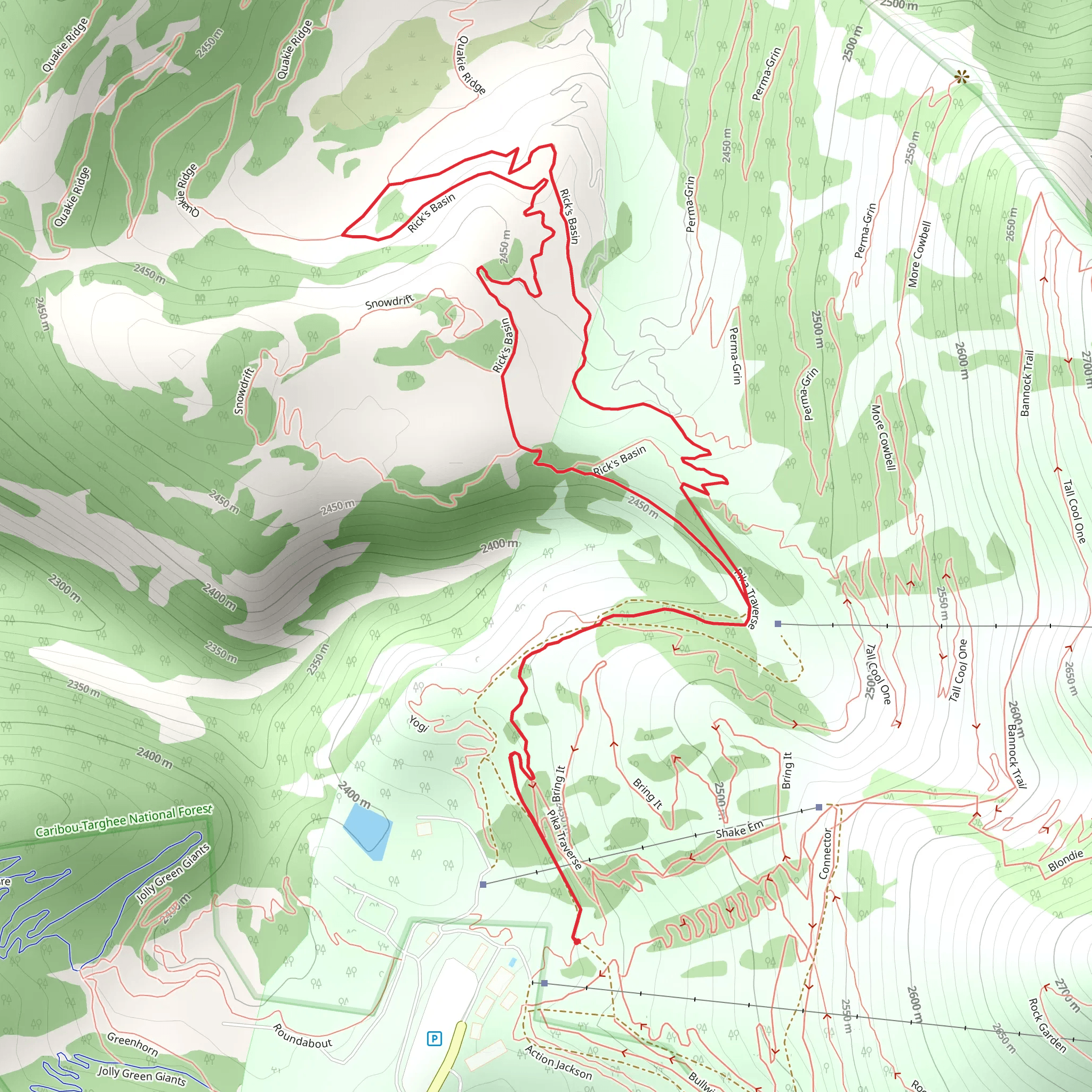
Nestled near Teton County, Wyoming, this loop trail offers a delightful 5 km (approximately 3.1 miles) journey with an elevation gain of around 200 meters (656 feet). The trailhead is conveniently located near the Grand Targhee Resort, making it easily accessible for those traveling by car. If you're using public transport, the nearest major hub is Jackson, Wyoming, from where you can catch a shuttle or taxi to the resort.### Getting There To reach the trailhead by car, drive towards the Grand Targhee Resort, which is well-signposted from Driggs, Idaho. From Driggs, take Ski Hill Road east for about 12 miles (19 km) until you reach the resort. Parking is available at the resort, and the trailhead is clearly marked.### Trail Overview The Rick's Basin Loop is a moderately challenging trail, perfect for hikers looking to experience the natural beauty of the Teton Range without the intensity of more strenuous hikes. The loop is well-marked and maintained, making navigation straightforward. For those who prefer digital navigation, the HiiKER app provides an excellent map and GPS tracking for this trail.### Key Landmarks and Points of Interest As you embark on the loop, you'll quickly find yourself immersed in a diverse landscape. The trail meanders through lush meadows, dense forests, and open ridgelines, offering a variety of scenery.- Meadows and Wildflowers: Approximately 1 km (0.6 miles) into the hike, you'll encounter expansive meadows that burst into color during the summer months. Wildflowers such as lupine, Indian paintbrush, and columbine are abundant, making this section a photographer's dream.- Forest Sections: Around the 2 km (1.2 miles) mark, the trail dips into a dense forest of lodgepole pines and aspens. This shaded area provides a cool respite on warmer days and is a great spot to observe local wildlife. Keep an eye out for deer and the occasional moose.- Ridgeline Views: As you ascend to the higher elevations, roughly 3 km (1.9 miles) into the loop, you'll be rewarded with stunning views of the Teton Range. This section offers panoramic vistas that are particularly breathtaking at sunrise or sunset.### Historical Significance The area around Rick's Basin has a rich history tied to the early settlers and Native American tribes who once roamed these lands. The Teton Range itself was named by French trappers in the early 19th century, and the region has been a hub for outdoor enthusiasts ever since. While hiking, you might come across remnants of old cabins and mining equipment, harking back to the days when the area was explored for its natural resources.### Wildlife and Flora The trail is home to a variety of wildlife, including elk, deer, and numerous bird species. It's not uncommon to spot a red-tailed hawk soaring above or hear the distant call of a coyote. The flora is equally diverse, with towering pines, vibrant wildflowers, and hardy shrubs dotting the landscape.### Final Stretch As you near the end of the loop, the trail descends gently back towards the trailhead, offering a pleasant cooldown. The final kilometer (0.6 miles) is relatively flat and passes through another meadow, providing one last opportunity to soak in the natural beauty of the area.### Preparation Tips Given the moderate difficulty of the trail, it's advisable to wear sturdy hiking boots and bring plenty of water, especially during the warmer months. Weather in the Teton Range can be unpredictable, so packing a light rain jacket and some extra layers is always a good idea. For navigation, the HiiKER app is highly recommended to ensure you stay on track and make the most of your hike.
What to expect?
Activity types
Comments and Reviews
User comments, reviews and discussions about the Rick's Basin Loop, Wyoming.
4.43
average rating out of 5
51 rating(s)
