Download
Preview
Add to list
More
61.5 km
~4 days
1926 m
Multi-Day
“Trek the Cirque of the Towers Loop for majestic peaks, diverse wildlife, and historical trails.”
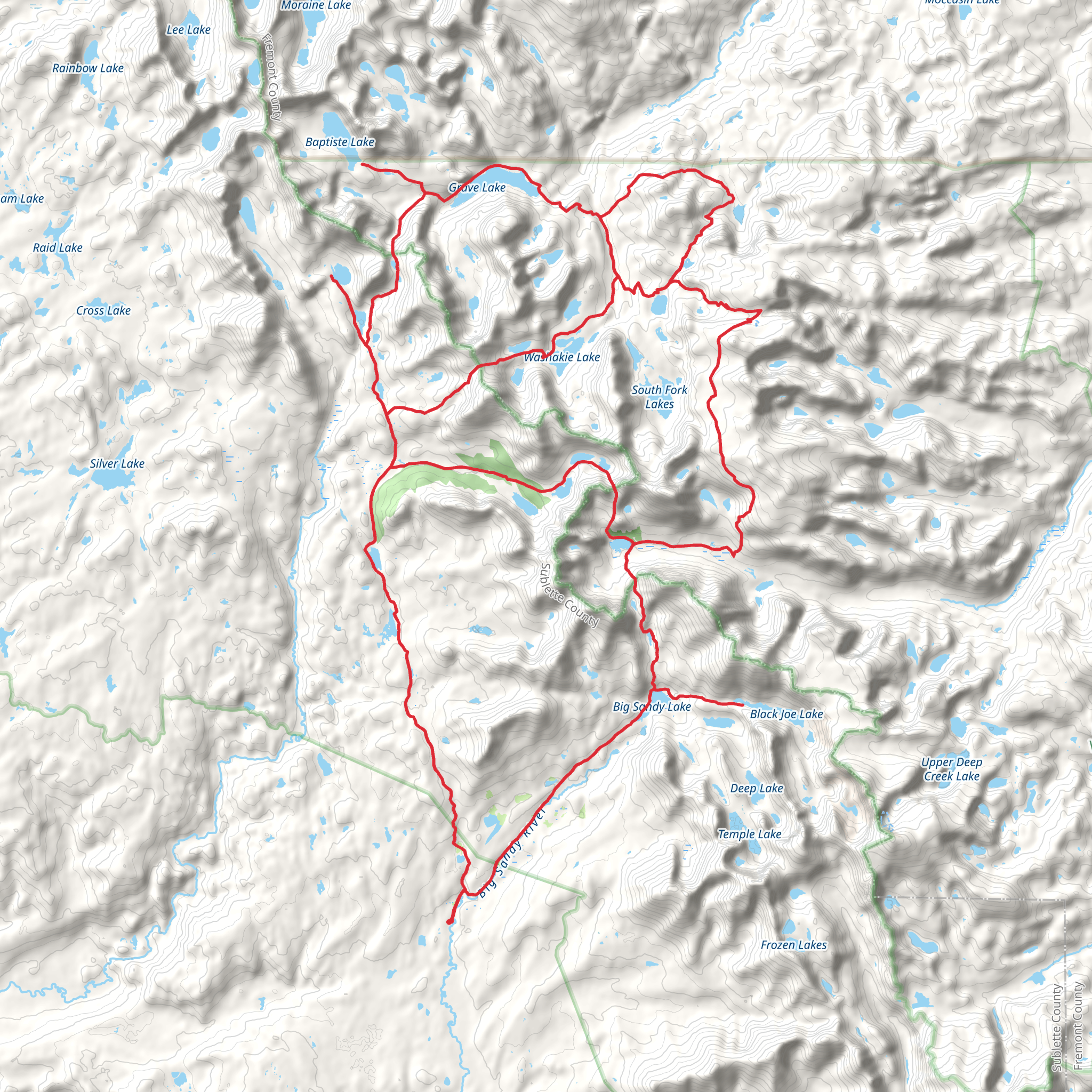
Embarking on the Cirque of the Towers Loop, you'll be traversing approximately 62 kilometers (about 38.5 miles) of Wyoming's most breathtaking backcountry in the Wind River Range. With an elevation gain of around 1900 meters (approximately 6200 feet), this loop is a medium difficulty trek that offers a mix of challenging and rewarding experiences.
Starting at the Big Sandy Trailhead, which is accessible by car from the nearest town of Pinedale, Wyoming, you'll need to navigate forest service roads to reach the trailhead. Pinedale is the closest town with amenities and can be reached by car from Jackson Hole or Rock Springs airports. From Pinedale, take WY-353 south for about 18 miles to Boulder, where you'll continue on the Big Sandy Opening Road for another 10 miles until you reach the trailhead.
Navigating the Loop
The trail begins by meandering through pine forests and meadows, gradually ascending towards the Continental Divide. As you progress, you'll encounter the Big Sandy River, a gentle waterway that you'll follow before the trail begins its climb. Using HiiKER to navigate, you'll find waypoints and water sources easily marked, ensuring you stay on track and hydrated.
The Cirque of the Towers, a jaw-dropping natural amphitheater of jagged granite peaks, is the highlight of this trek. You'll reach this point after approximately 24 kilometers (15 miles) of hiking. Here, the Lonesome Lake offers a serene spot for rest and reflection, surrounded by towering pinnacles like Pingora Peak and Wolf's Head.
Wildlife and Flora
As you hike, keep an eye out for the diverse wildlife that inhabits the region. You may spot moose, elk, mule deer, and even black bears, so be sure to practice bear safety. The area is also rich in birdlife, including eagles and peregrine falcons. The flora is equally impressive, with wildflowers like Indian paintbrush and lupine adding splashes of color to the landscape in the warmer months.
Historical Significance
The Wind River Range holds great historical significance, with Native American tribes such as the Shoshone and Arapaho having traversed these lands for centuries. The region was later explored by fur trappers and played a role in the westward expansion of the United States.
Preparing for the Hike
Before setting out, ensure you're prepared for the variable weather conditions that can occur at high altitudes. Pack layers, rain gear, and a reliable tent. It's also essential to have a map and compass or a GPS device; HiiKER is an excellent resource for trail maps and navigation. Remember to leave no trace, pack out all your trash, and be respectful of the natural environment.
Water is available from streams and lakes, but it should always be treated before drinking. Campsites are found along the trail, but they are first-come, first-served, so plan your days accordingly to secure a spot, especially during peak season.
Access and Transportation
To reach the trailhead, most hikers will drive as public transportation options are limited in this remote area. If you're coming from out of state, consider renting a car from one of the airports mentioned earlier. There is a parking area at the Big Sandy Trailhead, but it can fill up quickly in the summer months, so arrive early to secure a spot.
The Cirque of the Towers Loop is a must-do for avid hikers seeking a true wilderness experience. With its stunning landscapes, rich history, and diverse wildlife, it's a journey that encapsulates the rugged beauty of Wyoming's Wind River Range.
What to expect?
Activity types
Comments and Reviews
User comments, reviews and discussions about the Cirque of the Towers Loop, Wyoming.
4.33
average rating out of 5
21 rating(s)

