Download
Preview
Add to list
More
35.4 km
~2 day
1926 m
Out and Back
“Embark on the Deer Creek Trail for a moderately challenging, picturesque adventure through Wyoming's stunning Rocky Mountains.”
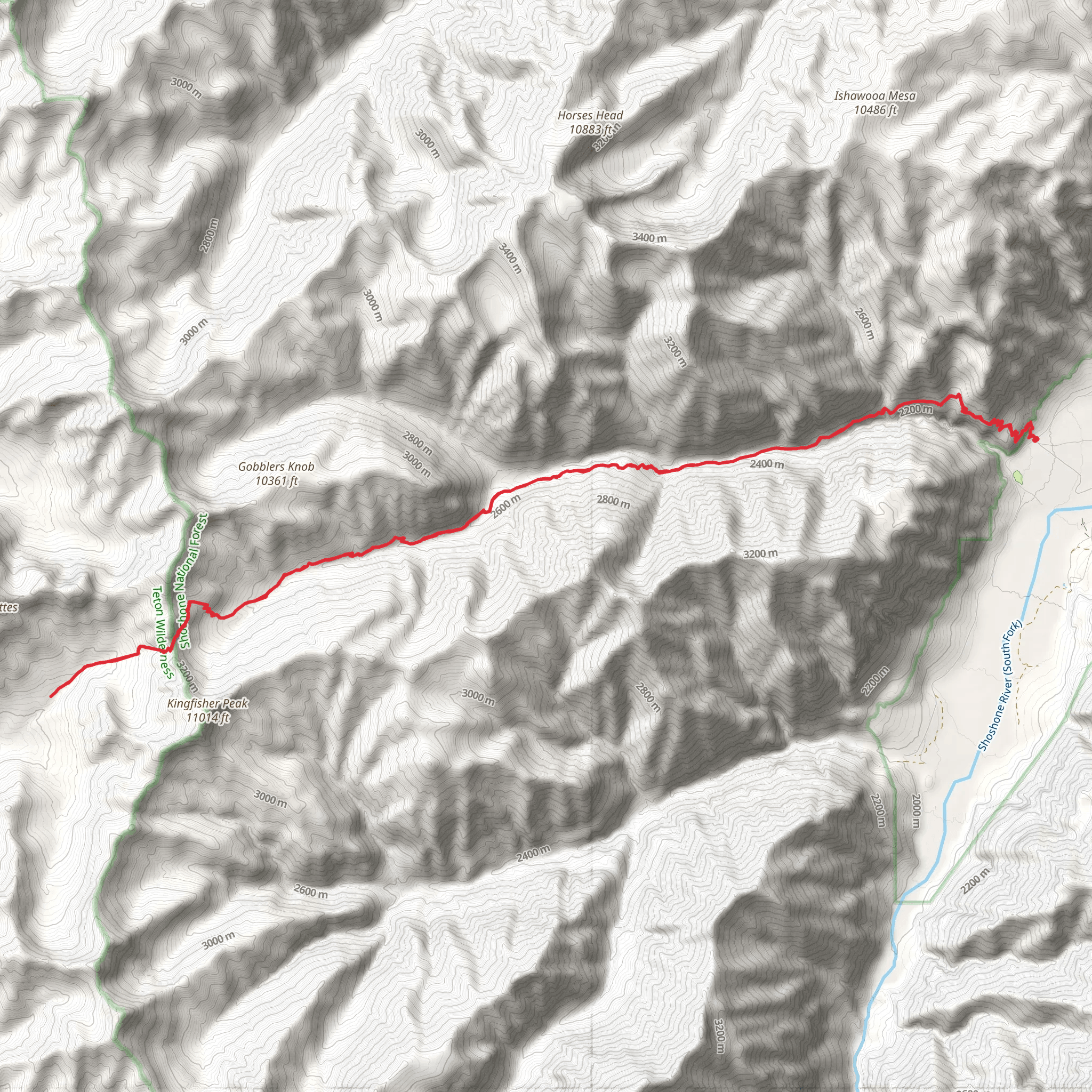
Starting your adventure near Park County, Wyoming, the Deer Creek Trail offers a captivating journey through the heart of the Rocky Mountains. Spanning approximately 35 kilometers (around 22 miles) with an elevation gain of about 1900 meters (6234 feet), this out-and-back trail is rated as medium difficulty, making it suitable for moderately experienced hikers.
Getting There To reach the trailhead, you can drive or use public transportation. If driving, head towards the nearest significant landmark, which is the town of Cody, Wyoming. From Cody, take the US-14/16/20 W for about 50 miles until you reach the trailhead near the Deer Creek Campground. For those using public transport, the nearest bus station is in Cody, and from there, you may need to arrange a taxi or shuttle service to the trailhead.
Trail Overview The Deer Creek Trail begins at an elevation of approximately 2000 meters (6562 feet) and gradually ascends to around 3900 meters (12795 feet). The initial part of the trail meanders through dense forests of pine and spruce, offering a cool and shaded environment. As you progress, the trail opens up to expansive meadows filled with wildflowers during the summer months.
Significant Landmarks and Points of Interest - **Deer Creek Falls (5 km / 3.1 miles in)**: One of the first major landmarks you'll encounter is Deer Creek Falls. This picturesque waterfall is a great spot for a short break and some photography. - **Alpine Meadows (10 km / 6.2 miles in)**: As you continue, you'll reach a series of alpine meadows. These meadows are home to a variety of wildlife, including elk and deer. Keep your eyes peeled for these majestic creatures, especially during the early morning or late afternoon. - **Rocky Outcrops (15 km / 9.3 miles in)**: About halfway through the trail, you'll come across several rocky outcrops that offer panoramic views of the surrounding mountains. These spots are perfect for a lunch break and some rest. - **Summit Ridge (17.5 km / 10.9 miles in)**: The trail's highest point, the Summit Ridge, provides breathtaking views of the Absaroka Range. This is the turnaround point for the out-and-back trail, so take some time to soak in the scenery before heading back.
Historical Significance The region around Deer Creek Trail is rich in history. The trail itself was used by Native American tribes for centuries as a hunting and trading route. In the late 1800s, it became a path for early settlers and miners searching for gold and other minerals. Remnants of old mining equipment and cabins can still be found along the trail, offering a glimpse into the area's storied past.
Wildlife and Nature The Deer Creek Trail is a haven for wildlife enthusiasts. In addition to elk and deer, you might spot black bears, mountain goats, and a variety of bird species. The trail also passes through several ecological zones, from dense forests to alpine tundra, providing a diverse range of flora and fauna.
Navigation and Safety Given the trail's length and elevation gain, it's crucial to be well-prepared. Ensure you have a reliable navigation tool like HiiKER to keep you on track. Weather conditions can change rapidly, especially at higher elevations, so pack accordingly with layers, rain gear, and plenty of water.
Final Tips - **Best Time to Hike**: Late spring to early fall is the best time to hike the Deer Creek Trail. Snow can linger at higher elevations well into June. - **Permits**: Check with local authorities regarding any required permits or fees. - **Leave No Trace**: Practice Leave No Trace principles to keep this beautiful trail pristine for future hikers.
Embark on the Deer Creek Trail for an unforgettable journey through some of Wyoming's most stunning landscapes.
What to expect?
Activity types
Comments and Reviews
User comments, reviews and discussions about the Deer Creek Trail, Wyoming.
4.33
average rating out of 5
45 rating(s)
