Download
Preview
Add to list
More
5.5 km
~1 hrs 46 min
411 m
Out and Back
“Discover the magic of Medicine Bow Peak Trail, a moderately challenging hike with stunning alpine views and rich history.”
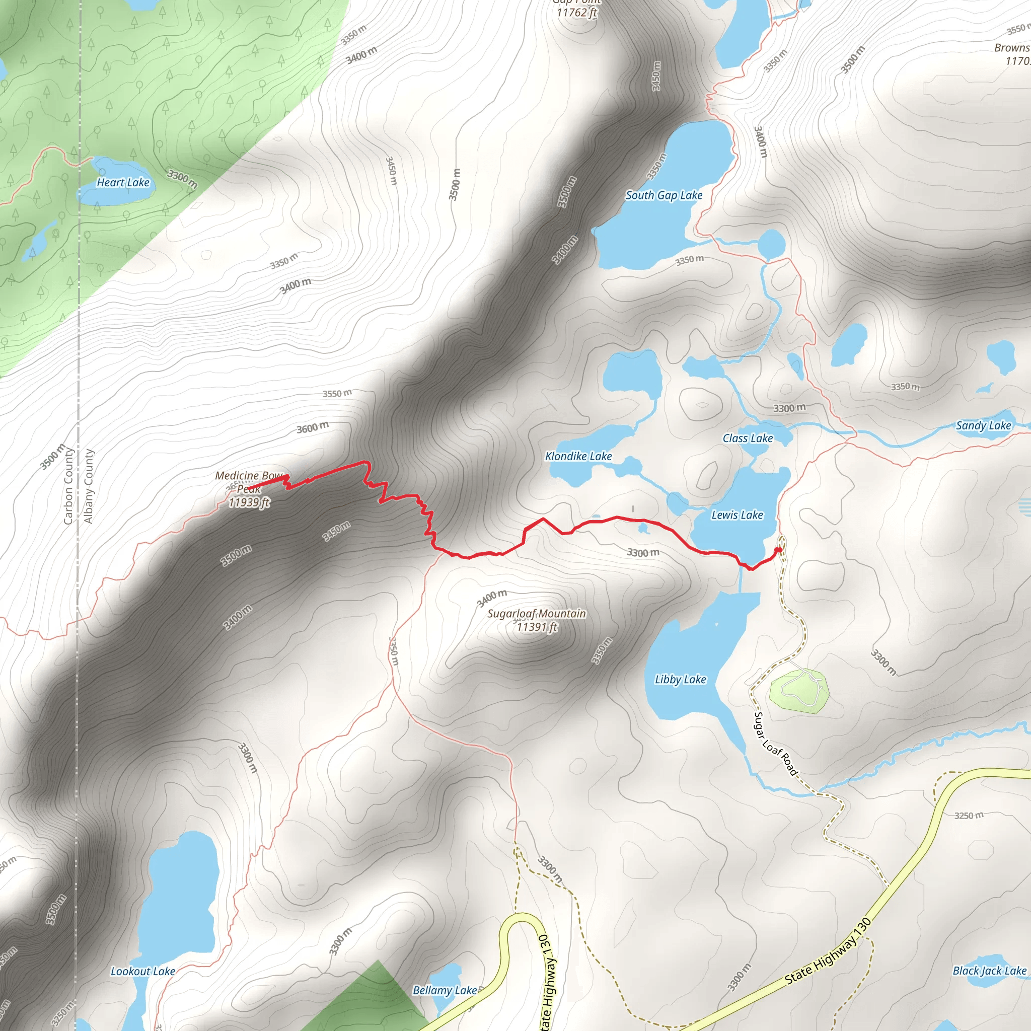
The Medicine Bow Peak Trail is a captivating hike located near Albany County, Wyoming. This out-and-back trail spans approximately 5 kilometers (3.1 miles) with an elevation gain of around 400 meters (1,312 feet), making it a moderately challenging adventure suitable for hikers with some experience.
Getting There To reach the trailhead, you can drive or use public transport. If driving, head towards the Snowy Range Scenic Byway (Wyoming Highway 130) and look for the turnoff to the Lewis Lake Trailhead, which is the nearest significant landmark. For those using public transport, the nearest major town is Laramie, Wyoming. From Laramie, you can take a regional bus service to Centennial, Wyoming, and then arrange for a local shuttle or taxi to the trailhead.
Trail Overview Starting at the Lewis Lake Trailhead, the trail immediately immerses you in the stunning alpine scenery of the Medicine Bow National Forest. The initial section of the trail is relatively gentle, winding through dense forests of spruce and fir. As you progress, the trail begins to ascend more steeply, offering panoramic views of the surrounding Snowy Range.
Significant Landmarks and Nature At approximately 1.5 kilometers (0.9 miles) into the hike, you'll encounter Lake Marie, a picturesque alpine lake that provides a perfect spot for a short break. The trail continues to climb, and around the 3-kilometer (1.9-mile) mark, you'll reach the saddle between Medicine Bow Peak and Sugarloaf Mountain. This section offers breathtaking views of the Snowy Range and the valleys below.
Wildlife and Flora The Medicine Bow Peak Trail is home to a diverse range of wildlife. Keep an eye out for mule deer, elk, and the occasional black bear. Birdwatchers will be delighted by the presence of various alpine species, including the Clark's nutcracker and the American pipit. The flora is equally impressive, with vibrant wildflowers such as Indian paintbrush and alpine forget-me-nots dotting the landscape during the summer months.
Historical Significance The Medicine Bow Range holds historical significance for the Native American tribes who once inhabited the region. The name "Medicine Bow" is believed to originate from the Native American practice of gathering mountain mahogany wood in the area to make bows. The region also played a role in the westward expansion of the United States, with early explorers and settlers traversing the rugged terrain.
Navigation and Safety Given the elevation gain and the potential for rapidly changing weather conditions, it's crucial to be well-prepared. Use the HiiKER app for accurate navigation and real-time trail updates. Ensure you have adequate clothing, water, and snacks, and be mindful of altitude sickness as you approach the peak.
Reaching the Summit The final push to the summit of Medicine Bow Peak involves a series of switchbacks and a rocky scramble. At the summit, you'll be rewarded with 360-degree views of the Snowy Range, the Medicine Bow National Forest, and the distant plains of Wyoming. The summit stands at an elevation of 3,662 meters (12,013 feet), making it the highest point in the Snowy Range.
After soaking in the views, retrace your steps back to the trailhead, taking care to descend safely. The Medicine Bow Peak Trail offers a memorable hiking experience, combining natural beauty, wildlife, and a touch of historical intrigue.
What to expect?
Activity types
Comments and Reviews
User comments, reviews and discussions about the Medicine Bow Peak Trail, Wyoming.
4.54
average rating out of 5
80 rating(s)
