Download
Preview
Add to list
More
15.3 km
~4 hrs 38 min
942 m
Out and Back
“Experience Wyoming's natural beauty and history on a moderately challenging 15-kilometer hike to Laramie Peak.”
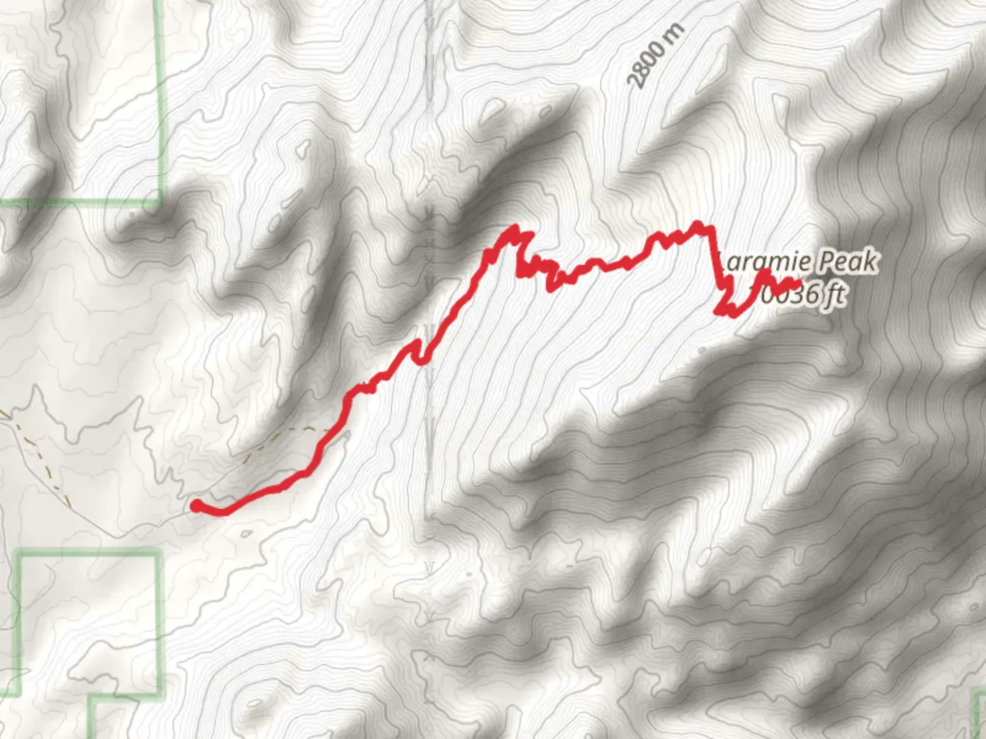
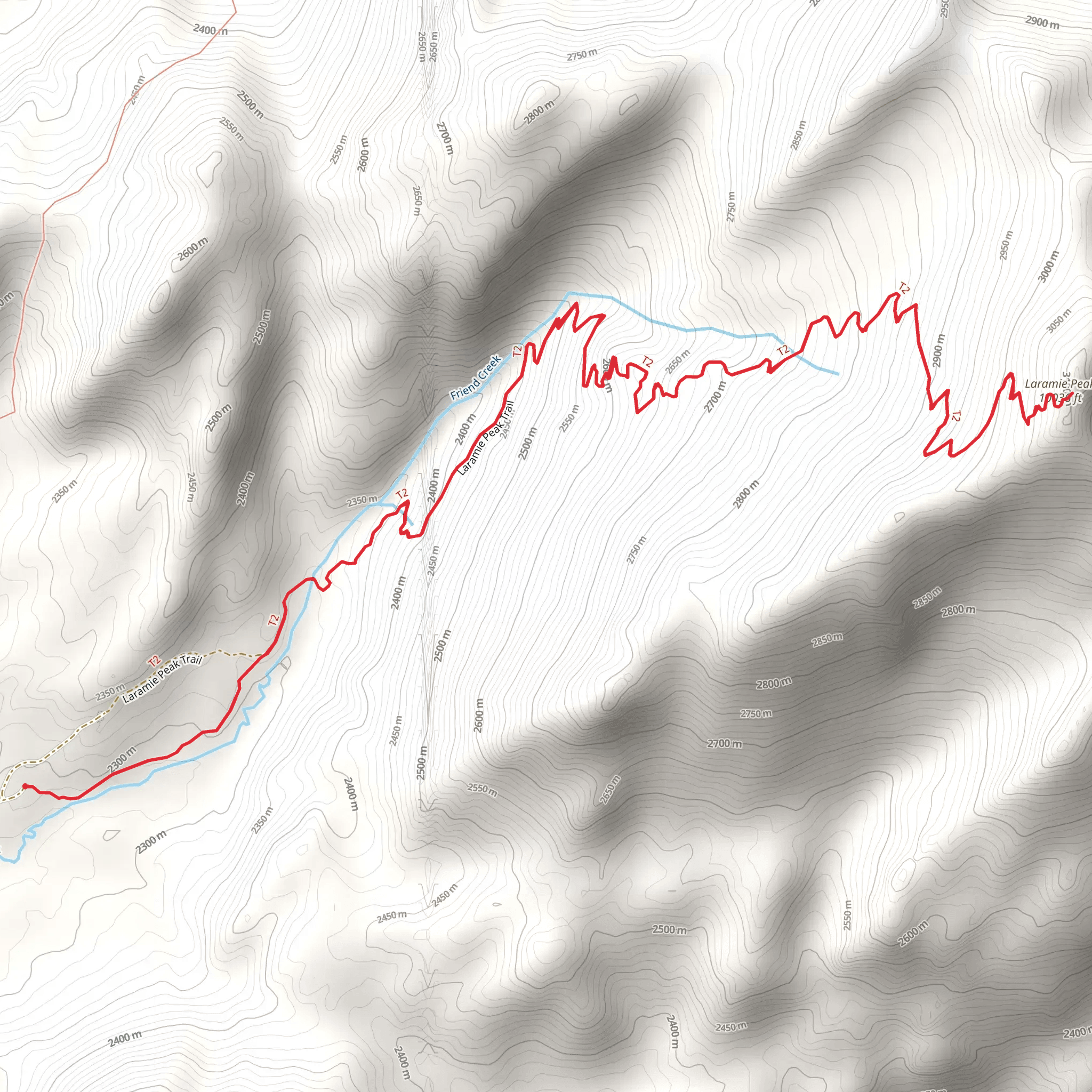
Starting your adventure near Albany County, Wyoming, the Laramie Peak via Friend Park Campground Trail offers a captivating journey through the Medicine Bow-Routt National Forest. This out-and-back trail spans approximately 15 kilometers (9.3 miles) with an elevation gain of around 900 meters (2,950 feet), making it a moderately challenging hike suitable for those with a reasonable level of fitness.
Getting There To reach the trailhead, you can drive to Friend Park Campground, located near Albany County. If you're using public transport, the nearest significant town is Laramie, Wyoming. From Laramie, you can rent a car or arrange for a shuttle service to take you to the campground. The campground itself is accessible via Friend Park Road, which branches off from Forest Road 705.
Trail Overview The trail begins at Friend Park Campground, a serene starting point surrounded by lush forest. As you set off, you'll immediately notice the dense canopy of pine and spruce trees, providing ample shade and a cool atmosphere. The initial section of the trail is relatively gentle, allowing you to acclimate to the terrain.
Significant Landmarks and Elevation At approximately 3 kilometers (1.9 miles) into the hike, you'll encounter a series of switchbacks. This section marks the beginning of a more strenuous ascent, with the trail gaining significant elevation. As you climb, take a moment to appreciate the panoramic views of the surrounding forest and distant mountain ranges.
Around the 5-kilometer (3.1-mile) mark, you'll reach a notable landmark: a large granite outcrop known locally as "The Rock." This is a great spot for a short break and some photos. The elevation here is roughly 2,700 meters (8,860 feet), and the views are nothing short of spectacular.
Flora and Fauna The trail is rich in biodiversity. Keep an eye out for mule deer, elk, and occasionally black bears. Birdwatchers will be delighted by the presence of various species, including the mountain bluebird and the Clark's nutcracker. The flora is equally impressive, with wildflowers such as Indian paintbrush and lupine adding splashes of color to the landscape.
Historical Significance Laramie Peak holds historical significance as it was a prominent landmark for pioneers traveling along the Oregon Trail. The peak was often the first major mountain seen by settlers heading west, symbolizing both the challenges and the opportunities that lay ahead. The region is steeped in history, and you might even come across remnants of old cabins and mining equipment along the way.
Final Ascent and Summit The final push to the summit is the most challenging part of the hike. The trail becomes steeper and rockier, requiring careful footing. At around 7.5 kilometers (4.7 miles), you'll reach the summit of Laramie Peak, standing at an elevation of 3,131 meters (10,272 feet). The 360-degree views from the top are breathtaking, offering a sweeping panorama of the Medicine Bow-Routt National Forest and beyond.
Navigation and Safety Given the trail's moderate difficulty and varying terrain, it's advisable to use a reliable navigation tool like HiiKER to stay on track. Weather conditions can change rapidly at higher elevations, so be prepared with appropriate gear, including layers, a rain jacket, and plenty of water.
Return Journey The descent follows the same path back to Friend Park Campground. While the downhill trek is less strenuous, it requires caution, especially on the steeper sections. Take your time to enjoy the scenery and perhaps spot some wildlife you might have missed on the way up.
This trail offers a rewarding experience for those looking to explore the natural beauty and historical richness of Wyoming's mountainous regions.
What to expect?
Activity types
Comments and Reviews
User comments, reviews and discussions about the Laramie Peak via Friend Park Campground Trail, Wyoming.
4.53
average rating out of 5
58 rating(s)
