Download
3D Flyover
Add to list
More
129.3 km
~5 days
473 m
Multi-Day
“Embark on a gentle yet historic trek through West Virginia's splendor along the Greenbrier River Trail.”
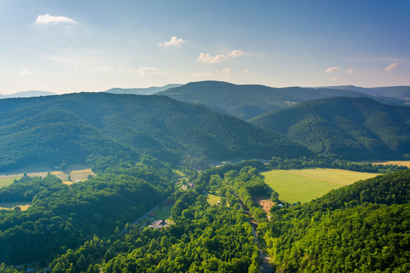
The Greenbrier River Trail carves a scenic 129 km (80 miles) path through the heart of West Virginia, following the course of the Greenbrier River. With an elevation gain of approximately 400 meters (1,312 feet), the trail offers a relatively gentle journey through a region rich in natural beauty and history.
Getting to the Trailhead
The northern trailhead is located near the town of Cass, close to Greenbrier County. To reach the starting point by car, hikers can navigate to Cass Scenic Railroad State Park, which is a significant landmark in the area. For those opting for public transport, options may be limited, but regional bus services can get you to nearby towns, from where you may need to arrange a taxi or shuttle to the trailhead.
Navigating the Trail
The Greenbrier River Trail is a point-to-point trail, meaning hikers can start at either end or even tackle sections of the trail for shorter hikes. The trail is well-marked, but carrying a reliable navigation tool like HiiKER is recommended to keep track of progress and nearby points of interest.
Historical Significance
The trail itself is a converted rail trail, once part of the Chesapeake & Ohio Railway. As you hike, you'll encounter several historical markers and remnants of the railroad era, including old train depots and mileposts. The trail also passes through several small towns that played significant roles during the logging boom in the early 20th century.
Landmarks and Nature
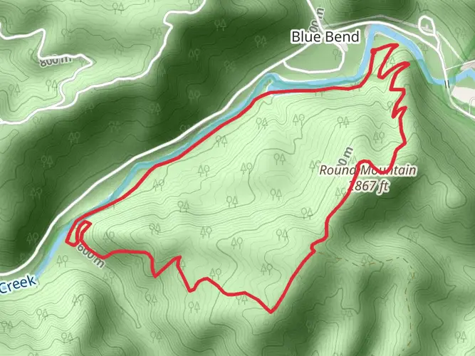
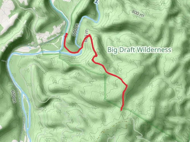
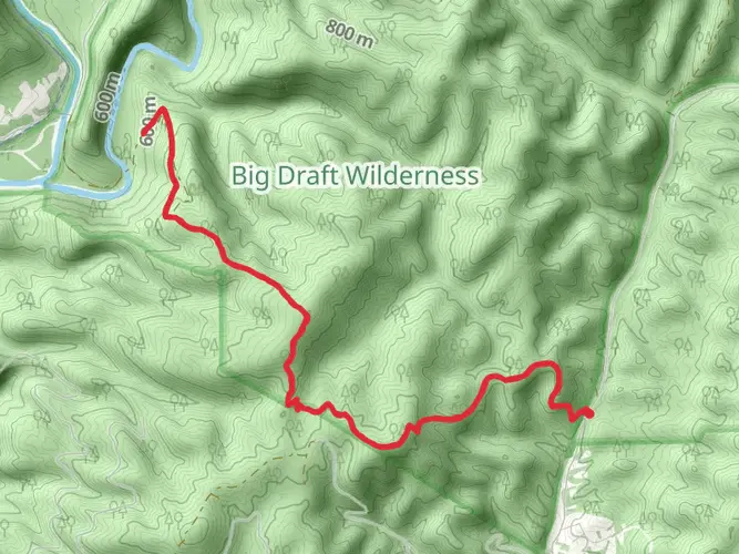
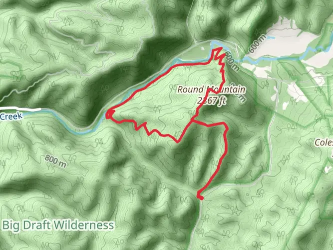
The Greenbrier River Trail is enveloped by the lush forests of the Appalachian Mountains, offering a serene backdrop for your hike. The trail crosses 35 bridges and passes through two tunnels, providing unique vantage points and photo opportunities. The Droop Mountain Tunnel and the Sharp's Tunnel are notable for their historical and architectural interest.
Wildlife is abundant in the area, with chances to spot white-tailed deer, beavers, and a variety of bird species. The river itself is a habitat for fish and occasionally offers sightings of river otters.
Seasonal Considerations
The trail is accessible year-round, but each season offers a different experience. Spring brings wildflowers and rushing waters, summer is lush and green, fall features a spectacular display of foliage, and winter presents a quiet, snow-covered landscape. It's important to prepare for the season, with layers for cold weather and adequate water and sun protection for the warmer months.
Amenities and Camping
Along the route, there are numerous campsites and picnic areas for those looking to extend their adventure. Primitive camping is available, and some sites are equipped with amenities such as tables and restrooms. It's advisable to plan your stops in advance and be aware that amenities are more sparse in certain sections of the trail.
Safety and Etiquette
As with any trail, it's important to practice Leave No Trace principles to preserve the natural environment. Be mindful of trail etiquette, particularly when sharing the path with cyclists and equestrians, who also frequent the Greenbrier River Trail.
In conclusion, the Greenbrier River Trail offers a unique blend of natural beauty, historical interest, and recreational opportunities. Whether you're looking for a multi-day adventure or a leisurely day hike, this trail provides an enriching experience for hikers of all levels.

What to expect?
Activity types
Frequently asked questions
How long does it take to hike the full Greenbrier River Trail?
The full Greenbrier River Trail is 129.27 km, or about 78 miles, so most hikers treat it as a multi-day trip rather than a single-day walk. With only about 473 m of total elevation gain and a gentle rail-trail grade, many backpackers split it into 3 to 5 days depending on pace, shuttle plans, and overnight stops.
Where are the trailheads and parking areas for the Greenbrier River Trail?
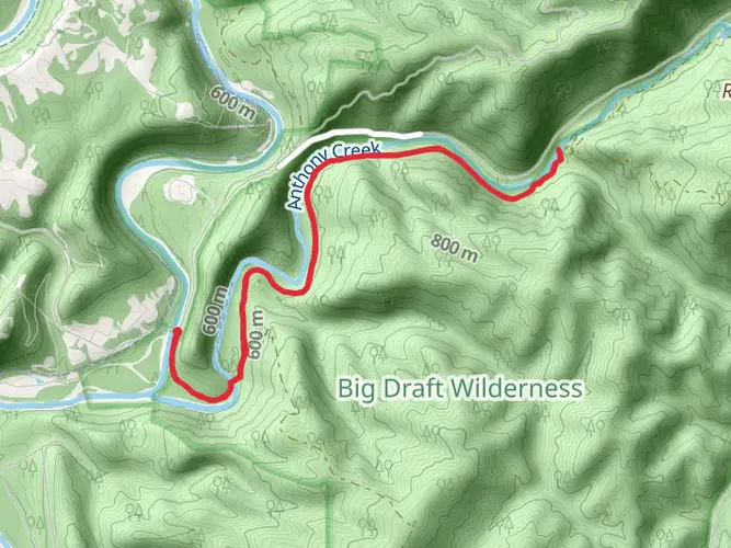
The Greenbrier River Trail runs point to point between Cass and North Caldwell near Lewisburg. Major access and parking are available at North Caldwell around mile 3, Marlinton around mile 56, Clover Lick around mile 71, and near Cass at the north end, with additional smaller access points such as Anthony, Renick, Seebert, and Beard.
Is the Greenbrier River Trail hard, and is it suitable for beginners?
The Greenbrier River Trail is generally considered easy because it follows a former railroad grade with only about 473 m of elevation gain over 129.27 km. That makes it much gentler than a typical mountain trail, and many hikers choose it for first multi-day trips, family section hikes, or long-distance walking with a lighter physical demand.
What are the main landmarks on the Greenbrier River Trail?
Notable features on the Greenbrier River Trail include 35 bridges, the restored Marlinton Depot, the historic water tank in Marlinton, the Watoga Bridge, and two railroad tunnels. Droop Mountain Tunnel is about 402 feet long near mile 30.9, and Sharp's Tunnel is about 511 feet long near mile 65.2.
Can you camp along the Greenbrier River Trail?
Yes. The Greenbrier River Trail has multiple trailside camping areas spaced along the route, including sites near mile 4.7, 9.5, 28.5, 32.1, 33.7, 49.3, 63.8, and 69.6. Several of these include basics such as toilets, drinking water, fire rings, tables, and Adirondack-style shelters, and there is also nearby camping at places like Watoga State Park and Seneca State Forest.
Which direction is best to hike the Greenbrier River Trail?
Many hikers prefer going from Cass south to Caldwell because the route gradually descends overall. Cass sits at about 2,688 feet, while Caldwell is around 1,696 feet, so a north-to-south trip tends to feel easier even though the trail is gentle in either direction.
What towns and services are along the Greenbrier River Trail?
The Greenbrier River Trail passes or connects with communities including Caldwell, Anthony, Renick, Seebert, Marlinton, Buckeye, Clover Lick, and Cass. Marlinton is one of the best service hubs on the route, with parking, groceries, water, a post office, nearby food, lodging, and the restored depot close to the trail.
Comments and Reviews
User comments, reviews and discussions about the Greenbrier River Trail, West Virginia.
4.63
average rating out of 5
24 rating(s)