Download
Preview
Add to list
More
18.5 km
~1 day 2 hrs
2392 m
Out and Back
“Embark on a challenging 18 km journey through lush forests to breathtaking alpine vistas and glaciers.”
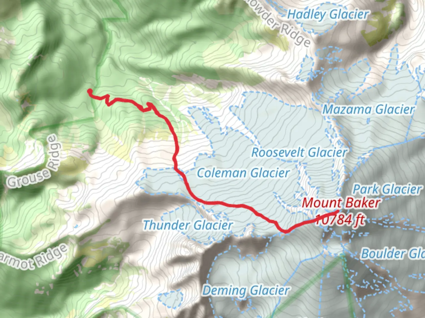
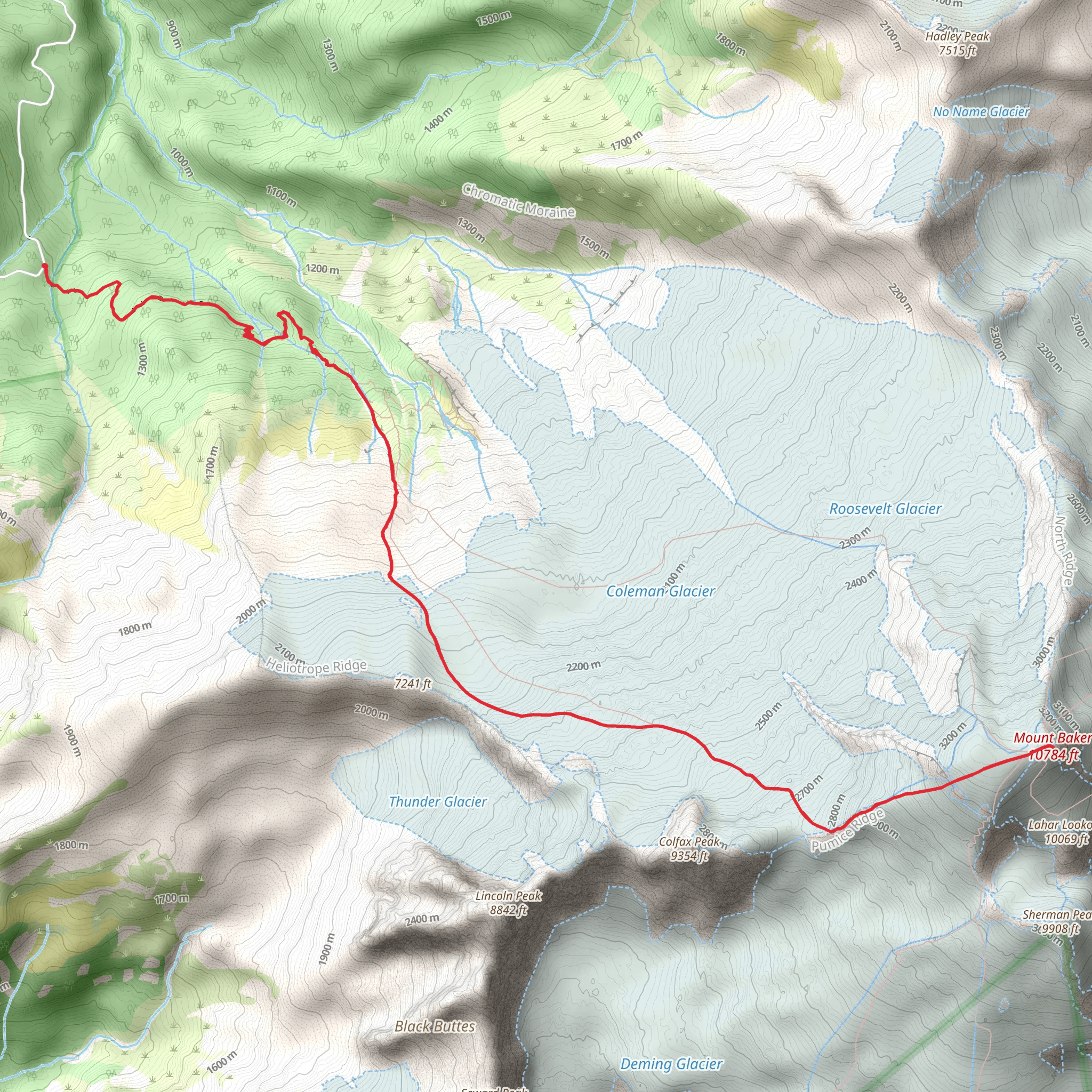
Starting your adventure near Whatcom County, Washington, the Mount Baker via Heliotrope Ridge Trail offers an exhilarating out-and-back journey spanning approximately 18 km (11.2 miles) with an elevation gain of around 2300 meters (7546 feet). This trail is rated as medium difficulty, making it suitable for hikers with some experience and a good level of fitness.### Getting There To reach the trailhead, you can drive or use public transport. If driving, head towards the town of Glacier, Washington. From there, take the Glacier Creek Road (Forest Service Road 39) for about 13 miles until you reach the trailhead parking area. For those relying on public transport, the nearest major city is Bellingham, Washington. From Bellingham, you can take a bus to Glacier and then arrange for a local shuttle or taxi to the trailhead.### Trail Overview The trail begins at an elevation of approximately 1100 meters (3609 feet) and gradually ascends through lush forests and alpine meadows. The first 3 km (1.9 miles) are relatively gentle, with an elevation gain of about 300 meters (984 feet), making it a pleasant warm-up. As you hike, you'll be surrounded by towering Douglas firs and Western hemlocks, with the occasional glimpse of Mount Baker in the distance.### Significant Landmarks Around the 4 km (2.5 miles) mark, you'll encounter the first significant landmark: the Heliotrope Ridge. This area offers stunning views of the Coleman Glacier, one of the most accessible glaciers in the region. The trail becomes steeper here, with an elevation gain of approximately 500 meters (1640 feet) over the next 2 km (1.2 miles). Be prepared for some rocky and uneven terrain.### Wildlife and Flora As you ascend, keep an eye out for local wildlife. Black bears, mountain goats, and marmots are commonly spotted in this area. The alpine meadows are also home to a variety of wildflowers, including lupines, Indian paintbrush, and avalanche lilies, especially vibrant during the late spring and early summer months.### Historical Significance The Mount Baker area holds historical significance for the indigenous Nooksack people, who have lived in the region for thousands of years. The mountain itself was named after British naval officer Joseph Baker, who first sighted it in 1792. The trail and surrounding areas have been used for centuries for hunting, gathering, and spiritual practices.### Final Ascent The final stretch of the trail is the most challenging, with an elevation gain of about 1500 meters (4921 feet) over the last 9 km (5.6 miles). The terrain becomes more rugged, and you may encounter snowfields even in the summer months. It's crucial to have proper gear, including crampons and an ice axe, for this section. The views from the summit are breathtaking, offering panoramic vistas of the North Cascades and beyond.### Navigation Given the complexity of the trail, it's highly recommended to use a reliable navigation tool like HiiKER to ensure you stay on the correct path. The app provides detailed maps, real-time GPS tracking, and important waypoints to help you navigate the trail safely.### Return Journey The descent follows the same path back to the trailhead. While descending, take your time to enjoy the scenery and perhaps spot any wildlife you may have missed on the way up. The return journey offers a different perspective, with the changing light and angles providing new photo opportunities.This trail is a rewarding experience for those prepared for its challenges, offering a mix of natural beauty, wildlife, and historical significance.
What to expect?
Activity types
Comments and Reviews
User comments, reviews and discussions about the Mount Baker via Holiotrope Ridge Trail, Washington.
4.56
average rating out of 5
9 rating(s)
