Download
Preview
Add to list
More
4.0 km
~1 hrs 2 min
143 m
Loop
“Explore a 4 km loop through lush forests and historical paths with stunning views and diverse wildlife.”
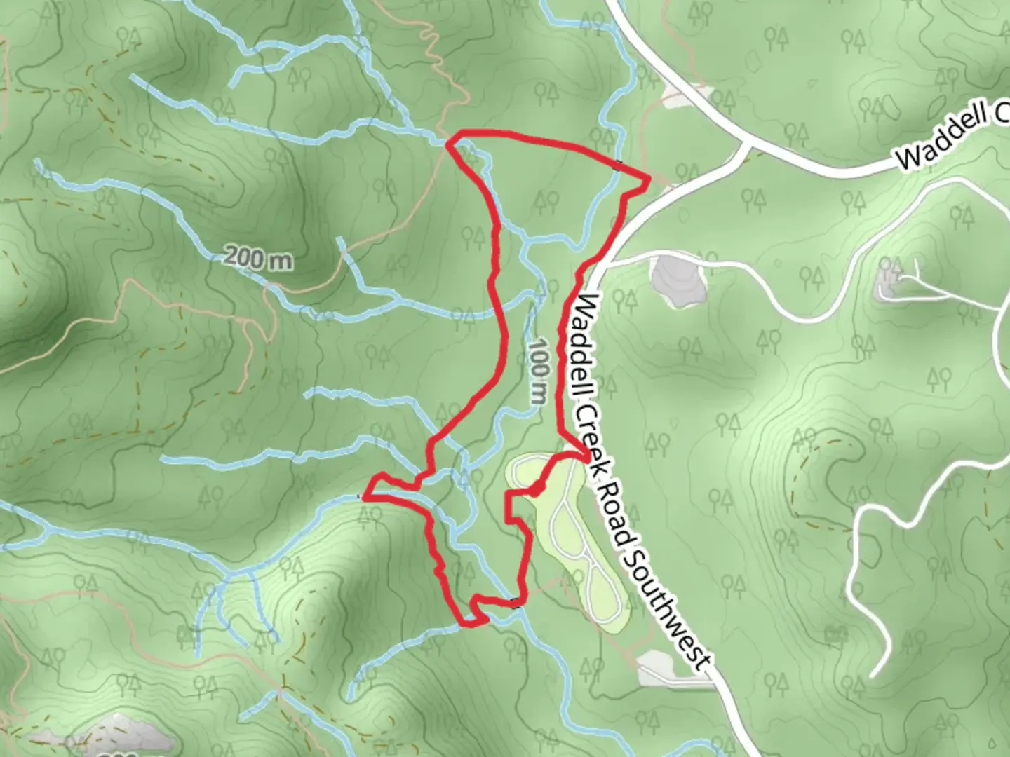
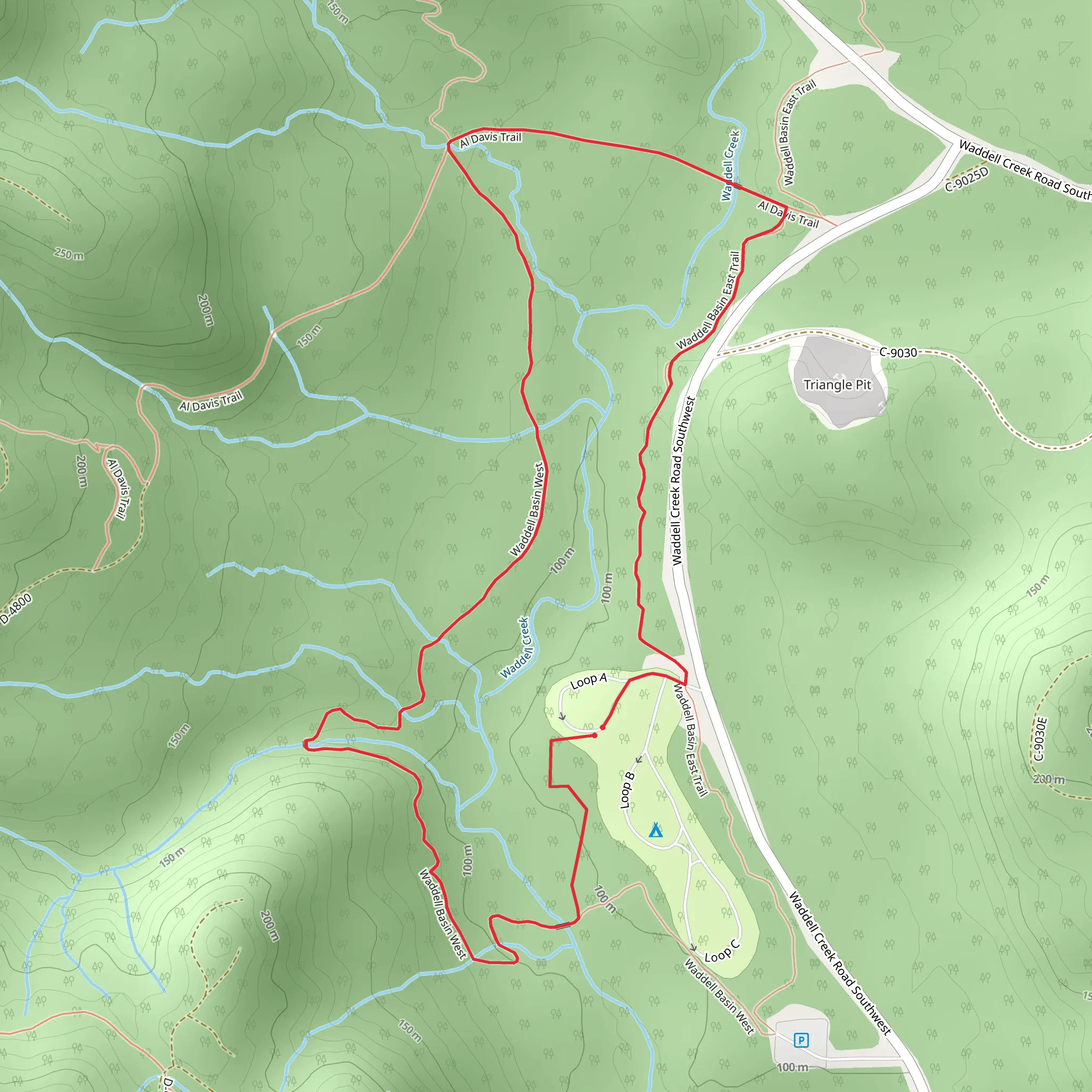
Starting near Thurston County, Washington, the Waddell Basin West and Waddell Basin East Trail offers a delightful 4 km (2.5 miles) loop with an elevation gain of approximately 100 meters (328 feet). This medium-difficulty trail is perfect for those looking to immerse themselves in the natural beauty of the Pacific Northwest.
Getting There To reach the trailhead, you can drive or use public transportation. If driving, head towards the nearest significant landmark, which is the Capitol State Forest. The trailhead is accessible via Waddell Creek Road SW. For those using public transport, the nearest bus stop is at Delphi Road SW and Waddell Creek Road SW, from where you can either walk or arrange for a short taxi ride to the trailhead.
Trail Overview The loop begins with a gentle ascent through a dense forest of Douglas fir and western hemlock. The initial 1 km (0.6 miles) takes you through a lush understory of ferns and mosses, providing a serene and shaded environment. As you continue, keep an eye out for the diverse birdlife, including woodpeckers and owls, which are commonly spotted in this area.
Significant Landmarks At around the 1.5 km (0.9 miles) mark, you'll encounter a small, picturesque creek that runs through the basin. This is a great spot to take a short break and enjoy the tranquil sounds of flowing water. The trail then begins a moderate climb, gaining about 50 meters (164 feet) in elevation over the next kilometer. This section offers stunning views of the surrounding forest and occasional glimpses of Mount Rainier on clear days.
Historical Significance The Waddell Basin area has a rich history, having been used by Native American tribes for centuries as a hunting and gathering ground. The trail itself follows some of these ancient paths, offering a unique glimpse into the region's past. Interpretive signs along the way provide additional historical context, making this hike not only a natural but also an educational experience.
Wildlife and Flora As you loop back towards the trailhead, the final 1.5 km (0.9 miles) descends gently through a mixed forest of alder and maple. This section is particularly vibrant in the fall when the leaves turn brilliant shades of red and gold. Deer and other small mammals are often seen foraging in this area, so keep your camera ready.
Navigation For navigation, it's highly recommended to use HiiKER, which provides detailed maps and real-time updates to ensure you stay on track. The trail is well-marked, but having a reliable navigation tool can enhance your hiking experience.
This trail offers a perfect blend of natural beauty, historical significance, and moderate physical challenge, making it an excellent choice for a day hike in the Thurston County area.
What to expect?
Activity types
Comments and Reviews
User comments, reviews and discussions about the Waddell Basin West and Waddell Basin East Trail, Washington.
4.54
average rating out of 5
13 rating(s)
