Download
Preview
Add to list
More
9.0 km
~2 hrs 24 min
374 m
Out and Back
“This 9 km trail near Mount Spokane offers stunning views, rich history, and a moderate challenge.”
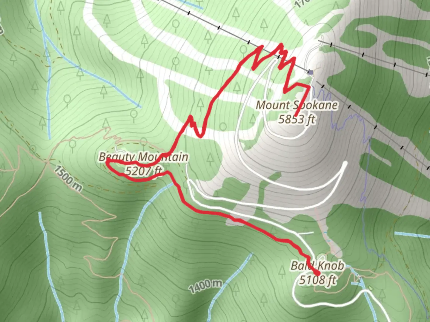
Starting your hike near Spokane County, Washington, this 9 km (approximately 5.6 miles) out-and-back trail offers a moderate challenge with an elevation gain of around 300 meters (about 984 feet). The trailhead is conveniently located near the Mount Spokane State Park, which is accessible by car. If you're using public transport, the nearest significant landmark is the town of Mead, WA, from where you can arrange a taxi or rideshare to the park entrance.
Trail Overview
As you begin your journey, the initial section of the trail is relatively gentle, winding through dense forest areas rich with Douglas fir and Ponderosa pine. The forest floor is often carpeted with ferns and wildflowers, especially vibrant in the spring and early summer months. Keep an eye out for local wildlife such as deer, squirrels, and a variety of bird species including woodpeckers and owls.
Significant Landmarks and Points of Interest
Around the 2 km (1.2 miles) mark, you'll encounter a small, serene creek. This is a great spot to take a short break and enjoy the tranquil sounds of flowing water. As you continue, the trail begins to ascend more steeply, offering increasingly impressive views of the surrounding landscape.
At approximately 4 km (2.5 miles) in, you'll reach Beauty Mountain. This vantage point provides panoramic views of the Spokane Valley and, on clear days, you can see as far as the Selkirk Mountains. This is an excellent spot for photography, so make sure to bring your camera.
Historical Significance
Mount Spokane and its surrounding areas have a rich history. The region was originally inhabited by the Spokane Tribe, who used the land for hunting and gathering. In the early 20th century, the area became a popular destination for outdoor enthusiasts, leading to the establishment of Mount Spokane State Park in 1927. The park itself is one of Washington's largest state parks, covering over 13,000 acres.
Final Ascent to Mount Spokane
The final stretch to Mount Spokane is the most challenging part of the hike, with a steeper incline and rocky terrain. This section requires careful footing, especially if the trail is wet or icy. Upon reaching the summit, you'll be rewarded with breathtaking 360-degree views. The summit area also features a historic fire lookout tower, which adds a touch of historical intrigue to your adventure.
Navigation and Safety
For navigation, it's highly recommended to use the HiiKER app, which provides detailed maps and real-time updates. The trail is well-marked, but having a reliable navigation tool can be invaluable, especially in poor weather conditions.
Flora and Fauna
Throughout your hike, you'll encounter a diverse range of flora and fauna. In addition to the towering trees and vibrant wildflowers, the area is home to various wildlife. Black bears and cougars are known to inhabit the region, so it's essential to stay alert and make noise to avoid surprising any animals.
Getting There
If you're driving, take Highway 2 north from Spokane to Mead, then follow the signs to Mount Spokane State Park. The park has ample parking facilities near the trailhead. For those relying on public transport, the nearest bus stop is in Mead, from where you can arrange a taxi or rideshare to the park entrance.
This trail offers a perfect blend of natural beauty, moderate physical challenge, and historical significance, making it a must-visit for any hiking enthusiast.
What to expect?
Activity types
Comments and Reviews
User comments, reviews and discussions about the Beauty Mountain and Mount Spokane via Trail 130, Washington.
4.57
average rating out of 5
14 rating(s)
