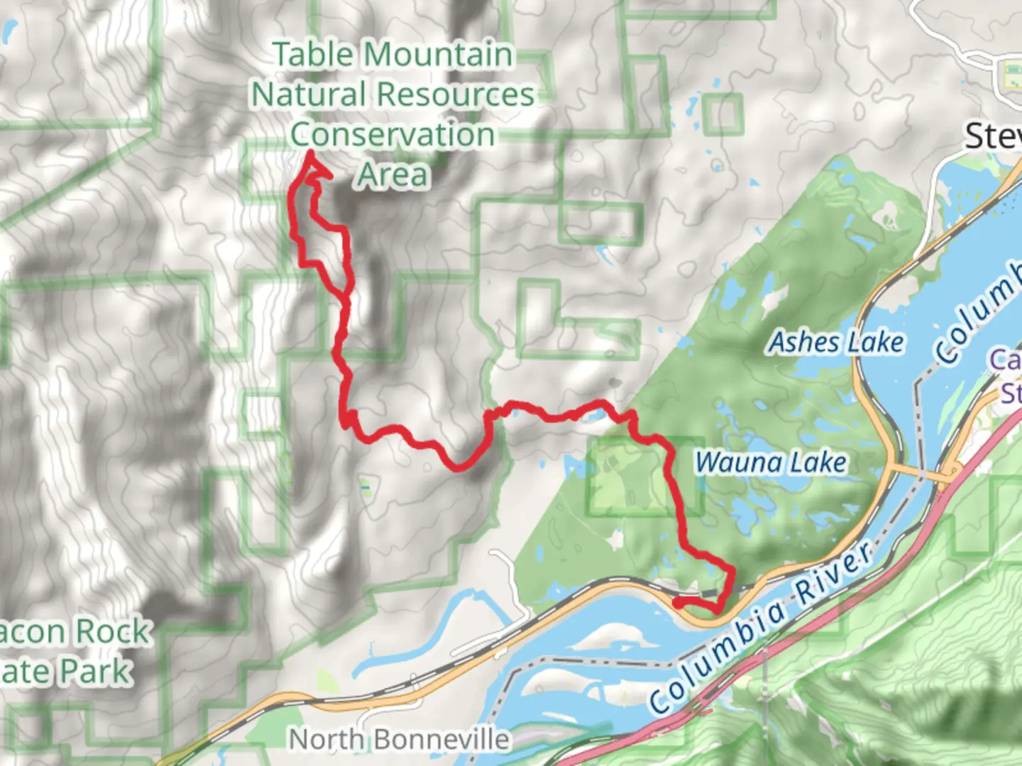
Table Mountain and Gillette Lake via Pacific Crest Trail
Download
Preview
Add to list
More
24.4 km
~1 day 2 hrs
1564 m
Loop
“Embark on a breathtaking 24 km loop from the Bonneville Trailhead, featuring panoramic summit views and serene lakes.”
Starting your adventure near Skamania County, Washington, the trailhead for this loop can be accessed by car, with parking available at the Bonneville Trailhead. If you're using public transport, the nearest significant landmark is the Bonneville Dam, from where you can arrange a taxi or rideshare to the trailhead.
The journey begins with a steady ascent, gaining approximately 1500 meters (4921 feet) in elevation over the course of the 24 km (15 miles) loop. The initial section of the trail takes you through dense forest, where you'll be greeted by towering Douglas firs and western hemlocks. Keep an eye out for local wildlife, including black-tailed deer and a variety of bird species.
Table Mountain Ascent
Around the 5 km (3 miles) mark, you'll start the more challenging ascent up Table Mountain. This section is steep and rocky, so sturdy hiking boots and trekking poles are recommended. As you climb, the forest begins to thin, offering glimpses of the Columbia River Gorge below. The trail here is well-marked, but it's always a good idea to have the HiiKER app handy for navigation.
Summit Views
Reaching the summit of Table Mountain at approximately 10 km (6 miles) into your hike, you'll be rewarded with panoramic views of the surrounding landscape. On a clear day, you can see Mount Hood to the south and Mount St. Helens to the north. This is a great spot to take a break, have a snack, and soak in the breathtaking scenery.
Descent to Gillette Lake
The descent from Table Mountain leads you towards Gillette Lake. This section of the trail is less strenuous, allowing you to enjoy the serene beauty of the area. At around the 15 km (9 miles) mark, you'll arrive at Gillette Lake, a picturesque spot perfect for a quick dip or a leisurely lunch. The lake is surrounded by lush vegetation, and you might spot beavers or otters if you're lucky.
Historical Significance
As you continue your hike, you'll be walking along parts of the historic Pacific Crest Trail, a long-distance hiking and equestrian trail that spans from Mexico to Canada. This trail has been a significant route for Native American tribes for centuries and later became a key path for settlers moving westward.
Return Loop
The final stretch of the loop takes you back through forested areas and meadows, gradually descending towards the trailhead. This section is relatively easy, allowing you to reflect on the diverse landscapes and rich history you've encountered. The loop concludes back at the Bonneville Trailhead, where you can easily find your car or arrange for transportation back to the Bonneville Dam.
Throughout the hike, ensure you have adequate water, snacks, and layers of clothing to adapt to changing weather conditions. The trail is well-maintained, but always check for any trail updates or closures on HiiKER before you set out.

What to expect?
Activity types
Comments and Reviews
User comments, reviews and discussions about the Table Mountain and Gillette Lake via Pacific Crest Trail, Washington.
4.45
average rating out of 5
11 rating(s)