Download
Preview
Add to list
More
16.0 km
~4 hrs 52 min
1009 m
Out and Back
“Embark on the Owyhigh Lakes Trail, a scenic adventure of waterfalls, wildlife, and wildflowers in Mount Rainier's embrace.”
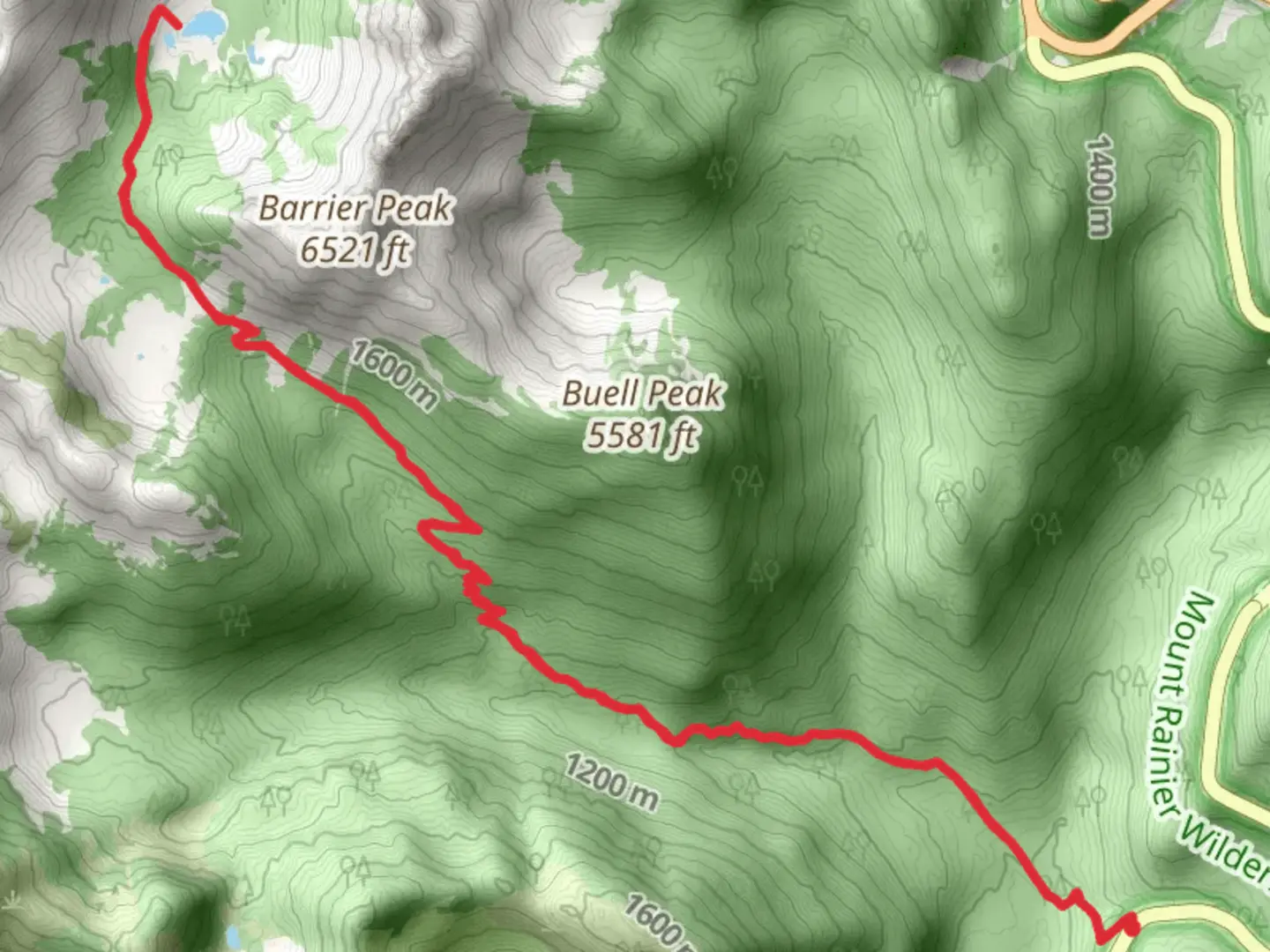
The Owyhigh Lakes Trail offers a rewarding journey through the diverse landscapes of Mount Rainier National Park. Starting near Pierce County, Washington, this out-and-back trail spans approximately 16 kilometers (10 miles) and ascends roughly 1000 meters (3280 feet), presenting a medium difficulty level that is suitable for hikers with some experience.
Getting to the Trailhead
To reach the trailhead, you can drive to the White River Entrance of Mount Rainier National Park. From there, take the White River Road to the Deer Creek parking area, which serves as the starting point for the Owyhigh Lakes Trail. If you're relying on public transportation, check the local schedules for any buses that approach the park boundaries, but be prepared to arrange a taxi or shuttle service for the final leg to the trailhead.
The Hike
As you embark on your hike, the trail begins with a steady climb through old-growth forests, where towering Douglas firs and western red cedars provide a canopy overhead. The sound of Deer Creek accompanies you as you ascend, and the lush undergrowth is home to a variety of ferns and wildflowers, especially vibrant in the spring and early summer.
Landmarks and Scenery
After approximately 3 kilometers (1.9 miles), you'll encounter the first of several waterfalls, offering a picturesque spot for a brief rest. As you continue, the trail becomes steeper, and switchbacks will aid your ascent as you gain elevation. At around the 5-kilometer (3.1-mile) mark, you'll reach the junction with the Eastside Trail. Keep left to stay on the Owyhigh Lakes Trail.
The path then leads you through subalpine meadows, which burst into a riot of color when wildflowers bloom in late July and August. The views open up to reveal sweeping vistas of Governors Ridge and Tamanos Mountain. Keep an eye out for wildlife, including marmots, pikas, and the occasional black bear or mountain goat.
Owyhigh Lakes and Beyond
Upon reaching the Owyhigh Lakes at about 8 kilometers (5 miles) in, you'll be greeted by the serene beauty of the twin lakes, set against the backdrop of craggy peaks. This area, named after a local Native American chief, offers a tranquil spot for lunch and exploration. The lakes are also a historical site, as they were once a seasonal camp for indigenous people.
For those wishing to extend their hike, trails continue from the lakes to connect with the Eastside Trail or lead further into the backcountry. However, if you're planning a day hike, this is a good turnaround point.
Preparation and Safety
Before setting out, ensure you have adequate supplies, including water, food, and layers for changing weather conditions. The elevation gain can be challenging, so pace yourself and take breaks as needed. Always check the weather forecast and trail conditions beforehand, and be prepared for snowfields that can linger into the early summer.
For navigation, HiiKER is an excellent tool to use for this trail, providing detailed maps and waypoints that can help you stay on track. Remember that cell service may be unreliable in the park, so download maps and trail information ahead of time.
Wildlife and Conservation
As you hike, remember that you're a guest in the home of countless wildlife species. Maintain a safe distance from any animals you encounter and do not feed them. Practice Leave No Trace principles to preserve the beauty and ecological integrity of the area for future generations.
By respecting these guidelines and being prepared, your hike to Owyhigh Lakes will be a memorable journey through the heart of Mount Rainier's wilderness.

What to expect?
Activity types
Comments and Reviews
User comments, reviews and discussions about the Owyhigh Lake Trail, Washington.
4.45
average rating out of 5
11 rating(s)