Download
Preview
Add to list
More
20.7 km
~1 day 1 hrs
1455 m
Out and Back
“The Basin Lake via Nose Peak Trail offers a scenic, moderately challenging 21-kilometer hike through diverse landscapes.”
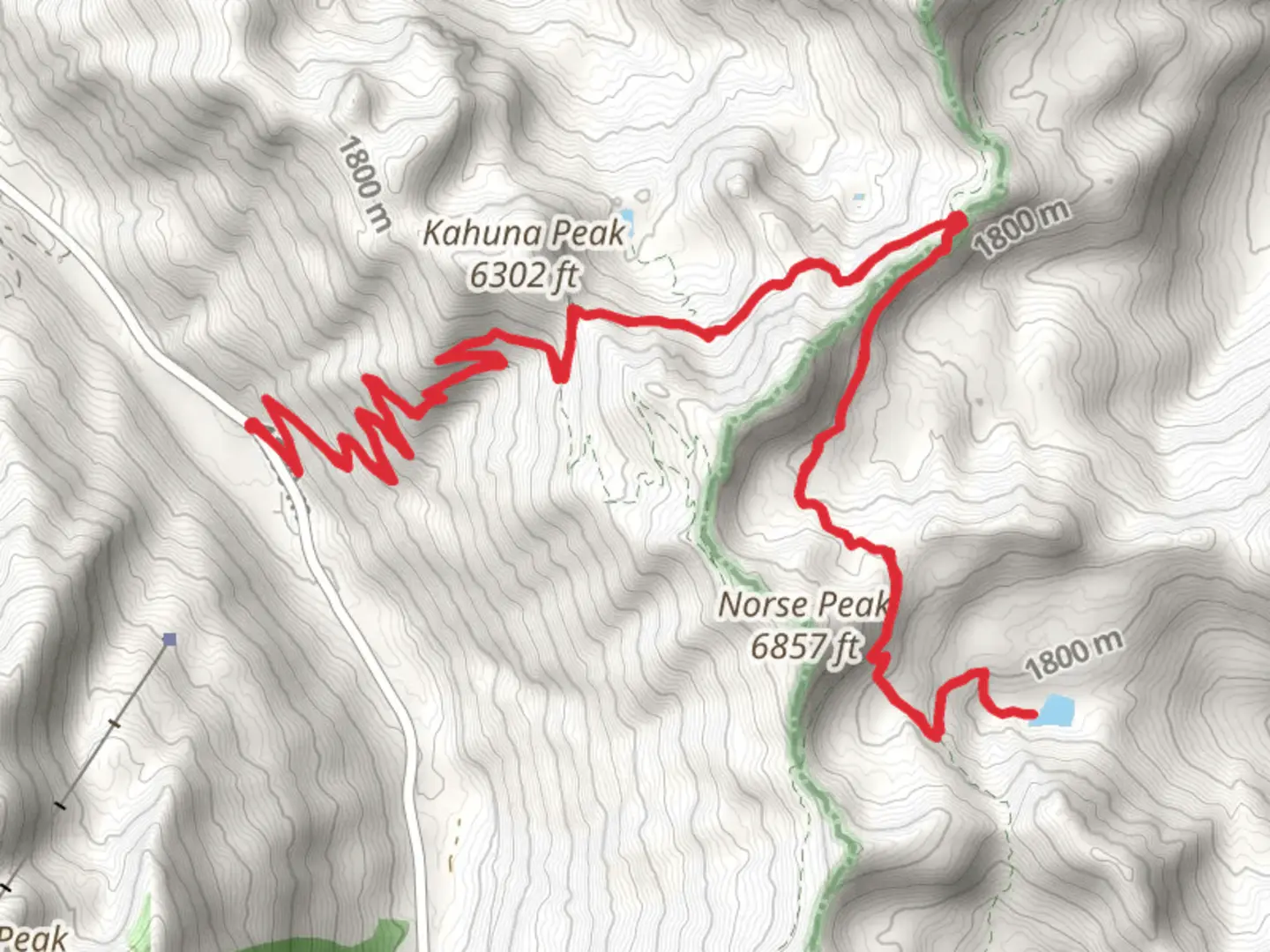
Starting your adventure near Pierce County, Washington, the Basin Lake via Nose Peak Trail offers a captivating journey through diverse landscapes. This out-and-back trail spans approximately 21 kilometers (13 miles) with an elevation gain of around 1400 meters (4600 feet), making it a moderately challenging hike suitable for those with some experience.### Getting There To reach the trailhead, you can drive or use public transportation. If driving, head towards the nearest significant landmark, which is the town of Eatonville, WA. From Eatonville, follow the signs towards the trailhead, which is located near the entrance to Mount Rainier National Park. For those using public transport, buses run from major cities like Seattle and Tacoma to Eatonville, where you can then take a local taxi or rideshare service to the trailhead.### Trail Overview The trail begins with a gentle ascent through dense forest, characterized by towering Douglas firs and western hemlocks. The first 3 kilometers (1.9 miles) are relatively easy, with an elevation gain of about 200 meters (650 feet), making it a good warm-up for the more strenuous sections ahead.### Significant Landmarks and Nature As you progress, the trail becomes steeper, and around the 5-kilometer (3.1-mile) mark, you'll encounter a series of switchbacks. These switchbacks offer stunning views of the surrounding valleys and, on clear days, glimpses of Mount Rainier. Keep an eye out for wildlife; deer and black bears are commonly sighted in this area, so it's wise to carry bear spray and make noise to avoid surprising any animals.### Nose Peak At approximately 10 kilometers (6.2 miles) into the hike, you'll reach Nose Peak. This is a great spot to take a break and enjoy panoramic views. The elevation gain to this point is around 1000 meters (3280 feet). The peak offers a 360-degree view of the surrounding wilderness, including the distant peaks of the Cascade Range.### Basin Lake From Nose Peak, the trail descends slightly before the final ascent to Basin Lake. The last 1.5 kilometers (0.9 miles) involve a steep climb, adding another 400 meters (1310 feet) of elevation gain. Basin Lake is a serene alpine lake surrounded by wildflowers in the summer and vibrant foliage in the fall. It's an ideal spot for a picnic or a refreshing dip, though the water can be quite cold.### Historical Significance The region around Basin Lake has a rich history. Indigenous tribes, including the Nisqually and Puyallup, have long inhabited these lands, using the trails for hunting and gathering. In the early 20th century, the area saw an influx of settlers and loggers, which led to the establishment of many of the trails we use today. Remnants of old logging camps can still be found near the trail, offering a glimpse into the past.### Navigation and Safety Given the trail's moderate difficulty and varying terrain, it's advisable to use a reliable navigation tool like HiiKER to stay on track. The trail is well-marked, but weather conditions can change rapidly, especially at higher elevations. Always check the weather forecast before you set out and be prepared for sudden changes.### Return Journey The return journey follows the same path, allowing you to revisit the stunning vistas and perhaps notice details you missed on the way up. The descent can be tough on the knees, so trekking poles are recommended.This trail offers a rewarding experience for those willing to take on its challenges, providing a mix of natural beauty, wildlife, and historical intrigue.

What to expect?
Activity types
Comments and Reviews
User comments, reviews and discussions about the Basin Lake via Nose Peak Trail, Washington.
4.43
average rating out of 5
7 rating(s)