Download
Preview
Add to list
More
10.7 km
~4 hrs 21 min
1327 m
Out and Back
“Embark on a scenic 6.8-mile hike via Putvin Trail to Lake of the Angels for breathtaking alpine views.”
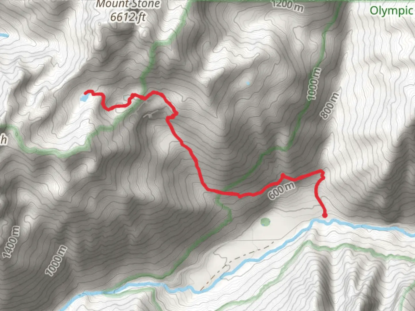
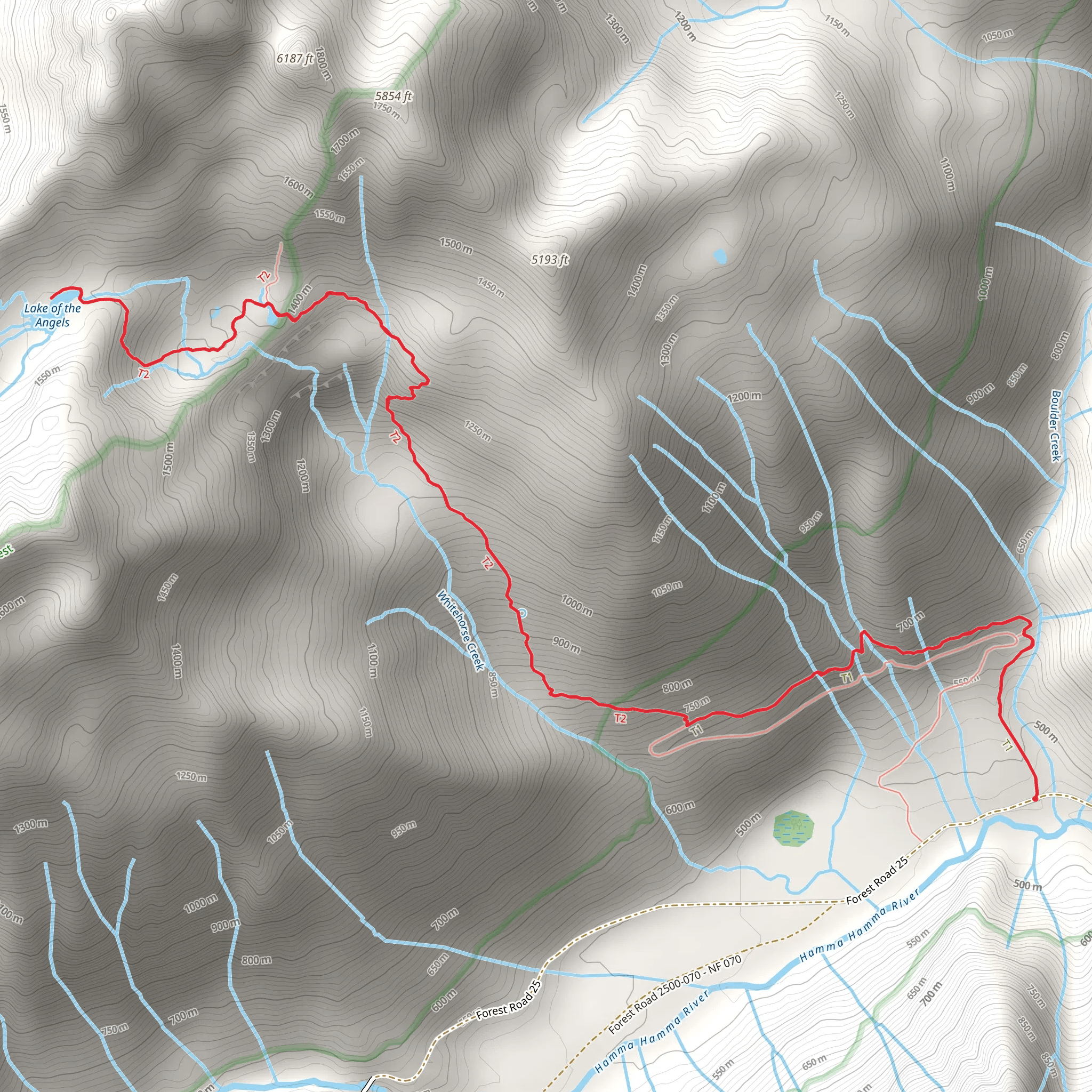
Starting your adventure near Mason County, Washington, the Lake of the Angels via Putvin Trail is an 11 km (approximately 6.8 miles) out-and-back hike with an elevation gain of around 1300 meters (4265 feet). This trail is considered to be of medium difficulty, making it suitable for hikers with some experience and a good level of fitness.
Getting There To reach the trailhead, you can drive to the nearest significant landmark, which is the Hamma Hamma Campground. From there, follow Forest Road 25 for about 8 miles until you reach the Putvin Trailhead. If you're relying on public transport, the nearest major city is Seattle, from where you can take a bus to Hoodsport and then arrange for a taxi or rideshare to the trailhead.
Trail Overview The trail begins with a moderate ascent through dense forest, where you'll be surrounded by towering Douglas firs and Western hemlocks. The first 2 km (1.2 miles) are relatively gentle, gaining about 300 meters (984 feet) in elevation. This section is a good warm-up and allows you to acclimate to the terrain.
Significant Landmarks and Sections #### The Boulder Field Around the 3 km (1.9 miles) mark, you'll encounter a challenging boulder field. This section requires careful navigation and some scrambling. The rocks can be slippery, especially after rain, so take your time and ensure you have a good grip. This area is also a great spot to take a break and enjoy the panoramic views of the surrounding mountains.
#### The Waterfall At approximately 4 km (2.5 miles), you'll come across a stunning waterfall cascading down the rocks. This is a perfect spot for a quick rest and some photos. The sound of the rushing water adds a serene ambiance to your hike.
#### The Climb to the Lake The final 2 km (1.2 miles) involve a steep ascent, gaining about 700 meters (2296 feet) in elevation. This section is the most strenuous part of the hike, with several switchbacks and rocky terrain. As you climb, you'll notice the vegetation thinning out, giving way to alpine meadows filled with wildflowers during the summer months.
Lake of the Angels Upon reaching Lake of the Angels, you'll be rewarded with breathtaking views of the crystal-clear alpine lake surrounded by rugged peaks. The lake sits at an elevation of approximately 1500 meters (4921 feet). This is a great spot to relax, have lunch, and take in the natural beauty. Keep an eye out for mountain goats, which are commonly seen in this area.
Historical Significance The region around Lake of the Angels has a rich history, with evidence of Native American use for hunting and gathering. The name "Lake of the Angels" is believed to have been inspired by the serene and almost otherworldly beauty of the lake and its surroundings.
Wildlife and Flora The trail offers a diverse range of flora and fauna. In the lower forested sections, you might spot black-tailed deer and various bird species. As you ascend, the alpine meadows are home to marmots and pikas. The wildflower blooms in late spring and early summer are particularly spectacular, with lupines, Indian paintbrush, and avalanche lilies adding vibrant colors to the landscape.
Navigation For navigation, it's highly recommended to use the HiiKER app, which provides detailed maps and real-time updates. This will help you stay on track, especially in the more challenging sections like the boulder field and the final ascent to the lake.
Prepare well for this hike by bringing plenty of water, snacks, and appropriate gear, including sturdy hiking boots and trekking poles. The weather can change rapidly, so layers and a rain jacket are advisable. Enjoy your hike to Lake of the Angels, a true gem in the heart of Washington's wilderness.
What to expect?
Activity types
Comments and Reviews
User comments, reviews and discussions about the Lake of the Angels via Putvin Trail, Washington.
4.45
average rating out of 5
11 rating(s)
