Download
Preview
Add to list
More
34.6 km
~1 day 4 hrs
1668 m
Point-to-Point
“Traverse diverse terrain from dense forests to alpine meadows on the scenic, moderately challenging Snowgrass-Upper Lake Creek Trail.”
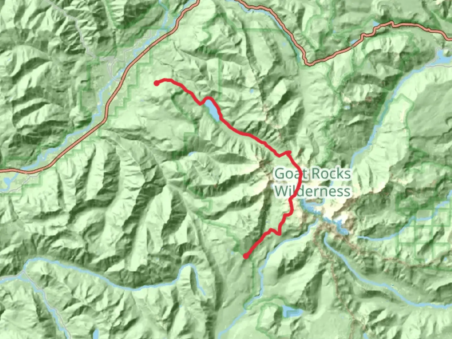
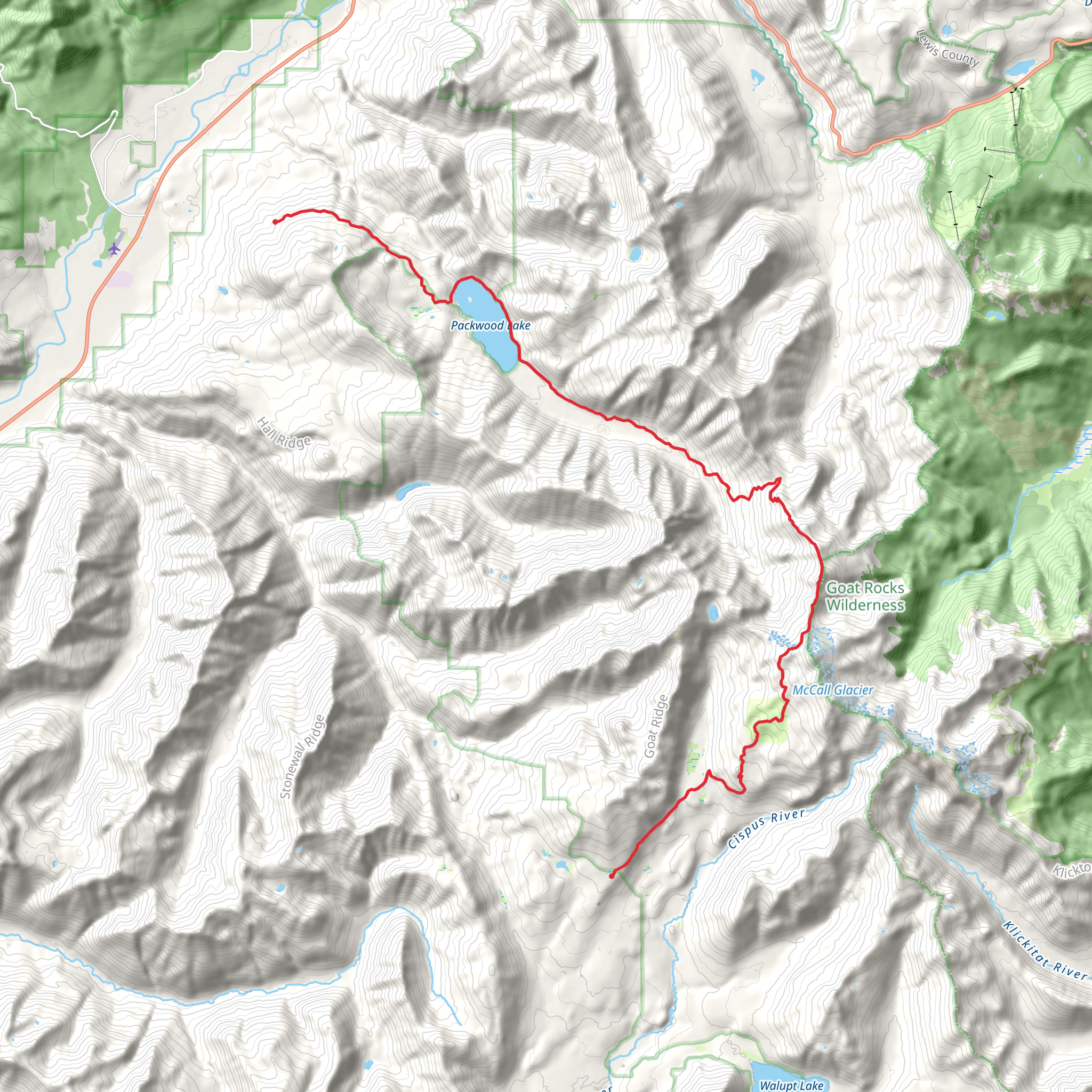
Starting near Lewis County, Washington, the Snowgrass, Packwood Lake, and Upper Lake Creek Trail spans approximately 35 kilometers (about 22 miles) with an elevation gain of around 1600 meters (5250 feet). This point-to-point trail is rated as medium difficulty, making it suitable for moderately experienced hikers.
Getting There To reach the trailhead, you can drive or use public transport. If driving, head towards the town of Packwood, Washington. From there, follow Forest Road 1260 to the trailhead. For those using public transport, the nearest major city is Seattle. From Seattle, take a bus or train to Centralia, then a local bus to Packwood. From Packwood, you may need to arrange a taxi or rideshare to the trailhead.
Trail Overview The trail begins with a gentle ascent through dense forest, offering a serene start to your journey. As you progress, the trail opens up to meadows filled with wildflowers, especially vibrant in late spring and early summer. The first significant landmark is Snowgrass Flat, approximately 8 kilometers (5 miles) in, where you can enjoy panoramic views of the surrounding peaks.
Packwood Lake Continuing on, you'll reach Packwood Lake at around the 16-kilometer (10-mile) mark. This pristine alpine lake is a perfect spot for a rest or even a quick swim if the weather permits. The lake is also a popular fishing spot, so you might see anglers trying their luck. The area around Packwood Lake is rich in history, having been a traditional fishing ground for Native American tribes.
Upper Lake Creek From Packwood Lake, the trail becomes more challenging as you ascend towards Upper Lake Creek. This section is about 11 kilometers (7 miles) long and includes a significant portion of the total elevation gain. The trail here is rocky and can be slippery, especially after rain, so good hiking boots are essential. Keep an eye out for mountain goats and marmots, which are commonly seen in this area.
Navigation and Safety Given the trail's length and varying terrain, it's crucial to have a reliable navigation tool. HiiKER is highly recommended for its detailed maps and real-time updates. Make sure to download the trail map before you start, as cell service can be spotty.
Flora and Fauna The trail is a haven for nature enthusiasts. In addition to wildflowers and alpine meadows, you'll pass through old-growth forests with towering Douglas firs and western hemlocks. Birdwatchers will appreciate the variety of species, including the occasional sighting of a bald eagle near the lakes.
Historical Significance The region has a rich history, from its use by Native American tribes to its role in early 20th-century logging. Packwood Lake, in particular, was a crucial resource for both indigenous peoples and early settlers. The remnants of old logging equipment can still be seen near the lake, offering a glimpse into the area's past.
Final Stretch The final stretch towards Upper Lake Creek is both challenging and rewarding. The trail narrows and becomes steeper, but the views from the top are worth the effort. You'll be treated to sweeping vistas of the surrounding valleys and peaks, making it a perfect spot for photography.
This trail offers a mix of natural beauty, historical significance, and moderate physical challenge, making it a rewarding experience for those prepared to tackle its diverse terrain.
What to expect?
Activity types
Comments and Reviews
User comments, reviews and discussions about the Snowgrass, Packwood Lake and Upper Lake Creek Trail, Washington.
4.5
average rating out of 5
6 rating(s)
