Download
Preview
Add to list
More
5.0 km
~1 hrs 48 min
483 m
Out and Back
“Embark on the Plummer Peak Trail for stunning views, moderate challenge, and rich history.”
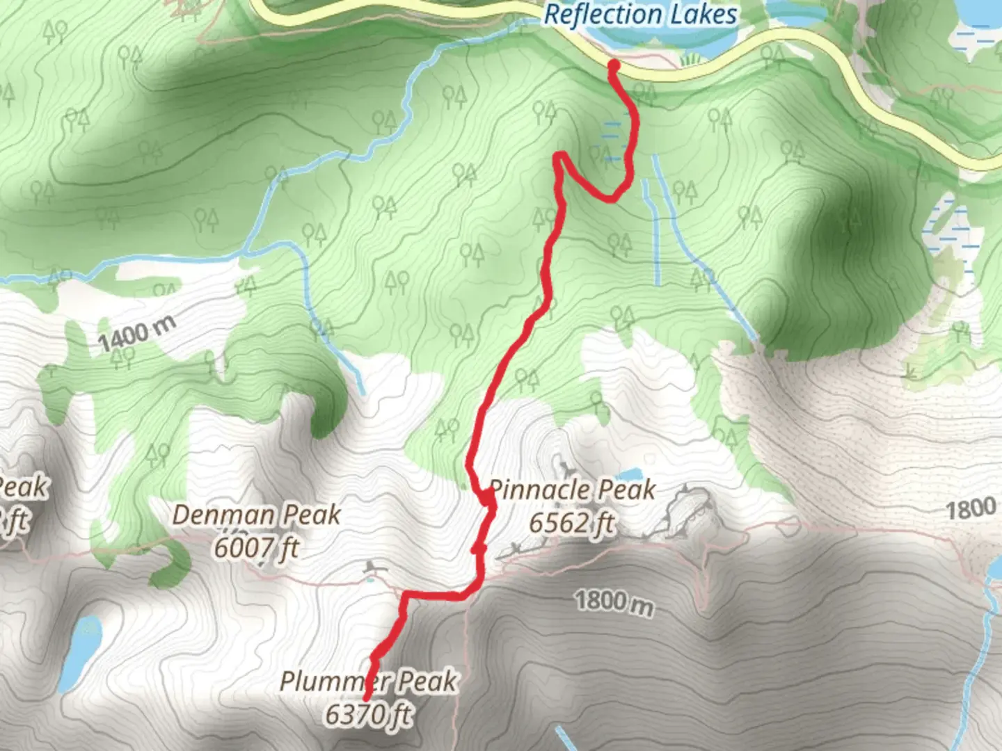
Starting your adventure near Lewis County, Washington, the Plummer Peak via Pinnacle Peak Trail offers a rewarding hike with a distance of around 5 km (3.1 miles) and an elevation gain of approximately 400 meters (1,312 feet). This out-and-back trail is rated as medium difficulty, making it accessible for most hikers with a moderate level of fitness.
Getting There To reach the trailhead, you can drive or use public transportation. If driving, head towards the Pinnacle Peak Trailhead, located near the Reflection Lakes area in Mount Rainier National Park. The nearest significant landmark is the Paradise Visitor Center, which is a popular starting point for many hikes in the region. For those using public transport, the closest major city is Seattle, from where you can take a bus or shuttle service to Ashford, the gateway town to Mount Rainier National Park. From Ashford, you may need to arrange a taxi or rideshare to the trailhead.
Trail Overview The trail begins at the Pinnacle Peak Trailhead, situated at an elevation of about 1,524 meters (5,000 feet). The initial section of the trail is relatively gentle, winding through lush alpine meadows adorned with wildflowers during the summer months. As you progress, the trail becomes steeper and rockier, requiring careful footing.
Significant Landmarks and Nature At approximately 1.5 km (0.9 miles) into the hike, you'll reach a saddle between Pinnacle Peak and Plummer Peak. This spot offers breathtaking panoramic views of Mount Rainier, the Tatoosh Range, and the surrounding valleys. It's a great place to take a break and soak in the scenery.
Continuing towards Plummer Peak, the trail becomes narrower and more rugged. Keep an eye out for mountain goats and marmots, which are commonly seen in this area. The flora transitions from dense forest to more sparse, alpine vegetation as you gain elevation.
Historical Significance The Tatoosh Range, where this trail is located, holds historical significance for the indigenous tribes of the region, including the Cowlitz and Nisqually peoples. These tribes have long considered the area sacred and used it for hunting and gathering. The name "Tatoosh" itself is derived from the Chinook Jargon, meaning "breast," likely referring to the shape of the peaks.
Navigation and Safety Given the trail's moderate difficulty, it's advisable to use a reliable navigation tool like HiiKER to keep track of your progress and ensure you stay on the correct path. Weather conditions can change rapidly in this alpine environment, so be prepared with appropriate clothing and gear. Always check the weather forecast before heading out and be aware of potential hazards like loose rocks and steep drop-offs.
Final Stretch The final push to Plummer Peak involves a bit of scrambling over rocky terrain. Once you reach the summit, at an elevation of about 1,920 meters (6,300 feet), you'll be rewarded with stunning 360-degree views. On a clear day, you can see as far as Mount Adams and Mount St. Helens.
After taking in the views, retrace your steps back to the trailhead, enjoying the different perspectives and perhaps spotting wildlife you missed on the way up. This trail offers a perfect blend of natural beauty, moderate challenge, and historical richness, making it a must-do for any hiking enthusiast.
What to expect?
Activity types
Comments and Reviews
User comments, reviews and discussions about the Plummer Peak via Pinnacle Peak Trail, Washington.
4.56
average rating out of 5
16 rating(s)
