Download
Preview
Add to list
More
10.1 km
~3 hrs 10 min
688 m
Out and Back
“The Silver Star Mountain via Grouse Vista Trail offers stunning views, diverse wildlife, and a moderate challenge.”
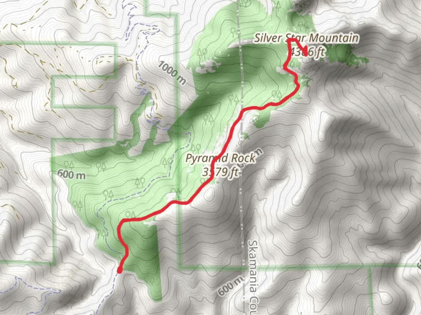
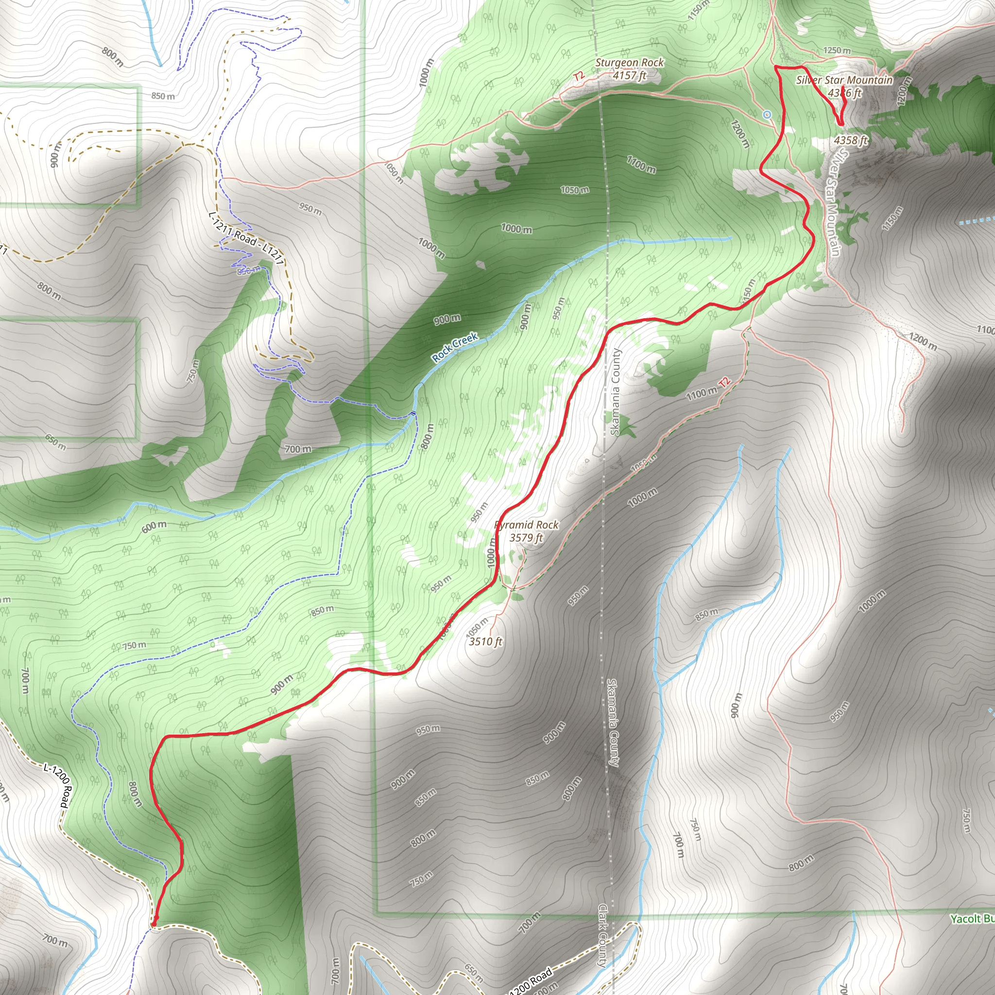
Starting near Clark County, Washington, the Silver Star Mountain via Grouse Vista Trail offers a rewarding hike with a distance of around 10 km (6.2 miles) and an elevation gain of approximately 600 meters (1,968 feet). This out-and-back trail is rated as medium difficulty, making it suitable for moderately experienced hikers.
Getting There To reach the trailhead, you can drive or use public transport. If driving, head towards the Grouse Vista Trailhead, located near the intersection of L-1200 Road and Dole Valley Road. For those using public transport, the nearest significant landmark is the town of Yacolt, Washington. From Yacolt, you may need to arrange a taxi or rideshare to the trailhead, as public transport options are limited in this rural area.
Trail Overview The trail begins with a steady ascent through dense forest, offering a cool and shaded start to your hike. As you progress, the trail opens up to more exposed areas, providing stunning views of the surrounding landscape. The first significant landmark you'll encounter is Pyramid Rock, approximately 2 km (1.2 miles) into the hike. This large rock formation is a great spot for a short break and some photos.
Flora and Fauna The trail is rich in diverse plant life, including Douglas fir, western hemlock, and various wildflowers that bloom in the spring and summer months. Keep an eye out for wildlife such as black-tailed deer, black bears, and a variety of bird species, including the northern spotted owl.
Historical Significance The Silver Star Mountain area has a rich history, with evidence of Native American use dating back thousands of years. The mountain was named for the silver star-shaped patches of snow that remain on its slopes well into the summer. During the early 20th century, the area was also used for logging, and remnants of old logging roads can still be seen along the trail.
Navigation and Safety As you continue your ascent, the trail becomes steeper and rockier. Around the 5 km (3.1 miles) mark, you'll reach the summit of Silver Star Mountain. The summit offers panoramic views of the Cascade Range, including Mount St. Helens, Mount Adams, and Mount Hood. Make sure to bring a reliable navigation tool like HiiKER to stay on track, especially in areas where the trail may be less defined.
Final Stretch After enjoying the summit views, retrace your steps back to the trailhead. The descent can be challenging due to loose rocks and steep sections, so take your time and watch your footing. The entire hike typically takes around 4-6 hours, depending on your pace and the time spent at the summit.
Preparation Tips - Wear sturdy hiking boots with good ankle support. - Bring plenty of water and snacks. - Check the weather forecast before heading out, as conditions can change rapidly. - Carry a first aid kit and know basic first aid procedures. - Inform someone of your hiking plans and expected return time.
This trail offers a mix of natural beauty, historical significance, and a moderate challenge, making it a must-visit for hikers in the Pacific Northwest.
What to expect?
Activity types
Comments and Reviews
User comments, reviews and discussions about the Silver Star Mountain via Grouse Vista Trail, Washington.
4.5
average rating out of 5
18 rating(s)
