Download
Preview
Add to list
More
28.4 km
~1 day 3 hrs
1469 m
Out and Back
“Embark on a 28-kilometer journey through forests and alpine meadows to reach the pristine Stiletto Lake.”
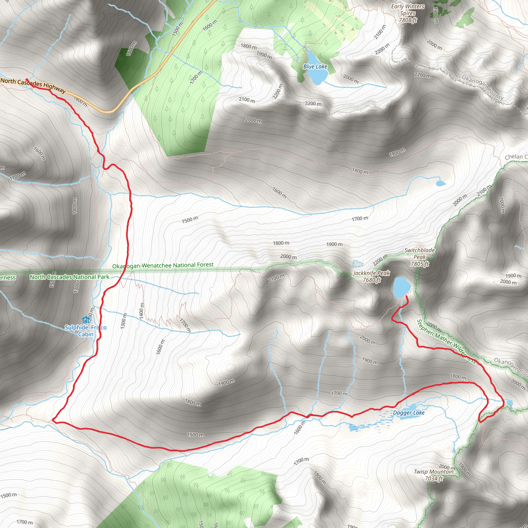
Starting near Chelan County, Washington, the Stiletto Lake via Pacific Crest Trail is an out-and-back hike that spans approximately 28 kilometers (17.4 miles) with an elevation gain of around 1400 meters (4593 feet). This trail is rated as medium difficulty, making it suitable for moderately experienced hikers.
Getting There To reach the trailhead, you can drive or use public transportation. If driving, head towards the nearest significant landmark, the town of Stehekin, Washington. From Stehekin, you can access the trailhead by taking the Stehekin Valley Road. Public transportation options include taking a ferry from Chelan to Stehekin, followed by a shuttle service that runs along Stehekin Valley Road.
Trail Overview The trail begins with a gradual ascent through dense forests, offering a serene start to your journey. As you progress, the trail becomes steeper, leading you through a series of switchbacks. This initial section covers about 5 kilometers (3.1 miles) and gains approximately 300 meters (984 feet) in elevation.
Significant Landmarks - **Bridge Creek Campground (5 km / 3.1 miles):** This is a great spot to take a short break. The campground is well-maintained and offers a good place to refill your water bottles. - **McAlester Pass (10 km / 6.2 miles):** At this point, you've gained about 700 meters (2297 feet) in elevation. The pass offers stunning views of the surrounding peaks and valleys, making it a perfect spot for photography.
Flora and Fauna As you continue, the trail opens up into alpine meadows filled with wildflowers during the summer months. Keep an eye out for local wildlife, including deer, marmots, and various bird species. The meadows are particularly vibrant around the 15-kilometer (9.3 miles) mark.
Historical Significance The Pacific Crest Trail, part of which you will be hiking, has a rich history. Originally conceived in the 1930s, it was officially designated as a National Scenic Trail in 1968. This section of the trail has been used by Native American tribes for centuries, and you may come across historical markers and interpretive signs that provide insights into the region's past.
Final Stretch to Stiletto Lake The last 4 kilometers (2.5 miles) to Stiletto Lake are the most challenging, with a steep ascent that gains about 400 meters (1312 feet) in elevation. The effort is well worth it, as Stiletto Lake is a pristine alpine lake surrounded by rugged peaks. The lake is an excellent spot for a picnic and some well-deserved rest before you begin your descent.
Navigation Given the trail's complexity, it's advisable to use a reliable navigation tool like HiiKER to keep track of your progress and ensure you stay on the correct path.
Return Journey The return journey follows the same path, offering a different perspective on the stunning landscapes you passed on the way up. Make sure to pace yourself and take breaks as needed, especially on the steeper sections.
This hike offers a mix of challenging terrain, breathtaking views, and a touch of historical significance, making it a rewarding experience for those who undertake it.
What to expect?
Activity types
Comments and Reviews
User comments, reviews and discussions about the Stiletto Lake via Pacific Crest Trail, Washington.
4.56
average rating out of 5
9 rating(s)

