Icicle Creek, Frosty - Wildhorse, Lake Edna and Icicle Ridge Trail
Download
Preview
Add to list
More
30.1 km
~1 day 4 hrs
1930 m
Point-to-Point
“The Icicle Ridge Trail offers a 30-kilometer journey through diverse landscapes, perfect for moderately experienced hikers.”
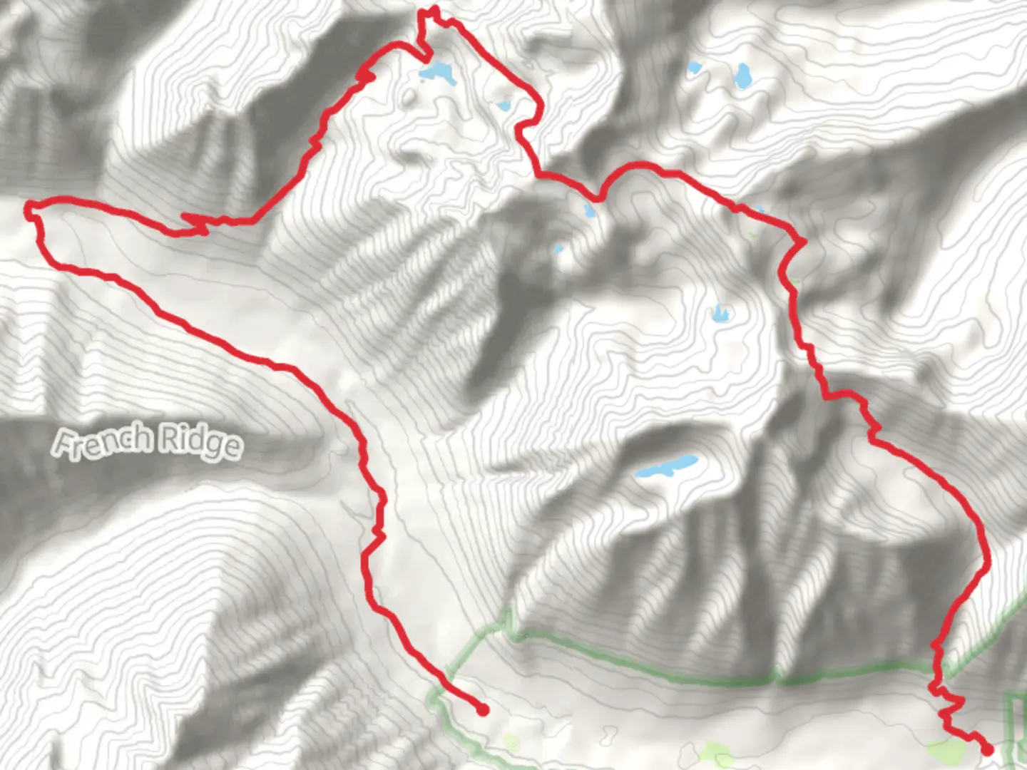
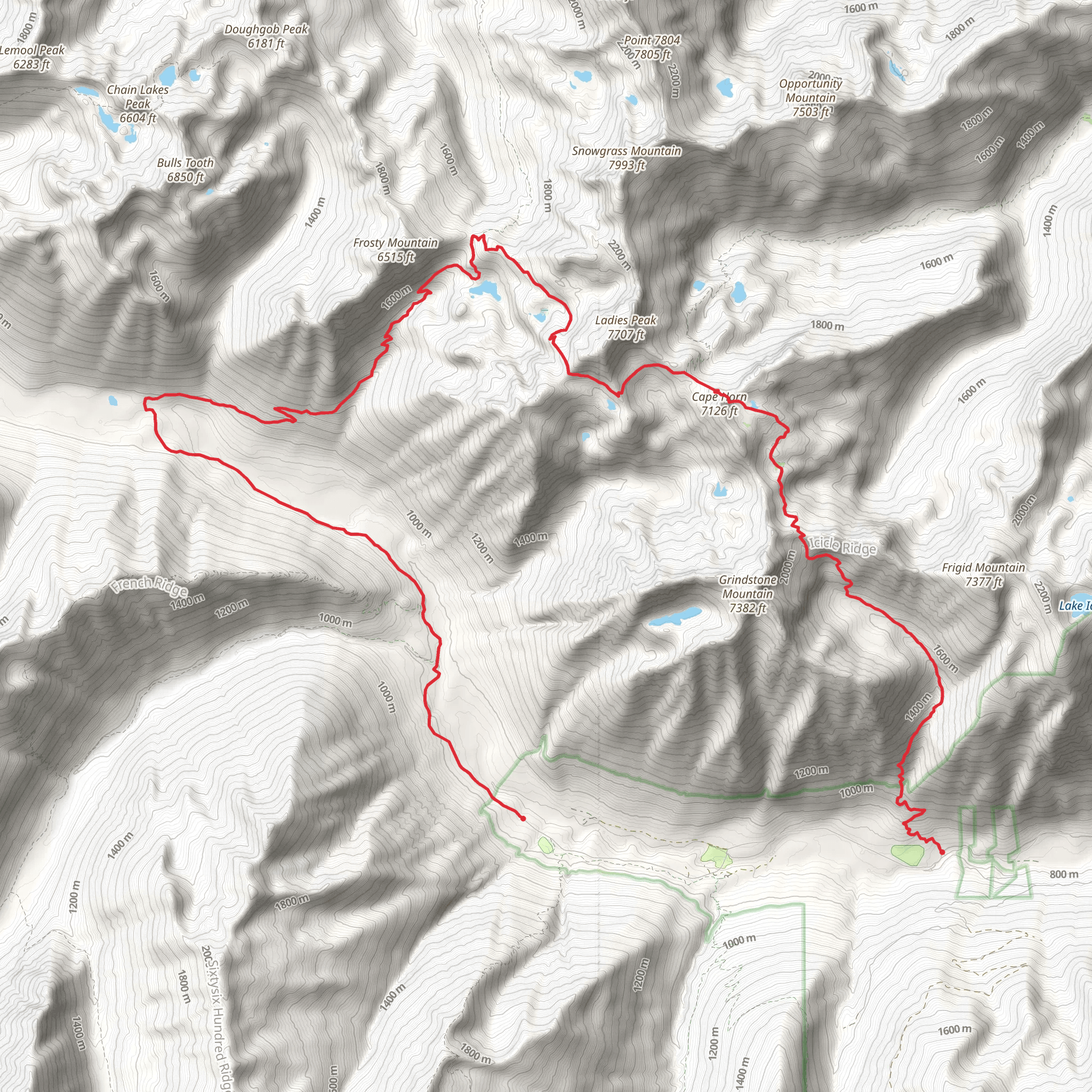
Starting near Chelan County, Washington, the Icicle Creek, Frosty - Wildhorse, Lake Edna, and Icicle Ridge Trail spans approximately 30 kilometers (18.6 miles) with an elevation gain of around 1900 meters (6234 feet). This point-to-point trail is rated as medium difficulty, making it suitable for moderately experienced hikers.
Getting There To reach the trailhead, you can drive or use public transport. If driving, head towards the town of Leavenworth, Washington. From there, follow Icicle Road for about 16 miles until you reach the trailhead near the Icicle Creek area. For those using public transport, the nearest major hub is Wenatchee, WA. From Wenatchee, you can take a bus to Leavenworth and then arrange for a local taxi or shuttle service to the trailhead.
Trail Overview The trail begins in a lush forested area near Icicle Creek, known for its dense canopy of Douglas fir and western hemlock. Early on, you'll encounter a series of gentle inclines, making it a good warm-up for the more challenging sections ahead. As you progress, the trail becomes steeper, leading you through a series of switchbacks.
Significant Landmarks and Sections #### Frosty Pass Around the 8-kilometer (5-mile) mark, you'll reach Frosty Pass. This area offers stunning views of the surrounding peaks and is a great spot for a short break. The elevation gain here is approximately 600 meters (1968 feet) from the trailhead.
#### Wildhorse Creek Continuing on, you'll descend slightly into the Wildhorse Creek basin. This section is characterized by its alpine meadows, which are often dotted with wildflowers in the summer months. Keep an eye out for wildlife such as marmots and mountain goats. This part of the trail is relatively flat, making it a pleasant respite before the next climb.
#### Lake Edna At around 18 kilometers (11 miles), you'll arrive at Lake Edna. This serene alpine lake is a popular spot for camping and fishing. The elevation here is about 1500 meters (4921 feet). The lake is surrounded by rugged cliffs and offers a picturesque setting for photos.
#### Icicle Ridge The final section of the trail takes you up to Icicle Ridge. This is the most challenging part, with a steep ascent that gains approximately 800 meters (2625 feet) over 4 kilometers (2.5 miles). The effort is well worth it, as the ridge provides panoramic views of the Cascade Range and the Wenatchee River Valley.
Historical Significance The region around Icicle Creek has a rich history. It was originally inhabited by the Wenatchi tribe, who used the area for hunting and gathering. In the late 19th and early 20th centuries, the area saw an influx of European settlers, primarily for logging and mining. Remnants of old mining equipment can still be found along the trail, adding a historical dimension to your hike.
Navigation and Safety Given the trail's length and elevation gain, it's crucial to be well-prepared. Use HiiKER for detailed maps and real-time navigation. The trail is well-marked, but weather conditions can change rapidly, especially at higher elevations. Always carry sufficient water, food, and emergency supplies.
Flora and Fauna The trail offers a diverse range of flora and fauna. In the lower elevations, you'll find dense forests of Douglas fir and western hemlock. As you ascend, the vegetation transitions to alpine meadows filled with wildflowers like lupine and Indian paintbrush. Wildlife is abundant, with frequent sightings of deer, marmots, and occasionally black bears.
This trail offers a comprehensive experience of the Pacific Northwest's natural beauty, from lush forests and alpine meadows to serene lakes and rugged ridges.
What to expect?
Activity types
Comments and Reviews
User comments, reviews and discussions about the Icicle Creek, Frosty - Wildhorse, Lake Edna and Icicle Ridge Trail, Washington.
4.5
average rating out of 5
10 rating(s)
