Download
Preview
Add to list
More
4.3 km
~1 hrs 30 min
395 m
Out and Back
“Experience the Pacific Northwest's beauty with a moderately challenging 4 km hike up Fourth of July Mountain.”
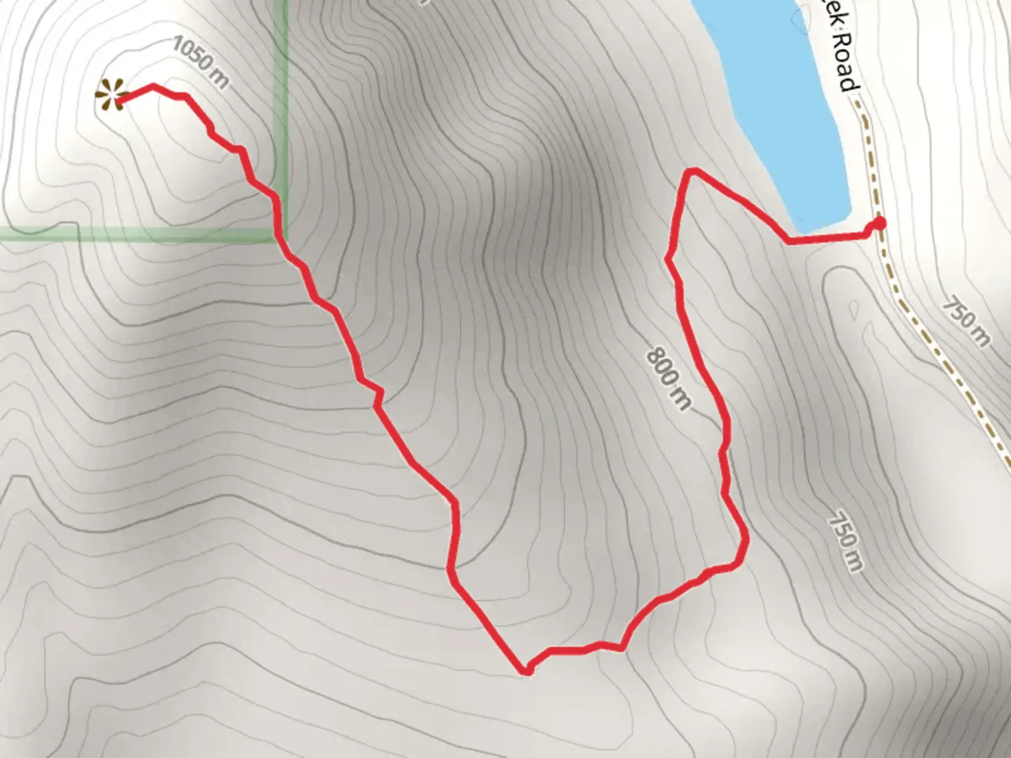
Starting near Chelan County, Washington, the Fourth of July Mountain Trail offers a moderately challenging hike with a round-trip distance of approximately 4 km (2.5 miles) and an elevation gain of around 300 meters (984 feet). This out-and-back trail is perfect for those looking to experience the natural beauty of the Pacific Northwest.### Getting There To reach the trailhead, you can drive or use public transportation. If driving, head towards the town of Leavenworth, Washington. From there, follow Icicle Road for about 8 miles until you reach the trailhead parking area. For those using public transport, the nearest significant landmark is the Leavenworth Amtrak Station. From the station, you may need to arrange a taxi or rideshare to the trailhead, as public buses do not directly service this area.### Trail Overview The trail begins with a gentle ascent through a dense forest of Douglas fir and ponderosa pine. As you progress, the path becomes steeper, offering a good workout for your legs. The first kilometer (0.6 miles) of the trail gains about 150 meters (492 feet) in elevation, making it a steady climb.### Flora and Fauna Keep an eye out for the diverse plant life along the trail. In spring and early summer, wildflowers such as lupine and Indian paintbrush add vibrant splashes of color to the landscape. The forest is also home to various wildlife, including deer, black bears, and numerous bird species like the Steller's jay and the pileated woodpecker. Always carry bear spray and make noise to avoid surprising any wildlife.### Significant Landmarks At approximately the 2 km (1.2 miles) mark, you'll reach a scenic viewpoint offering panoramic views of the surrounding mountains and valleys. This is a great spot to take a break and snap some photos. The trail continues to climb for another kilometer (0.6 miles) before reaching the summit of Fourth of July Mountain.### Historical Significance The region around Fourth of July Mountain has a rich history. The area was originally inhabited by Native American tribes, including the Wenatchi people, who used the land for hunting and gathering. In the late 19th and early 20th centuries, the region saw an influx of settlers and miners, drawn by the promise of gold and other resources. Remnants of old mining operations can still be found in the area, adding a historical dimension to your hike.### Navigation For navigation, it's highly recommended to use the HiiKER app, which provides detailed maps and real-time updates on trail conditions. This will help ensure you stay on the correct path and can safely enjoy your hike.### Final Stretch The final stretch to the summit is the most challenging, with a steep incline that will test your endurance. However, the effort is well worth it. Upon reaching the summit, you'll be rewarded with breathtaking views of the Cascade Range and the Wenatchee River Valley. On clear days, you can even see as far as Glacier Peak.Remember to pack plenty of water, snacks, and appropriate gear for changing weather conditions. Enjoy your hike and the stunning natural beauty that Fourth of July Mountain Trail has to offer.

What to expect?
Activity types
Comments and Reviews
User comments, reviews and discussions about the Fourth of July Mountain Trail, Washington.
4.14
average rating out of 5
7 rating(s)