Download
Preview
Add to list
More
12.2 km
~3 hrs 58 min
921 m
Out and Back
“Embark on the Chelan Butte Trail for a challenging 12-km hike with stunning panoramic views and rich biodiversity.”
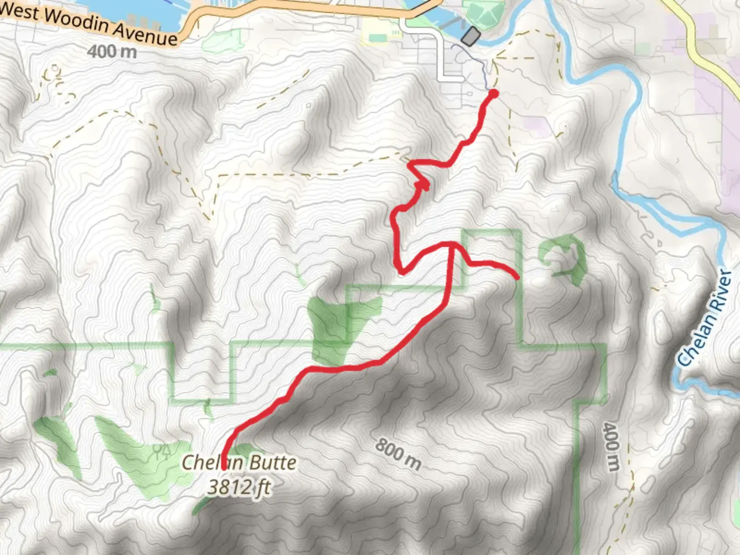
Starting your adventure near Chelan County, Washington, the Chelan Butte Trail offers a rewarding out-and-back hike that spans approximately 12 kilometers (7.5 miles) with an elevation gain of around 900 meters (2,950 feet). This trail is rated as medium difficulty, making it suitable for hikers with some experience and a good level of fitness.
Getting There To reach the trailhead, you can drive or use public transportation. If driving, head towards Chelan County and look for the trailhead near the town of Chelan. For those using public transport, the nearest significant landmark is the town of Chelan, which is accessible by bus services from larger cities like Seattle. From Chelan, you may need to arrange a taxi or rideshare to the trailhead.
Trail Overview The trail begins with a gradual ascent, allowing you to warm up before the more challenging sections. As you start, you'll be greeted by a mix of pine and fir trees, providing ample shade. The first 2 kilometers (1.2 miles) are relatively easy, with an elevation gain of about 150 meters (500 feet).
Mid-Trail Landmarks Around the 3-kilometer (1.9-mile) mark, you'll encounter a series of switchbacks. These can be quite steep, so take your time and enjoy the views of the surrounding valleys. At approximately 4 kilometers (2.5 miles), you'll reach a small plateau, offering a perfect spot for a short break. Here, you can enjoy panoramic views of Lake Chelan and the surrounding mountains.
Flora and Fauna The trail is rich in biodiversity. Keep an eye out for wildflowers such as lupines and Indian paintbrushes, especially in the spring and early summer. Wildlife is abundant; you might spot deer, marmots, and various bird species, including eagles and hawks.
Historical Significance The Chelan Butte area has a rich history. It was originally inhabited by Native American tribes, who used the land for hunting and gathering. In the late 19th and early 20th centuries, the region saw an influx of settlers and miners. Remnants of old mining equipment can still be found along the trail, adding a historical dimension to your hike.
Final Ascent The last 2 kilometers (1.2 miles) are the most challenging, with an elevation gain of about 300 meters (1,000 feet). The trail becomes rockier and more exposed, so be prepared for windy conditions. As you approach the summit, the vegetation thins out, giving way to stunning 360-degree views.
Navigation For navigation, it's highly recommended to use HiiKER. The app provides detailed maps and real-time updates, ensuring you stay on the right path.
Reaching the Summit Upon reaching the summit, you'll be rewarded with breathtaking views of Lake Chelan, the Columbia River, and the Cascade Range. This is a perfect spot to rest, take photos, and enjoy a well-deserved snack before heading back down.
Descent The descent follows the same path, so be cautious on the steep sections, especially if the ground is wet or loose. The return journey offers a different perspective, allowing you to appreciate the landscape from a new angle.
Preparation Tips Ensure you bring plenty of water, as there are no reliable water sources along the trail. Wear sturdy hiking boots and consider using trekking poles for added stability. Weather can change rapidly, so pack layers and be prepared for both sun and wind.
By following these guidelines and being well-prepared, you'll have a safe and enjoyable hike on the Chelan Butte Trail.

What to expect?
Activity types
Comments and Reviews
User comments, reviews and discussions about the Chelan Butte Trail, Washington.
4.21
average rating out of 5
19 rating(s)